An Adirondack Love of Mystery and Intrigue in the 1880’s

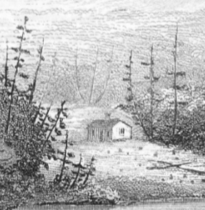
One mystery remains which my research has never fully solved. Why did the last two generations of our family have no knowledge of the original Thacher cabin? And why are there no photos or drawings of the cabin? Most importantly, why did the cabin disappear? Here is one surprising theory that could shed light on these questions.

The Thacher and FitzPatrick families are proud of our Irish heritage thanks to the courage of our grandfather Kenelm R. Thacher (KRT) choosing to marry Catherine Callahan.   Family lore is that this act labeled KRT as the black sheep of the family given the unfortunate bigotry toward Irish Catholics by blue blood Protestants in the late 19th and early 20th centuries.   My Aunt Ellen spoke of certain Thacher family members crossing the street in downtown Albany, rather than conversing with her parents.  It turns out that my grandfather was not the first Thacher to marry an Irish Catholic, nor was the resentment toward him the result of societal bigotry alone but rather a reflection of personal experiences.

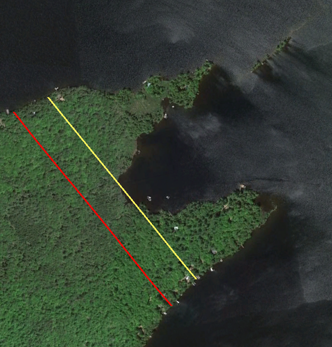
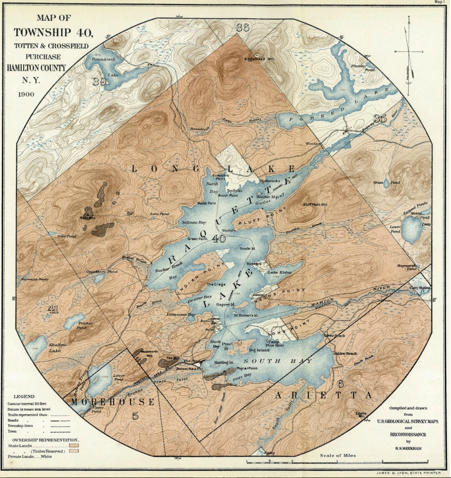
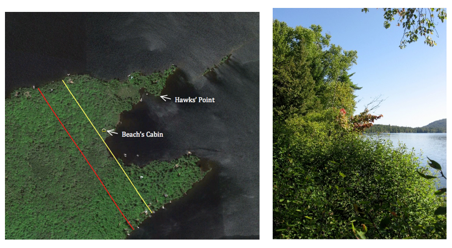
After the death of our great-grandfather George Hornell Thacher 2nd (GHT2), his properties (including Thacher Island at Blue Mountain Lake, his summer residence in Manchester, VT, the mansion in Albany, NY, and the family business) were divided among his five sons. Our grandfather was given the least valuable undeveloped lands at Raquette Lake with its one room cabin and lean-to. We have often believed that our present day enjoyment of the beauty of Indian Point is the result of this bigotry.

Given this family lore, it was most surprising when my research discovered three facts completely contrary to a perceived bias against Irish Catholics.

  • Reverend Henry Gabriels, President of St. Josephs’ Catholic Seminary in Troy, NY served Catholic mass at the Thacher Camp on Indian Point on July 11-14 in 1878.
  • Mayor George Hornell Thacher Sr. (GHT1) secretly donated $100 dollars (about $3,000 today) each year for the construction of a new St. Mary’s Catholic Cathedral in Albany from 1866 to 1869.
  • In July 1887, after GHT’s death in February, Mrs. George Hornell Thacher hosted Reverend Henry Gabriels at Thacher Island in Blue Mountain.

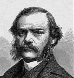
Why would GHT1 have a strong personal connection to Reverend Henry Gabriels and so generously support the construction of St. Mary’s? GHT1 had attended the Princeton Seminary and served as a Presbyterian Minister from 1843 to 1847.   Hardly a non-religious man, he was even less likely to find friendship with a Catholic.

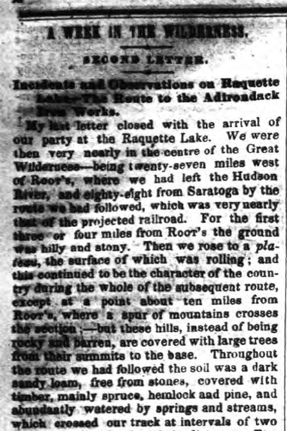
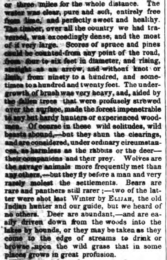
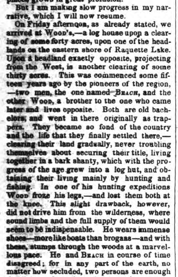
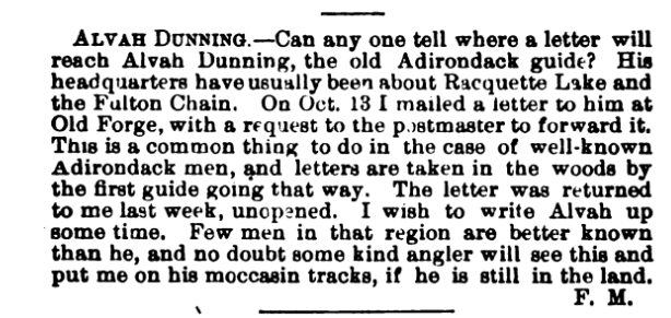
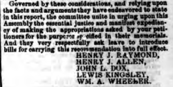
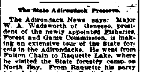
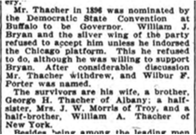
The mystery began to unravel as I was researching another line of investigation regarding John Boyd Thacher 1st .   Look at the last paragraph of this newspaper article regarding his funeral in 1909:

funeral png

Our family never knew about and none of the official biographies of the Thacher family in Albany ever mentioned half-siblings. However, this gave me another epiphany.   Ursula Jane Boyd Thacher, mother of JHT1 and GHT2, died in 1874.   Clearly, the Mrs. George Hornell Thacher who hosted Rev. Gabriels in 1887 was GHT1’s second wife (incidentally also omitted from all official biographies).

Using the names of William A. Thacher and Mrs. J. W. Morris, I began searching for more information and came upon this startling information.

Eliza obit png

So GHT1 had remarried after his first wife’s death and started a second family with an Irish Catholic woman. Who was this Elizabeth Thacher from Ireland?   What was her maiden name? The first clue came from an in memoriam to Mrs. J. W. Morris’ late husband which identified his wife as Mary Agnes Thacher.

Dr. Morris in memoriam

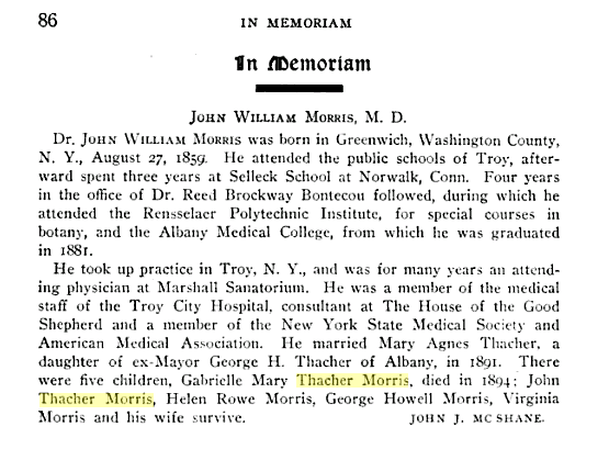
GHT1’s daughter’s name led to a reference in the St. Peter’s Catholic Church of Troy’s online listing of church donations and gifts. Dr. J.W. Morris and Mrs. J. W. Morris had donated a church bell chime in memory of their daughter Gabrielle Mary Thacher Morris.   In the same online listing, an “Eliza Thacher” had donated a stained glass window in memory of her father Matthew Toomey.

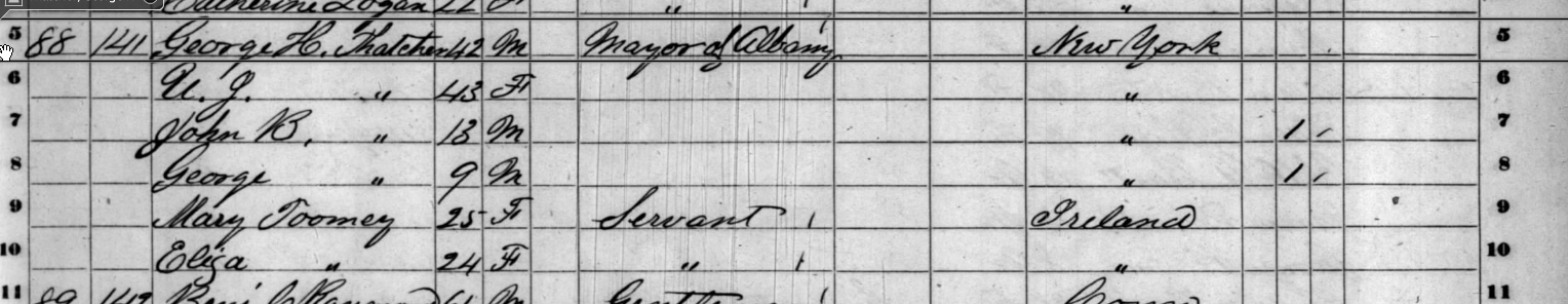
Based on the hunch that Elizabeth Thacher was originally Eliza Toomey, I pursued that name. As the 1860 US Census shows, Eliza Toomey, age 24, was a servant in George Hornell Thacher Sr.’s home in 1860.

1860 census png

So did GHT1 fall in love and marry Eliza Toomey after his first wife’s death?   No, not as simple as that. Mary Agnes was born in 1866, a full eight years before Ursula Jane Boyd’s death in 1874. William was born in 1868.

It appears that Eliza moved away to birth the children out of the prying eyes of Albany society. Mary Agnes supposedly was born in Pittsfield, MA and William in nearby Canaan, NY.   I have not yet found birth certificates nor baptismal papers for the children, nor a marriage certificate for GHT1 and Eliza. My suspicion is that the Rev. Henry Gabriels played a role in both aspects. While I have no proof, the strong, decades long personal friendship between Gabriels and Eliza Thacher leads me to believe that he secretly married the two sometime after GHT1’s first wife died. I find the timing of GHT1’s secret donations to the construction of St. Mary’s Catholic Cathedral an interesting coincidence. Might that have been compensation for private, off-the-record baptisms for the children in 1866 and 1868?

Even after GHT1’s death, Eliza continued to be a generous patron of the Catholic Church, such that her funeral was attended by several bishops and officials from different dioceses from across the State. Conjecture to be sure, but is it surprising that the Rev. Gabriels, possessing knowledge of a damning personal secret of one of the wealthiest political families in New York State, became the Bishop of Ogdensburg in 1892?

It appears that GHT1 continued his affair for over a decade. While we do not know exactly when they married, it must have been after his first wife’s death in 1874. We do know that the 1875 NYS Census shows GHT1 maintaining two households, one on Washington Avenue in Albany accompanied by his late wife’s sister, and one at 65 Grand Division Street in Troy where he resided with Eliza and the children.

Although they appear in the census, I believe GHT1 was attempting to keep this second family a secret from the Albany society. Nothing was published in the press actually naming Elizabeth Thacher nor identifying the children as being the son and daughter of GHT1 until after his death in 1887.

GHT1’s last will and testament makes no mention of nor bequeaths anything to Eliza or the children. In addition, his sons John Boyd and George Hornell, Jr., prepared a legal document by which Eliza signed away any rights she had to her late husband’s estate. A cruel act, I thought, until I learned that prior to his death GHT1 had provided for Eliza and the children’s future by giving her a sizable fortune in railroad company stock. It is unknown how much of the family wealth went to Eliza, but it could easily explain the apparent resentment that George Hornell Jr. displayed toward the second family and his future disdain for his son’s (my grandfather’s) wife Catherine Callahan.

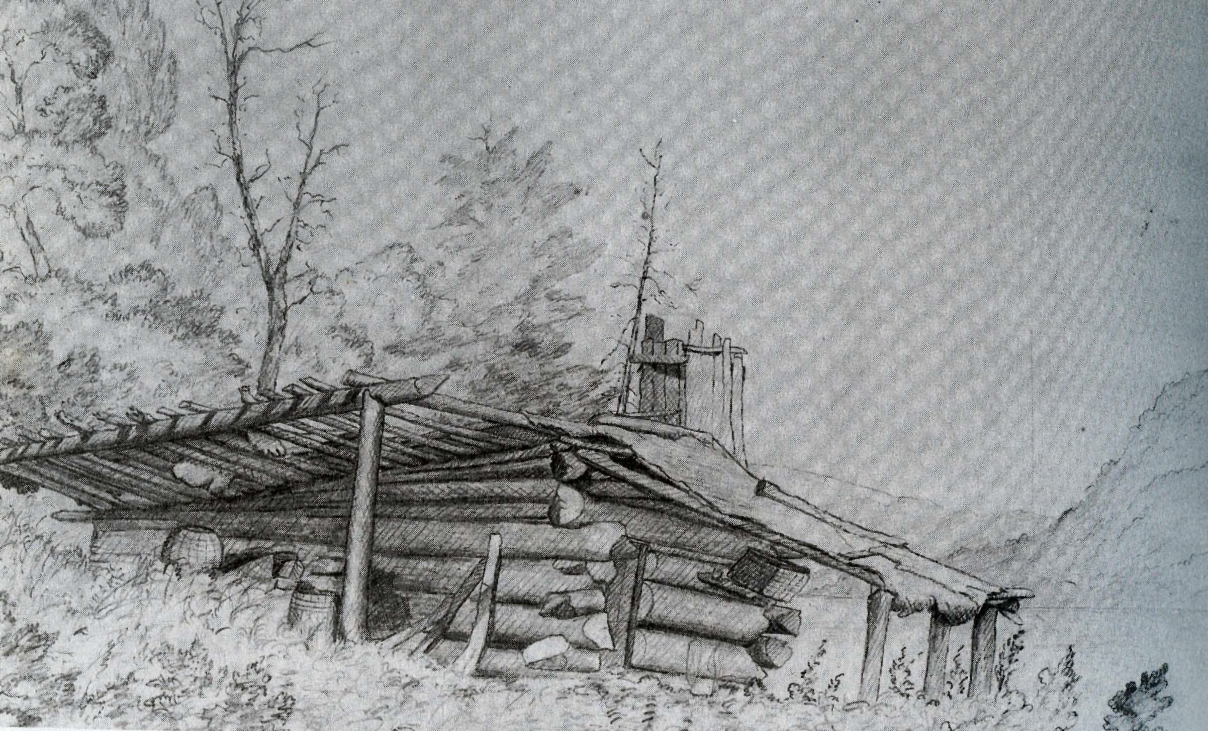
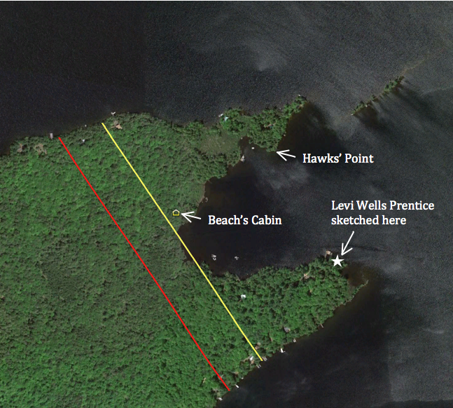
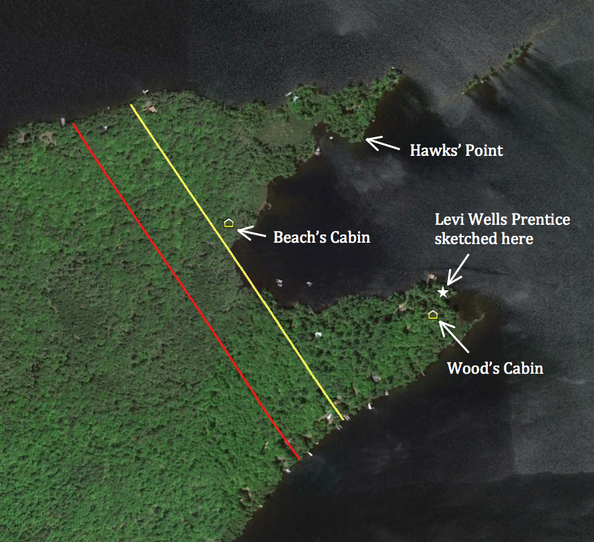
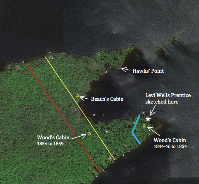
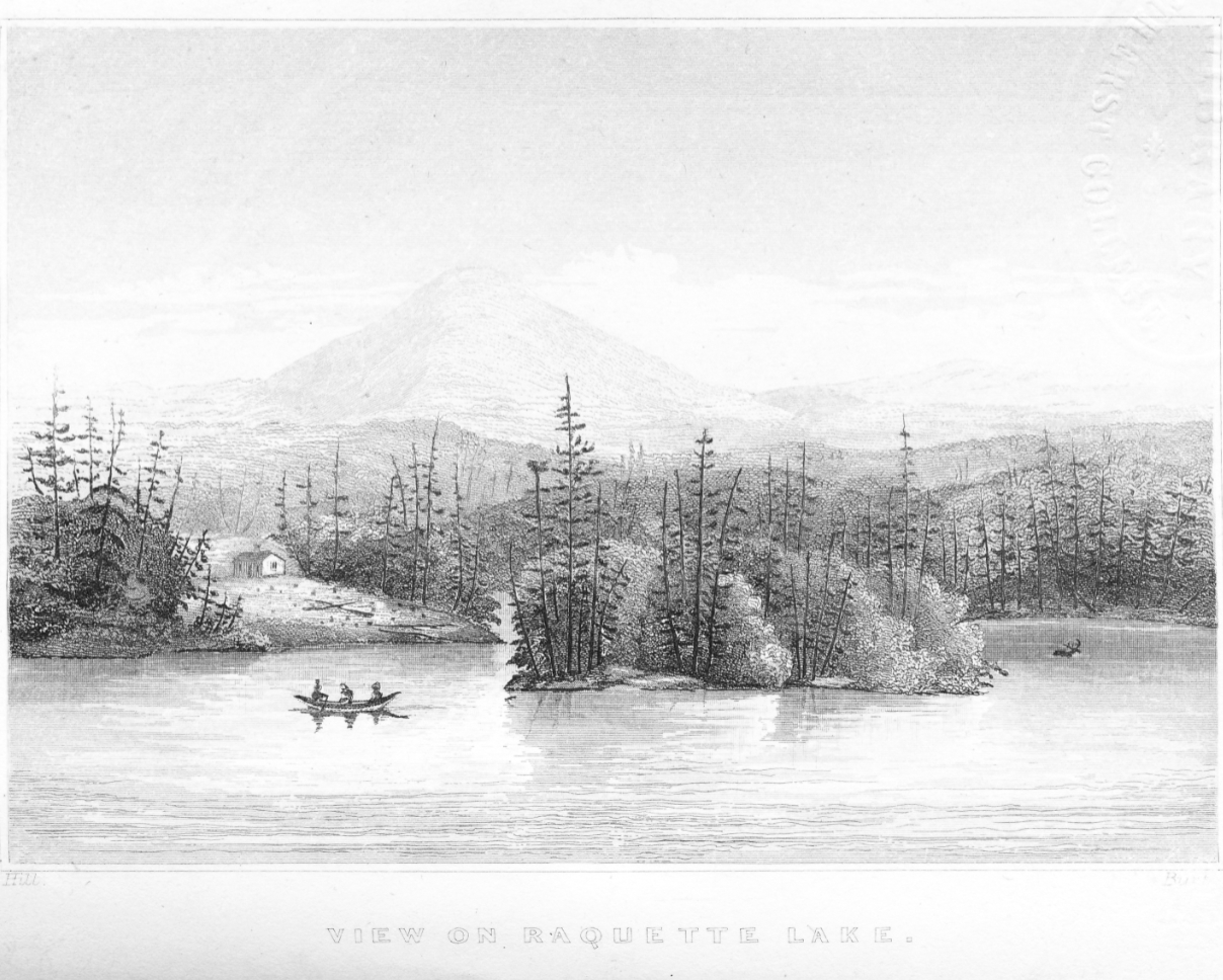
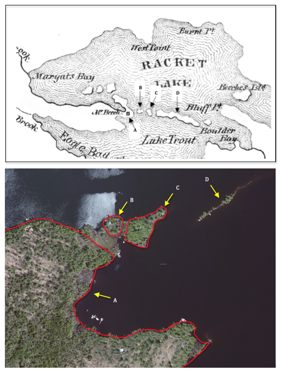
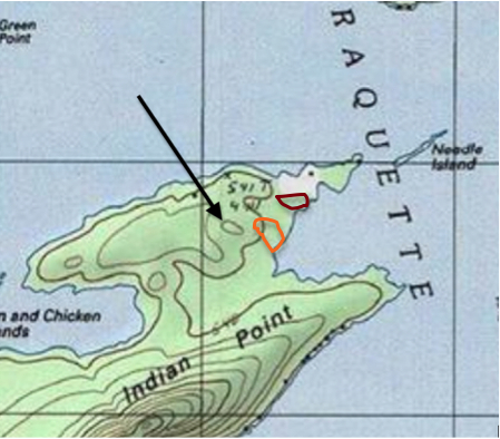
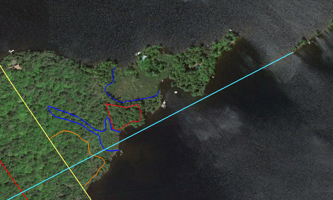
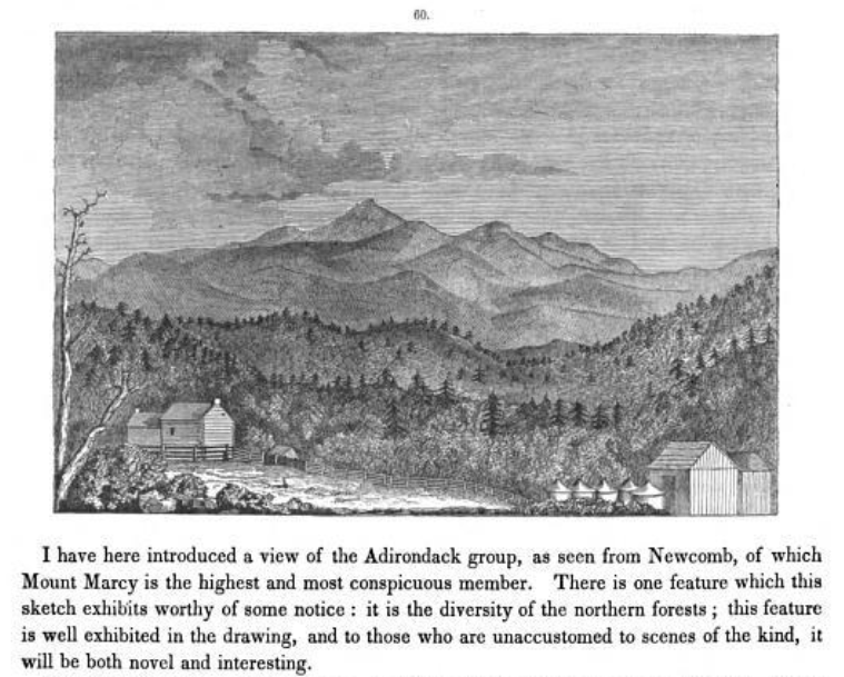
Which brings us back to the Adirondacks. According to the History of Hamilton County, John Boyd Thacher “built a cabin for the use of his father,” in 1867 on Thacher Island on Blue Mountain Lake. An interesting choice of words by the authors Aber and King? Could it be that the island was purchased specifically for GHT1 to have a place to spend time with his secret second family, one year after Mary Agnes’ birth?

Although the deed to Thacher Island is in John Boyd Thacher’s name, there is little evidence of his using the lodge there until after 1876, when he also purchased Indian Point on Raquette Lake. John Boyd appears to be the owner of Indian Point in name only. I have not found any evidence that he ever spent time there.

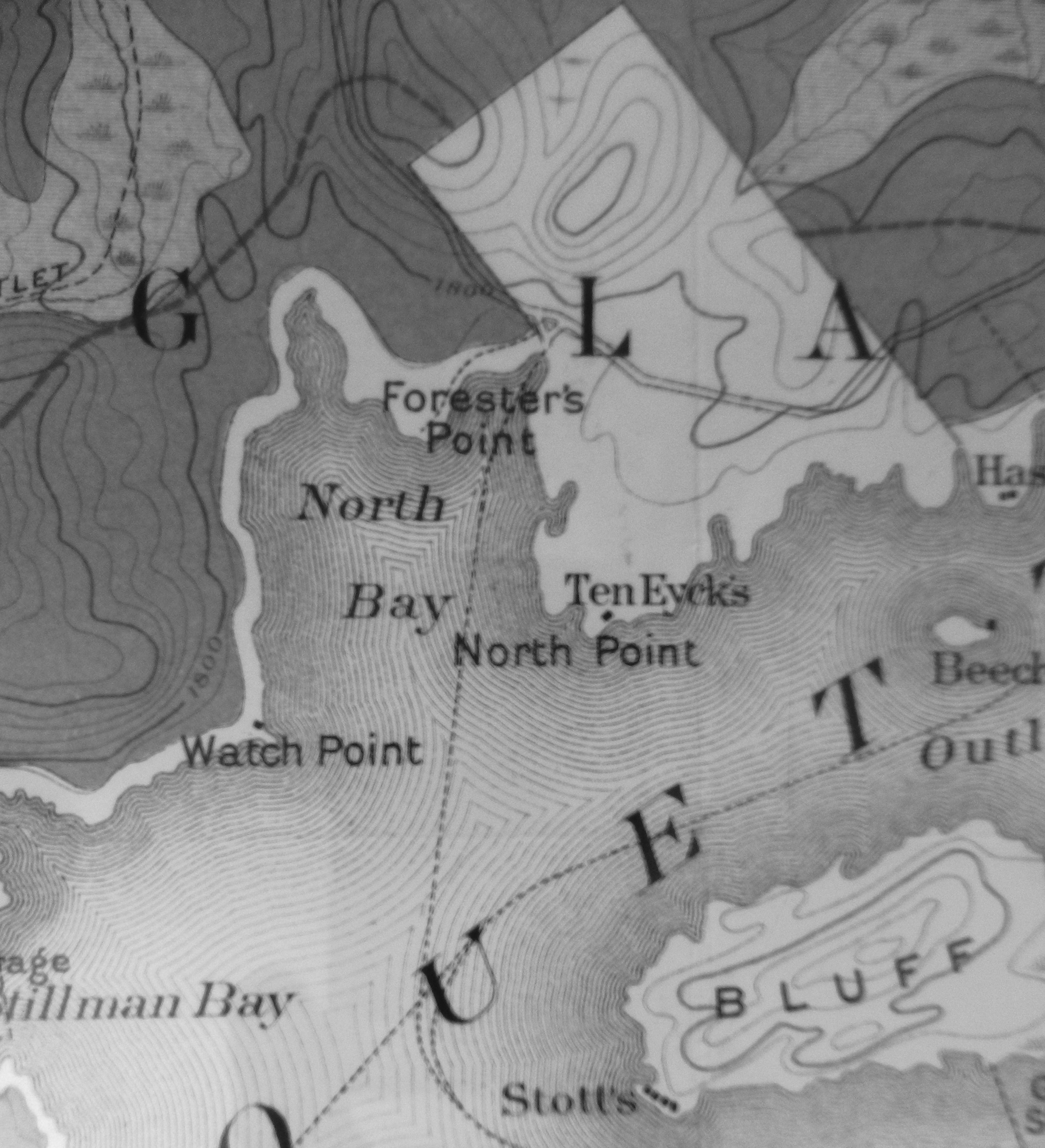
Conversely, the evidence shows that his father, Eliza, Mary Agnes and William regularly stayed at the Thacher Camp on Indian Point. According to the historian Larry Miller, it was common for the camp owners on Raquette to end their long day of travel by train, stage coach and steamer at Ike Kenwell’s Raquette Lake House on Tioga Point for the night and then move to their private camps the next morning.

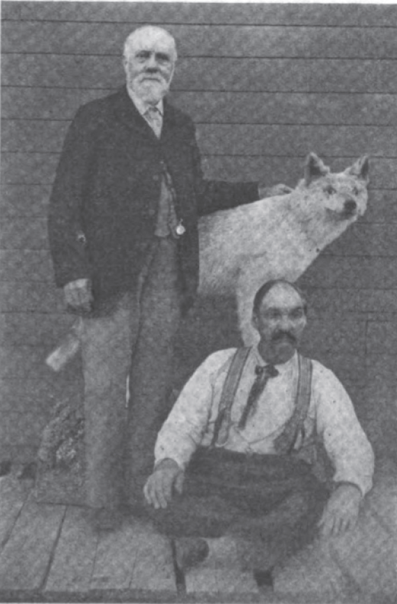
Entries for GHT1 and his second family appear at least two times in Ike Kenwell’s guest registry, July 8, 1882 is shown below.

kenwill

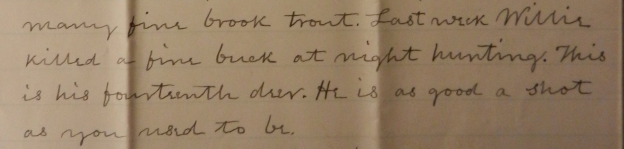
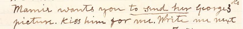
We also have letters written by GHT1 to his son George Jr. from the Thacher Camp on Indian Point referencing the children’s nicknames Willie and Mamie.

willie letter

mamie ltr

I believe that GHT1’s move from Blue Mt. Lake to Raquette Lake in 1876 may indicate that was the year that he revealed his second family to his sons. Perhaps the sons’ less than charitable response required GHT1 to build a new cabin at Raquette while John Boyd and George Jr. continued to use Thacher Island on Blue Mt. Lake.

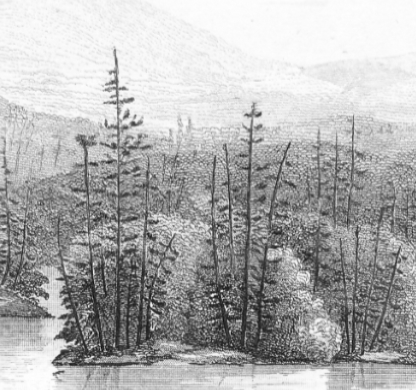
While he may have come out to his sons, I believe GHT1 still wanted Albany society to be in the dark about his new family. This could explain why the land on Indian Point was put in John Boyd’s name. While most of the other private camps on Raquette Lake at the time appeared on maps and in the photos of Seneca Ray Stoddard, the Thacher Camp was notably absent.

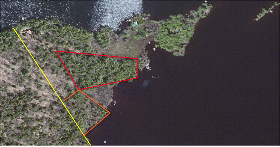
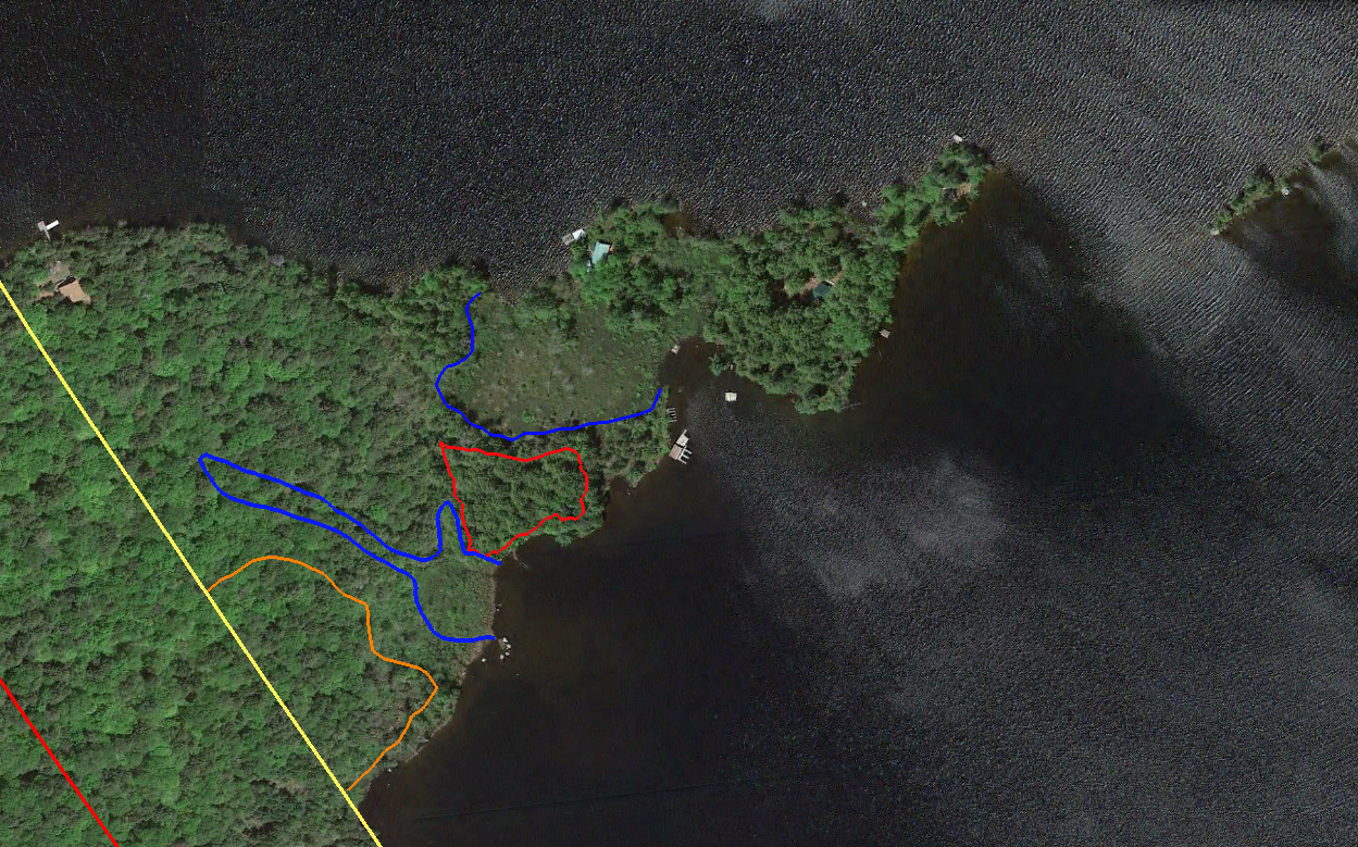
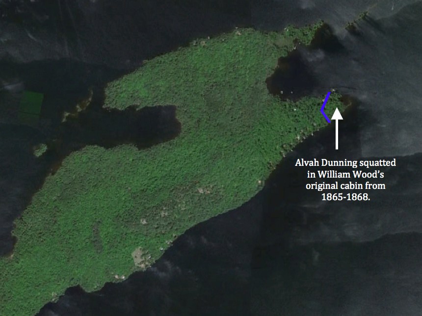
The property on Indian Point appears to have been abandoned between 1886 and 1910, and the original Thacher Camp cabin disappeared without a trace.   At the time of their father’s death in 1887, John Boyd established a summer residence in Altamont, NY and George Jr. began to summer in Manchester, Vt. I suspect that they associated the Adirondack camps with Eliza and her family.

We may never know the truth but fortunately, all trace of the second family was not lost. Last summer I hosted Nancy Morris Tuthill, the great-great-granddaughter of George and Eliza, at our cabin on Indian Point. It is fitting that this descendent of Eliza, who brought the Thachers to the Adirondacks, is a resident of Lake Placid.

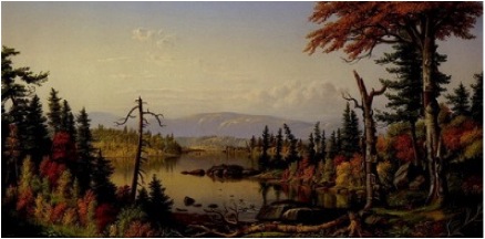
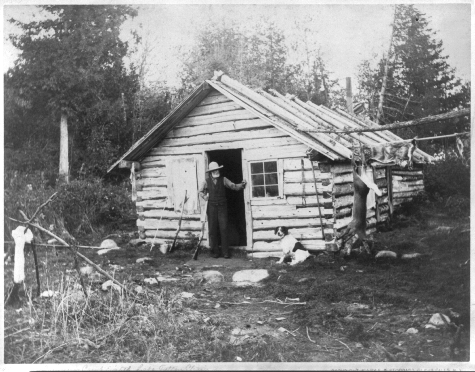
While I feel that our story has come full circle and our history on Indian Point is now understood, I will forever be searching for just one photo of the original Thacher Camp on Indian Point.

The End

The Search for William Wood’s Cabin

Courtesy of the Adirondack Museum

Courtesy of the Adirondack Museum

My last article identified the most likely location of the original cabin built by Matthew Beach and William Wood in the mid-1830s. Wood remained on Indian Point until 1859, but sometime between 1844 and 1846 he had a falling out with Beach and built a separate cabin (shown in this 1851 sketch from Jervis McEntee’s diary).

I began a new search to determine where Wood’s cabin had stood, using the 1851 sketch as a starting point. I feel confident in saying that the mountainscape in the background of the sketch is unmistakably Bluff Hill, which rises above the Bluff Point peninsula of Raquette Lake. So where would one see this particular view?

One might expect that each man’s cabin would have been located within their individual parcel when they obtained legal title to their lands in 1849. The image below shows that Beach was deeded 25 acres to the right of the yellow line, encompassing both tips of Indian Point. Wood was deeded 25 acres in a rectangular parcel between the red and yellow lines. My theory of the location of Beach’s cabin has it on Beach’s property, so Wood’s cabin should have been within his rectangular parcel.

Beach and Wood division

However, after carefully canoeing along the shores of the inner bay between the two tips of Indian Point and along the south shore of Indian Point, I can unequivocally state that the view captured in the McEntee sketch could not have been seen from within Wood’s 25 acre parcel. The only potential location would be at the very back of the inner bay but Needle Island obscures the view of Bluff Hill from that vantage point.

Why would Beach and Wood divide the end of Indian Point in a way that did not correspond to where the men’s cabins were located? The answer comes from looking at the Township 40 Map of 1900. Notice that most of the straight edges of the property parcels are all lines that run parallel to the diagonal boundaries of Township 40. In 1773, Ebenezer Jessup was charged with surveying the boundaries of the Totten & Crossfield Purchase and segmenting the area into townships. The reason why the township’s west and east boundaries run North 27 West rather than straight north-south has been lost to history. Nevertheless, it appears that in giving legal title to the men, Farrand Benedict and David Read chose an easier surveying technique to divide the land into equal 25 acre parcels, without regard to the location of the cabins.

jessup line

This realization opens up the possibility that Wood’s cabin actually existed on what was legally Beach’s land.   McEntee was not the only visitor who wrote about Wood’s cabin. In 1855, Henry Jarvis Raymond, the founder of The New York Times and NYS Lt. Governor, wrote of his visit to Indian Point.

[Wood] and Beach in course of time disagreed, for in any part of the earth, no matter how secluded, two persons are enough for a quarrel; and a clearing of ten acres, even in a wilderness a hundred miles through, affords ground enough for a local dissension. So finding they could no longer live together, they agreed to divide their fortunes and have nothing to do with each other. Wood moved into a hut, half logs and half bark, some fifty rods from Beach.

Fifty rods is 825 feet. From where I believe Beach’s cabin to have been, I ventured roughly that distance in each direction seeking to see if any point gave a view similar to the McEntee sketch. I found it at what our family calls Hawks’ Point (named for the family of Ken Hawks, current owners of Watch Point on North Bay, who camped here for many years). The view from here has a very close resemblance to the sketch.

Hawks point map view

Surely this was the location of Wood’s cabin.  I was convinced until I read the entirety of Jervis McEntee’s diary from his 1851 visit. McEntee said of Wood’s cabin, “The house is built of logs with a bark-covered porch in front, and standing on a gentle elevation about fifty yards from the lake.” A cabin 150 feet back from the lakeshore on Hawks’ Point would be in a marsh and no longer have a view of Bluff Hill.

McEntee also states that, “Wood was not at home but we saw him coming over the lake soon after we reached his house…he had just now returned from ‘Blue Mountain’.” This could be interpreted to mean that they were able to see Wood coming north across Beaver Bay up from the mouth of the Marion River. There is no such view from Hawk’s Point.

McEntee also commented that he had “stopped at Wood’s and got our clothes and some meal and potatoes. We heard three or four rifle shots in the direction of Beach’s, and rowing over there we found a skiff and a birch bark canoe and met Beach and an Indian at the landing.”

If Wood’s cabin had been on Hawks’ Point, Beach could have shouted over the water the short distance from his landing and would have not needed to fire gunshots in the air to get McEntee’s attention.

Levi Wells Prentice’s 1877 painting titled “Raquette Lake from Wood’s Clearing” alludes to another possible location for Wood’s cabin.   Prentice actually painted at least three versions from the same sketch. I believe the one shown below helps to identify where the sketch was drawn.

LWP Woods Clearing

I believe the sketch was drawn at a spot (marked with a white star below) on a small inner cove at the far east end of the southern tip of Indian Point while looking south. The peninsula on the left of the painting is Woods Point, where William Wood’s brother Josiah lived. Osprey Island appears to the right across a small channel from Woods Point. The far shoreline is not actually the southern shore of Raquette Lake but rather Long Point. The mountainscape in the background shows the Blue Ridge, Wakley, and Metcalf mountain ranges that lie south of Raquette Lake.

LWP sketched here

If one looks due east rather than south from here, you do see a view of Bluff Hill similar to the McEntee sketch. Sitting on the porch and looking south from here, you would see William Wood “coming over the lake” as he “returned from Blue Mountain”. The distance from Beach’s cabin and the fact that I believe Wood left a windbreak of trees to the north of his cabin (seen in McEntee’s sketch) would explain why Beach had to fire gunshots in the air to get McEntee’s attention. Finally, there are stone piles that appear to be corner foundation points found where I believe Wood’s cabin to have been.

Woods cabin v2My search would have ended here if not for two conflicting “facts”.

Warren Reynolds recalls his father showing him the remains of William Wood’s cabin when he was a small boy in the 1930s. Only a corner joint of rotting timbers remained. Warren’s father claimed that his friend Billy Wood, one of Wood’s descendants, originally showed him the site. These remains were not anywhere near the tip of the southern fork. Instead, this cabin had been located just to the west of the line dividing Beach and Wood’s properties on the southern fork but closer to the inner bay of Indian Point.

The second contradiction is Henry Jarvis Raymond’s 1855 comment that Wood’s cabin was “some fifty rods from Beach”.   The location near the tip of the southern fork is almost 100 rods away from Beach’s cabin.

My research of our family’s property deed revealed a clue that might explain these contradictions. In 1854, Matthew Beach sold a 4.75-acre parcel to Albert and Gardner Eldred. The boundaries of this small parcel, in blue below, enclose the area where I believe William Wood had his first cabin. Either Beach forced Wood out of his cabin or perhaps by 1854 Wood had already begun to court Celia Ann Whitman, whom he married in 1858 after fathering their daughter Lydia in 1857. Did he choose to build a more suitable cabin to raise a family in, within the boundaries of his legal property?

Woods 2nd cabin

Based on Reynolds’ recollection and the supposition that Henry Jarvis Raymond visited this second cabin in 1855, I have marked an approximate location around fifty rods from Beach’s cabin. It is likely that Wood occupied this cabin from 1854 until 1859 when he moved to Elizabethtown. Today the sites have modern construction or disrupted landscapes that preclude a more in-depth ground search for evidence, but I feel confident in my conclusions.


The Search for Raquette Lake’s First Cabin

I know where Matthew Beach and William Wood built their original cabin (depicted in this 1840 sketch by John Hill) on Indian Point. Or at least I think I know, or perhaps I should say I have deduced a pretty darn good educated guess. I welcome other’s critiques of my assumptions.

1840 Mathew Beach Cabin sketch2

After discovering the location of the mysterious 1878 Thacher cabin, my obsession turned to searching for the first settlers’ home on our land. The above sketch offers little in the way of accurate perception of distances given that the opposite side of North Bay appears as close to Needle Island as the tip of Indian Point. And don’t get me started on the apparent thickness of Needle Island. Yet the drawing holds some surprisingly valuable clues.

One might even question if this could possibly be a view of Needle Island and Indian Point. Thankfully, there exists exactly one more piece of contemporary evidence on the cabin’s location. A portion of the 1860 map of the Headwaters of the Racket River by F.A. Merritt shows the cabin on the north fork of Indian Point. Here again, the proportions do not reflect reality and the exact location of the cabin cannot be determined from the map.

interpretation 1860 map final

Although the sizes of the islands appear gigantic, my interpretation is that the very tip of the north fork appeared to the mapmaker as two small islands (B & C). If surveyed in early spring with unusually high water, what is today swampland separating A from B and B from C, could have been an open channel of water. This would imply that the cabin was located within the broad area marked A.

Having consulted the two pieces of evidence that provide graphic clues to the cabin’s location, I turned to the pitifully few cabin descriptions written by Beach and Wood’s visitors.

During his 1851 visit, James McEntee wrote:

We heard three or four rifle shots in the direction of Beach’s, and rowing over there we found a skiff and a birch bark canoe and me Beach and an Indian at the landing. Beach told us that a party had arrived and probably the one Brainerd was expecting…I had quite a curiosity to see him, and walking up to Beach’s house we found the party there.

The words “walking up to Beach’s house” appear to correspond with the 1840 drawing’s perspective that the cabin was on a slight rise of land above the lakeshore. The description also implies that McEntee could not hear or see the party at the cabin from the shore.

C. W. Webber wrote of his 1849 visit: “Securing our boat, and taking out our equipment, we walked to the hut, but a few rods from the edge of the lake”.   A rod is 16.5 feet, but the meaning of “but a few” could be interpreted to mean as little as two to perhaps five rods. This would imply that the cabin could have been between 33 and 82 feet of the shore. Given McEntee’s words, I suspect the cabin was at the higher end of this range.

An enticing yet cryptic clue comes from David Read’s 1848 letter published in Joel Tyler Headley’s The Adirondack or Life in the Woods.

About five hundred yards from Beach’s hut, stands a lofty pine tree, on which a grey eagle has built its nest annually during the nine years he has lived on the shores of the Raquette….From his cabin door he can see them in sunshine and storm.

If only Read had described where this lofty pine tree itself was located.

These writings did not help to zero in on the cabin’s location, so modern science was needed to aid the search. Dr. Mike Kudish, professor emeritus of forestry science from Paul Smith’s College suggested that the cabin and cropland clearing would likely today be a stand of spruce and white pine, secondary species that would have naturally reforested the open clearing.

Using an aerial photo from the early spring and Google Earth, I determined the GPS coordinates of the corners of two search areas (orange and red) mostly devoid of deciduous trees. The yellow line is the western boundary of Matthew Beach’s property.

tree cover search areas

Of course an aerial photo does not reveal what the reality is on the ground. Walking the two search areas with professional GPS equipment, I mapped the areas in blue that are wetlands and the red and orange areas which were the only ground suitable for the cabin’s location.

gps and wetlands

I searched the ground of both sites extensively but found nothing that indicated the remains of a cabin. The cabin had been described by C. W. Webber in 1849 as “of such peculiar and original construction that few would imagine it, at first sight, a human habitation…scarcely anything more that a hunter’s bark shanty of large size…and the roof was formed of as many as three different thicknesses of spruce bark, beside there being a rough flooring to the ‘building’, if indeed, I may use this term.”

Lacking a foundation or even stone pilings at its corners, it is not surprising that all surface evidence of the cabin has rotted away in the intervening 135 years since it was last occupied.

With the help of the Adirondack Research Consortium, I contacted Dr. Christopher Wolff of the SUNY Plattsburgh Anthropology Department. Dr. Wolff and two graduate assistants spent two days digging ten shovel test pits in each of the search areas.

shovel test pits

Alas, we found no evidence of the cabin’s location. In fact we found no man-made artifacts whatsoever. We did however discover that there is a burn layer in the ground about 8 to 12 inches below the surface (the grey ash in the photo). Dr. Wolff said it either indicates slash and burn cultivation at the hands of Beach and Wood or Native Americans, or a forest fire long ago. The burn layer is present throughout the north fork of Indian Point and thus does not provide any clue to the cabin’s location.

burn layer

The Empire State Metal Detector Association based near Albany also aided the search.   Tim Myers and Peter Teal travelled up to Indian Point for two days of detecting.

metal detector

Once again the search proved elusive. No artifacts were found in the red search area and the further west orange search area revealed only the lead bullet shown below which was fired from a .32 Smith & Wesson Number 2 Army Revolver (manufactured between 1861-1874) and a piece of iron from a chain link. Both of which post date the time of Beach and Wood.

Screen Shot 2015-06-23 at 5.51.26 AM

Meyers and Teal were very surprised to find so little in an area occupied from 1837-1870; however, Meyers commented that they have done detecting at sites clearly marked as homesteads on old maps and come up similarly empty-handed. Both men believe that the orange search area is much more suitable for the cabin site, given that the red search area is bordered on two sides by wetlands and susceptible to flooding.

The mystery would have remained unsolved if not for the following letter, written by Ms. Howell to Amanda Benedict during the 1873 women’s botany expedition chronicled in Barbara McMartin’s book To the Lake of the Skies.

The accompanying sketch is a view from our camp [on Indian Point] which we were looking upon when at supper…The little boat near the island [Needle Island] which is one of our own is trying to approach the splendid buck, which is swimming with all its might toward the west and will evidently reach land before the boat overtakes it. Near the boat on the end of the island is the Eagle’s nest which for many years was the home of a family of Osprey.

Alone this text offers no meaningful insight, but it is the next paragraph of the letter that enlightens. Ms. Howell’s letter proceeds with a verbatim plagiarizing of two whole paragraphs of David Read’s 1848 letter in which he speaks of the “lofty pine tree” 500 yards from Beach’s hut. We do not know if Ms. Howell included these words in her original letter or if Benedict placed them there when transcribing all of the expedition letters. However, I think it is clear that the writer is implying that the Eagle’s nest on the west end of Needle Island in 1873 is one and the same as that seen by David Read in 1849.

This is very plausible as John Plumley and Amos Hough, as close as family to Matthew Beach, were among the guides with the women’s expedition camping on Indian Point. They would have known and could have told Ms. Howell and Amanda Benedict of the lofty pine and eagle’s nest’s history. It is also likely that Amanda Benedict would have read and indeed might have had with her on the trip her uncle Joel Tyler Headley’s book in which David Read’s letter was published.

A closer study of the 1840 sketch of Beach and Wood’s cabin reveals corroborating evidence of this theory.   If you look closely, the second pine tree in from the west end of Needle Island is topped with a horizontal surface rather than coming to a point. No other tree in the drawing has a similar top. Could the artist have been attempting to indicate an eagle’s nest?

eagles nest

A similarly close look at the drawing of the cabin clearly shows a hill rising behind and above the cabin with a few trees on it.

hill above hut

I believe this hill to be the small rise indicated by the arrow in the topographical map below.

hill topo o & r areas

Putting together all of these clues, I theorize that the cabin was located at least 500 yards away from the west end of Needle Island, that the island was visible from the vantage point of the cabin, and the area northwest of the cabin had a higher elevation.

Needle Island is not visible from within the red search area, blocked by the portion of Indian Point between it and the island. Also, the red search area is almost completely level with no hill near a cabin’s possible location.

Needle view

I am convinced that the original cabin must have existed in that portion of the orange search area south of the light blue sight line from Needle Island. I welcome any suggestions for how to search for definitive evidence in this area. However, even if I never find a holy grail of an artifact, I am content with my current conclusion, and my obsession has been sated.


“A Week in the Wilderness” by Henry Jarvis Raymond 1855

Harold Jarvis Raymond

Among the many who visited Matthew Beach and William Wood on Indian Point, Henry Jarvis Raymond is notable as the founder of The New York Times.  Raymond was also the elected Lt. Governor of New York State in the summer of 1855 when he travelled through the region.  He published four letters detailing his Week in the Wilderness.   I have republished here his second letter which describes his time at Raquette Lake and at the Iron Works in Adirondac (present day Tahawus).

WiW1

WIW2

WIW3

WIW4

WIW5

WIW6

WIW7

WIW8

WIW9

WIW10

WIW11

WIW12

WIW13

WIW14

WIW15

WIW16

WIW17

WIW18


Alvah Dunning: The Hermit Who Could Not Escape Civilization

stoddard photo

Alvah Dunning was perhaps the most famous of Raquette Lake guides, alleged to have helped lead the first excursion of sportsmen to Raquette Lake at age eleven. Born in Lake Piseco in 1816, he lived there until 1860 when his neighbors’ rightful condemnation of his abuse of his wife forced him to flee.  1  From that moment, he chose to remove himself from society in favor of the freedom of the wilderness. Yet civilization’s constant barrage upon him eventually brought him to a tragic end.

Reverend Thomas Wall described the man from his 1856 excursion to the region:

Dunning…is a very close imitation of some of [Fenimore] Cooper’s models [of the Leatherstocking Tales]– silent, stealthy in movement, full of resources; he could almost speak the language of the animals. I have seen him, by a peculiar chipper, call a mink from its hiding place in the rocks and shoot it, and have known him to bring a deer back into the water by bleating and making the noise of wading. Dunning was a true sportsman, never allowing more fish or game to be taken than was needed…Indeed, his excellence, when in his prime, was so generally known that it excited much of the enmity with which he was regarded by some, for if he could be had he was always first choice.  2

Dunning’s woodsman skills were learned from his father, “Scout” Dunning, who had served under General William Johnston and perfected his woodcraft during the French and Indian Wars and the American Revolution. These skills served Alvah well as he fled civilization for Lake Lewey and later settled in Blue Mountain Lake.  3

According to Dr. Arpad Gerster, the growing attraction of wealthy sports to Blue Mountain Lake soured the tranquility that Dunning sought.  4  My great-great-grandfather George Hornell Thacher began visiting Blue in 1862 seeking his own solitude and yet he represents the first wave that drove Alvah further west.   Ironically, GHT followed Alvah’s footsteps to the same spot 15 years later driven by the growth of tourist hotels on Blue.

Several sources state that Dunning lived at Indian Point on Raquette Lake between 1865 and 1868. My research indicates that he likely squatted in the first of two cabins built by William Wood, the one nearest the very tip of the southern fork of the peninsula. During this time, ownership of the cabin and a small parcel of land surrounding it changed between Albert Eldred and John Plumley, both of whom lived elsewhere. Plumley lived in Long Lake and being well acquainted with Alvah, it is conceivable that he allowed this use of his land by Dunning.  5

map 1865-1868

Of his many clients, we know that one visitor of note in the summer of 1865 was Fred Mather, who later became the fisheries editor of Forest and Stream magazine. For two weeks, he stayed with Dunning on Indian Point and fished for trout in Raquette and Brown’s Tract Inlet.  6

Mather later described him in his book My Angling Friends;

Only men who possess strongly marked personalities are capable of making strong friends and as equally strong enemies…it seems that Alvah is well liked by sportsmen whom he has served…Others dislike him, and among Adirondack guides he is, for some reason, the most unpopular man in the woods.

The enmity of other guides was also stoked by Dunning’s fierce belief in his right to unfettered use of the land and to kill game any time of year. Mather writes of visiting Dunning again in 1882 when Alvah complained;

Times is different now, an’ wus. In them days nobody said a word if a poor man wanted a little meat an’ killed it, but now they’re a-savin’ it until the dudes get time to come up here an’ kill it, an’ some of ’em leave a deer to rot in the woods, an’ on’y take the horns ef it’s a buck, or the tail ef it’s a doe, just so’s they can brag about it when they go home, an’ they’d put me in jail ef I killed a deer when I needed meat. I dunno what we’re a-comin’ to in this free country.  7

Although praised and sought after by the wealthy for his guiding skills, Dunning did not return the appreciation, complaining to Mather,

These woods is a-gittin’ too full o’ people fer comfort—that is, in summer time ; fer they don’t bother the trappin’ in the winter; but they’re a-runnin’ all over here in summer a-shootin’ an’a-fishin’, but they don’t kill much, nor catch many fish ; but they git in the way, an’ they ain’t got no business here disturbin’ the woods.  8

There is no small irony in the fact that the writings of Mather, in Forest and Stream, brought an even greater number of adventurers into the Adirondacks. Forest and Stream became a prominent voice championing the forest conservation and game regulations that infringed upon Dunning’s freedom.

Dunning continuously moved around the area. He allegedly purchased Osprey Island on Raquette Lake from John Plumley in 1868, sharing the island with Reverend Adirondack Murray to the early 1870s.  9

alvah osprey camp

He then built a cabin at Brown’s Tract Inlet and later the one shown below on an island on Eighth Lake.

Alvah Dunning with dog

Mather attempted to remain in contact with Alvah as late as 1896 according to this classified placed in Forest and Stream.

Mather search Dunning

While Mather and other writers in the popular press always expounded on Dunning’s expertise, they also often portrayed the man as a simpleton, condescendingly alluding to his lack of understanding that the earth is round, the reasons for tides, and giving Alvah’s voice a foolish dialect.

A popular fable about Dunning claims that he sold his vote for President Grover Cleveland in the fall of 1892 in exchange for two boxes of Cleveland Baking Powder. The true story is more complex but equally amusing. Dunning had guided for Cleveland in the summer of 1892. Prior to Cleveland’s second inauguration in March of 1893, the Fort Orange Club of Albany, NY, hosted a celebratory dinner for the president-elect. James Ten Eyck, President of the Club and owner of a rustic lodge at North Point on Raquette Lake, contacted Ike Kenwell to procure the freshest trout for the dinner. Kenwell, who had previously owned the Raquette Lake House at Tioga Point on Raquette Lake, contracted Alvah Dunning for the task.   Dunning caught 35 pounds of brook trout through the frozen ice of Shallow Lake. Rather than be paid for the trout, Alvah decided to make a trade. Erroneously believing the newly inaugurated President was associated with the Cleveland Baking Powder company, he wrote:

 Mr. Cleveland:

Dear Sir: Some time ago Ike Kenwell asked me to get you twenty-five pounds of brook trout. I done so. He offered to pay me, but I did not take any pay. Just now I am out of baking powder and would be very much obliged if you would send me some.

Yours truly,

A. DUNNING

President Cleveland graciously sent two cases of one pound boxes to Alvah.  10

News of his exploits often made the press.   In the winter of 1894 came a report of his unfortunate death.   Forest and Stream magazine reported that Alvah had fallen on the ice of Raquette Lake and cracked his skull. He was brought to William S. Durant’s Camp Pine Knot where a doctor attending him said he would not recover. The magazine lamented “That such a man should, after long years of peril by field and flood, come to his death by a fall on the ice such as one might get on Broadway, is one of the ironical phases of fate.”  11  Fortunately for Alvah, the news of his demise was premature and he recovered to live another eight years.

His actual death was equally ironic. On the night of June 13, 1902, the 86 year old Alvah Dunning spent the night in a hotel in Utica, NY. Continuing their condescending tone, the press reported that Dunning died because he “blew out the light” on the gas lamp in his room and was asphyxiated by the gas.   A more accurate account is given in Forest and Stream magazine, which noted that the cock on the gas lamp was left one quarter open. It appears that Alvah had closed it enough so that the flame of the lamp died but that he did not seal the valve shut.  12

Modern civilization, which he had sought to escape all his life, tragically ended that life.


1850 – The Raquette River is Declared a Public Highway


raq river log drive

Log Drive on Raquette River. Published by Jon Kopp in Tupper Lake – Images of America


Prior to his visit to Matthew Beach and William Wood’s cabins on Indian Point in 1855, Henry Jarvis Raymond was instrumental in securing the funding from the New York State Assembly to make the necessary infrastructure improvements to turn the Raquette River and the Moose River into public highways for the transportation of logs through the vast wilderness of the Adirondacks.  Here is a reprint of the 1850 NYS Assembly committee report which led to this achievement as published in the March 1, 1850 edition of the New York Morning Courier.

raymond 1

raymond 2

raymond 3

raymond 4

raymond 5

raymond 6

raymond 7

raymond 8

raymond 9

raymond 10

raymond 11

raymond 12

raymond 13

raymond 14

a line of text is missing from the bottom edge of the newspaper


raymond 15raymond 16raymond 17raymond 18

raymond 19

He Who Would Give the Name ————– “Adirondacks” —————– Prof. Ebenezer Emmons

After much toil and labor in rowing, in consequence of a strong head wind, we reached the lake at its eastern extremity. This accomplished, our next business was to find the establishment of Beach and Wood situated on some point on the opposite shore. By fortunate conjecture, our guide struck upon the right course and soon landed on Indian Point at the residence of the above named gentlemen. Here we determined to remain till we had thoroughly explored the region.  1

Thus Prof. Ebenezer Emmons described his arrival on my family’s land in 1840, captured in this sketch of Beach and Woods’ cabin by John William Hill.

1849 Birch Pt sketch

Emmons was continuing his efforts, begun in 1837, as director of the Survey of the Second Geological District to study the mineralogy, geography and geology of 10,000 acres across northern New York State.  2

In his 1838 report Emmons wrote:

The cluster of mountains in the neighborhood of the Upper Hudson and Ausable river, I propose to call the Adirondack group, a name by which a well known tribe of Indians who once hunted here may be commemorated. 3

Emmons’ term for the high peaks region was adopted and expanded to describe all of the area now known as the Adirondacks.

However, Emmons’ impact on the region is not limited to its name. In the summer of 1837, he led the first recorded ascent of the tallest mountain in New York and named it Mt. Marcy, in recognition of Governor William Marcy who appointed him to lead the survey.  4

Ebenezer Emmons

Emmons was a true renaissance scholar who took a winding path through various disciplines before taking the helm of the survey. Born in 1799 in Middlefield, MA, his fascination with the natural world began early. According to an 1896 biography published in Popular Science Monthly,

The doors in his room were covered with bugs and butterflies pinned on when he was a small boy. His mother often used to say: ‘Eb, why do you always have your pockets filled with stones? I have to mend them every week.  5

Emmons enrolled at the age of fifteen to study botany at Williams College, graduating in 1818. He then attended Berkshire Medical College and became a practicing physician in Chester, MA. In 1824, he began his pursuit of geology at the Rensselear Institute (RPI), a member of the first graduating class of 1826. That year, he published his Manual of Mineralogy and Geology, which became the instructional text at RPI. He returned to Williams to chair the Natural History department, while spending part of each year teaching chemistry and obstetrics at the Albany Medical College.  6

While traveling with Williams College President Hopkins and Hopkins’ brother Emmons’ enthusiasm for discovery got the better of him according to the 1896 biography.

Emmons asked his friends to turn aside with him to visit a certain cave. They consented to the delay, although the brother was on his way to be married, and waited just within the entrance of the cavern while Emmons penetrated to its inmost depths. After a time they heard the excited cry, ‘I’ve got it! I’ve got it! And out rushed the geologist, bearing triumphantly a muddy fragment of rock.  7

Governor Marcy selected Emmons to lead the geologic survey because of his preeminence in the field best expressed a century later by Cecil J. Schneer.

If we were to limit our study to the selection of any single individual as principally responsible for transformation of American geology it would have to be Professor Ebenezer Emmons. Emmons’ work served as a model and a standard for the geologic-stratigraphic surveys for the rest of the United States.  8

While Emmons’ work left an imprint across the country, some of his impacts on the Adirondacks were short-lived. During the 1840 expedition, Emmons travelled through the Eckford Chain of Lakes, named for Henry Eckford who originally surveyed them in 1811. Emmons named the individual lakes for Eckford’s daughters: Lake Janet (Blue Mt. Lake), Lake Catherine (Eagle Lake) and Lake Marion (Utowana Lake). For a short time, Blue Mountain was called Mt. Emmons.  Today the Marion River is the only piece still carrying the name Emmons gave it.  9

LAKE JANET

The long-term impact of Emmons on the Adirondacks has more to do with the language and art work in his Survey reports. His writing romanticized an idyllic location that previously had been portrayed as cold, swampy and dreary. His reports were accompanied by some of the first drawings to show the public the majestic beauty of the Adirondack mountains, lakes and streams.

Emmons drawing 4

He gave an attractive description of Raquette Lake, which others ascribed to the region as a whole.

The view of the lake from [Indian Point] is also fine, and it is no exaggeration to represent it as equal to any in the northern highlands of New York. The waters are clear but generally ruffled with the breeze. It is well supplied with lake trout, which often weigh twenty pounds. The neighboring forests abound also in deer and other game. Hence it is finely fitted for the temporary residence of those who are troubled with ennui or who wish to escape for a time during the months of July and August from the cares of business or the heat and bustle of the city. To enable the traveler or invalid to make the most of the situation, a supply of light boats are always on hand for fishing and hunting, or for exploring the inlets and neighboring lakes which are connected with the Racket [sic].  10

Historian Philip Terrie places Emmons in the context of his times.

Emmons understood that America would follow western Europe down the path of industrialization, and he knew that the beauty and opportunities for spiritual renewal offered by the Adirondacks would be an invaluable treasure in a state where mills and smokestacks were even then beginning rapidly to replace forests and farms.  11

However, Emmons also promoted the economic exploitation of the natural resources within the Adirondacks. According to Terrie, Emmons had a vision of an “intensely populated and cultivated landscape” that embodied within one man the conflict between natural preservation and resource use, which still confounds us today. It is probable that the indomitable pioneer spirit of Matthew Beach and William Wood and early settlers of Long Lake and similar hamlets caused this vision to flourish as Emmons described.

We found that Indian Point was situated about midway in the lake between its southern and northern extremities and projecting far into it towards the northeast. It contains four or five hundred acres of excellent land, a warm, rich soil, as it appeared from the fine state of vegetables which were growing in the garden, and which were in an equal state of forwardness with the same vegetables growing on Lake Champlain.  12

Beach and Woods’s farm consisted of several acres of crops and hay pasture for up to ten cattle. But, theirs was a deceptively impressive subsistence farm. Though most Adirondack soils and the climate would not support expansive cultivation, their farm likely owed its success to two centuries of soil enrichment through burning and cultivating of root crops by Native Indians for their seasonal hunting parties.

Emmons’ experience on Indian Point affected his overall vision for the region. Fortunately for us, his connection to Indian Point did not alter the lake’s name. Had Emmons chosen to re-name the lake, we might know it today by the aboriginal name recorded in his report, Lake Fobullangamuck.

Adirondack Bear Tales

Screen Shot 2015-02-02 at 4.58.05 PM

We have had our share of bear stories at the little red cabin on the tip of Birch Point.  As a young boy I remember the night my brother, my father and I were sleeping in the lean-to, solely enclosed behind window screens and a screen door.  In the middle of the night, I was awakened by the rustling of my father going out to fertilize the tree roots around the left side of the lean-to (I guess he just didn’t feel like making the trek to the outhouse down the path away from camp).  Just as he disappeared around the corner of the lean-to, I noticed a big dark shadow off the right side of the lean-to, halfway between the little red cabin and our lean-to.  As my eyes adjusted I could clearly see the slow lumbering movement of a black bear.  I called for my father and he rushed back and made for the door of the lean-to just before the bear reached the same spot.  As we sat inside, we thought ourselves fortunate that this bear had no interest in us because the screens would have slowed him little if he wished to enter the lean-to.

Sometime in the 1990s was the last time we know bears visited the end of Birch Point.  A mother and two cubs broke through the front door of the red cabin, tipped over the refrigerator and knocked the stove pipe off the cast iron pot belly wood stove, spraying soot and ash over everything.  To make things worse, they somehow blocked their own escape and were forced to exit the cabin through the back window and in the process pulled the window, jam and all, right out of the wall.  Fortunately, no one was home at the time but my cousins found the cabin in such a state when they arrived.

Obviously such interactions between humans and black bears have been happening for centuries and here is such a story published in The Sun newspaper of New York City.

ADK bear tales title

ADK bear tales 1

ADK bear tales 2

ADK bear tales 3

ADK bear tales 4

ADK bear tales 5

ADK bear tales 6

ADK bear tales 7

ADK bear tales 8

ADK bear tales 9

The August Forest Camp on Indian Point

Post Standard 06211915

This article in the June 21, 1915, Syracuse Post-Standard was the first anyone in our family had heard of the role our property on Indian Point played in the evolution of early forestry education in the United States. 1

The August Forest Camp was a miniature village of 9×9 tents where approximately twelve boys and men lived while participating in morning instruction and afternoon fieldwork. The month long program included elementary forestry, zoology, botany and fungi courses taught by prominent U. S. pioneers of forestry science. An old Adirondack guide also taught a week of Woodcraft “such as a man should know who wishes to spend any length of time in the woods”. 2

The Camp brochure noted,

any young man over fifteen years of age and in good physical condition may attend the Camp… [which] is equipped with a motor boat and a number of guide boats and canoes and it is expected that every man will learn to swim if he does not know how… The entire cost of the Camp will be $50.00 [that] covers instruction, rental of tents, cots and boats and board… It will be understood that plain wood’s fare and plenty of it will be given as board. It cannot be expected that table will be supplied with fresh vegetables and other things easily obtainable in the cities but often difficult to get in the woods. No refund will be made for absence from mess. 3

Unfortunately, Flora Nyland, College Archivist at the SUNY College of Environmental Science & Forestry in Syracuse, has found no documents or photos relating to the August Forest Camp on Raquette Lake.  There appears to be a conspicuous absence of sources describing the camp during or after August 1915. The archives only have material describing the summer camp for students of the College, which has been held at the 1,800-acre forest station in Wanakena on Cranberry Lake since 1912. Nyland suggested that perhaps the August Forest Camp had been planned for Raquette Lake but eventually held at Wanakena instead. 4

My search for other evidence of the August Forest Camp at Raquette Lake led to this article from the Herald Dispatch of Utica dated August 1st. 5

Utica NY Herald Dispatch 8-1-1900

The northern shore of Indian Point is on North Bay, but this article is from 1900. Had George Hornell Thacher offered our land for a State Forestry Camp as early as 1900?

It turns out that Raquette Lake was ground zero for the political debate over the survival of the 1895 “Forever Wild” Amendment to the New York State Constitution. In 1896, Colonel William F. Fox, Superintendent of New York’s state-owned forests, began a campaign to repeal the amendment. He believed that the electorate had erred in passing the amendment due to their lack of knowledge of conservative, science-based modern forestry. Fox believed that a successful demonstration forest could educate the voters as to his vision of sustainable forest management and exploitation of the timber in the state forest preserves as an alternative to preservation. 6

Fox persuaded the state legislature and Governor Black to establish the New York State College of Forestry within Cornell University in 1898, the first four-year forestry degree program in the United States. The College of Forestry was also given a tract of 30,000 acres near Saranac Lake. Dr. Bernard Fernow, the dean of the college, attempted to create a nursery and managed forest out of the tract. 7

Fox was also instrumental in the 1900 application by the NY Forest, Fish and Game Commission to the federal Division of Forestry for the creation of a forest working-plan that could show the potential for modern forestry practices within the Adirondack Forest Preserve. “A Forest Working Plan for Township 40, Totten and Crossfield Purchase, Hamilton County, New York State Forest Preserve” by Ralph S. Hosmer and Eugene Bruce is the result of this effort. 8

While forest working plans had been created for the private Adirondack forest preserves of Seward Webb’s Nehasanee Park and the Whitney Preserve, this effort was the first in the nation concerning public lands. It was the first to combine a lumberman’s perspective with that of a forester’s survey of the forest. 9 As Hosmer stated, “The foresters made actual surveys, gridironing the tract, carefully measuring the trees in diameter, and estimating the heights; so that with so-called volume tables showing the board contents of the logs…very accurate estimates could be made as to what was standing on the land.” 10

The base of operations for Hosmer and his team was the State forestry camp noted as “on the North Bay of Raquette Lake”, but I could not find a description of the campsite’s exact location. However, I did see a name I recognized: H. S. Meekham, one of the State foresters on the project. 11

The 1900 Lumbering Map of Township 40 created by the same H. S. Meekham hangs on our living room wall. The location of the campsite is clearly marked as “Forester’s Point”, east of what today is called Quaker Beach.

Foresters Point

The forest working plan for Township 40 was never implemented because the effort to repeal the “Forever Wild” amendment failed, as did the original College of Forestry itself. Wealthy New Yorkers owned private summer camps in Saranac Lake adjoining the forestlands that Prof. Fernow clear-cut to prepare his demonstration forest. The camp owners sparked a newspaper outcry over mismanagement of the forestlands (their hunting grounds) and ultimately persuaded the new Governor Odell to defund the entire College of Forestry in 1903. 12

It was not until 1911 that a new State College of Forestry was established at Syracuse University with a mandate for forest conservation. Louis Marshall, father of the renowned wilderness conservationist Bob Marshall, was the university trustee who lobbied Governor Hughes for a professional college of forestry in the state saying,

one of the greatest duties of State and National Governments is that of conserving our natural resources. The State of New York…[has] millions of acres of forest lands which are in constant jeopardy, and which is beginning to suffer the consequences of the evils of deforestation…[The State] is under an imperative duty to call a halt to the wild rage for destruction which seems to grow by what it feeds upon. 13

The new College created the State Ranger School and the Summer Camp for the College’s four-year degree students at Wanakena on Cranberry Lake. However, the August Forest Camp was indeed a separate program, as this 1916 advertisement in American Forestry magazine shows. 14

1916 American Forestry ad

The four-week Forest Camp is one of the earliest examples of a career exploration program for high school youth as well as an adult learning vacation designed to build a political constituency that would advocate for forest conservation.

The College’s bulletin described it thus:

The August Forest Camp has been very successful in its purpose which has been the development of the Forestry attitude among men who are interested in the forest and yet who do not expect to be connected in any way with forestry work. It is not the idea of the Camp to train foresters and the College prefers that the men who go into the Camp come from offices, from other walks of life, to which they will return with renewed interest in and a right attitude toward the forest. In some instances young men who are thinking of going into Forestry but have not decided will find the Camp a very desirable place to let them decide definitively. 15

The first August Forest Camps were held in 1913 and 1914 at Hoel Pond just north of Upper Saranac Lake. Although a beautiful landscape, the pond was not ideal for gaining access to virgin forest. Raquette Lake was chosen for “being in the midst of a very large tract of State land and the lake is so connected with the chain of other lakes that very attractive canoe trips may be taken [for] carrying out the field work.” 16

This innovative camp was held on our family’s property in 1915 and 1916, a successful endeavor that was ended by the onset of World War I. Alas, just like the original Thacher cabin of the 1880s, neither detailed descriptions nor photos of these two August Forest Camps appear to have survived.


Adirondack Murray’s Guide Honest John

John Plumley Photo

Honest John Plumbley [sic], the prince of guides, patient as a hound, and as faithful, – a man who knows the wilderness as a farmer knows his fields, whose instinct is never at fault, whose temper is never ruffled, whose paddle is silent as falling snow, whose eye is true along the sights, whose pancakes are the wonder of the woods…

Reverend William H. H. Murray in Adventures in the Wilderness 1869.

Murray is widely credited with bringing the masses to the Adirondacks.   The historian Warder Cadbury said, “Murray quite literally popularized both wilderness and the Adirondacks.” “Murray’s Rush”, the onslaught of tourists who rushed to the mountains in response to his book, gave rise to the claim that the Adirondacks are the birthplace of the American vacation.

John Plumley* is the man who brought the Adirondacks to Murray, serving as his guide through his adventures.

Following the similar Adirondack migration of fellow Vermonters Matthew Beach and William Wood, Plumley’s father moved his family from Shrewsbury, Vermont, to Long Lake in the 1830s. John was younger than ten when he arrived and quickly befriended an older boy, Mitchell Sabattis. Like Sabattis, John became an active guide at the age of twenty-one.

Plumley was the first guide to introduce Beach’s Lake to Dr. Benjamin Brandreth. In 1851, Brandreth purchased 24,000 acres surrounding Beach’s Lake (now called Brandreth Lake) to form the first private preserve in the region. Plumley served several years as caretaker for Brandreth Park and constructed many of the cabins within the park. The last photo taken of Plumley in 1899 shows him seated at the feet of what was believed to be the last wolf killed in the Adirondacks.

Screen Shot 2014-12-17 at 3.13.46 PM

There are two strings that tie Plumley to the fifty acres of Beach and Wood. As a young man, Plumley married Zobeda Hough, the daughter of Amos Hough. In 1856, Matthew Beach deeded his 25 acres on Indian Point to Amos Hough on condition that Hough would care for Beach until his death. Although Hough sold the land the same year to a land speculator named Marshall Shedd, from 1856 to1859, Hough and Beach still lived in his cabin on Indian Point. However in the 1860 census, Beach is found living in the Long Lake home of John Plumley, who had assumed his father-in-law’s obligation. Plumley also purchased William Wood’s 25 acres on Indian Point, owning the land from 1859 to 1864.

Hough and Plumley’s intimate familiarity with Indian Point led to a most remarkable rendezvous that occurred on these shores in the summer of 1873. Using Adirondack Murray’s book as a guide, a group of 25 women traversed the Adirondacks from four directions to meet at Indian Point. They were a group of teachers and students from a women’s academy in New York City founded by Amanda Benedict, the wife of Farrand Benedict’s younger brother Joel.

While not the first group of women to explore the Adirondacks, this expedition was clearly the most ambitious. The 16 Adirondack guides employed by the expedition included several of the most prominent guides of Adirondack history: Mitchell Sabattis and his son Charlie, John Cheney, William Higby, James Sturgess, Alvah Dunning, and Plumley.

One group travelled from Lake Champlain along the Saranac River and Raquette River to Raquette Lake in the company of Amos Hough. Another entered the region from the west, following the Moose River into the Fulton Chain of Lakes where Plumley guided them through to Raquette. A third group followed a path similar to Sir John Johnson’s escape north from Lake Pleasant, approaching Raquette Lake from the south. The forth group departed Ticonderoga and followed the Schroon River, and then hiked west to meet the rest.

The expedition’s final destination was Blue Mountain Lake, or as the women called it the “Lake of the Skies” (also the title of Barbara McMartin’s wonderful book detailing the expedition). All four groups rendezvoused at Raquette Lake’s South Inlet Falls on June 11th, then spent four days camped near the site of Beach’s cabin on Indian Point prior to continuing to Blue Mountain Lake on June 15th.

A number of places could have served for their base camp, perhaps Big Island or Woods Point, which both lie between South Inlet and the mouth of the Marion River that leads to Blue Mountain Lake. Indian Point was out of their way and double the distance from South Inlet. Hough and Plumley must have proposed the use of their former property for the base camp.

Screen Shot 2014-12-20 at 1.59.16 PM

When John Plumley died in 1900, the Rev. William H. H. Murray wrote in the journal Woods and Waters:

He taught me a faultless knowledge of the woods, the name and nature of plant and herb and tree, the languages of the night, and the occultism of silent places and soundless shores…He had a most gentle and mannerly reticence and that sweetest of all habits in man or woman – the habit of silence. He could look and see, listen and hear, and say nothing… His knowledge of woodcraft was intuitive. He knew the points of the compass sensationally. He was an atom whose nature mysteriously held it in reciprocal connection with the magnetic currents of the world. In the densest woods, on the darkest nights, he was never bewildered, never at fault… He was the only guide I ever knew…that could not in any circumstance lose himself or his way.

They tell me he is dead. It is a foolish fashion of speech and not true. Not until the woods are destroyed to the last tree, the mountains crumbled to their bases, the lakes and streams dried up to their beds, and the woods and wood life are forgotten, will the saying become fact. For John Plumbley [sic] was so much of the woods, the mountains and the streams that he personified them. He was a type that is deathless. Memory, affection, imagination, literature – until these die, the great guide of the woods will live with ever enlarging life as the years are added to the years, and the lovers of nature and sport multiply.

And so here I do my part to breathe life into the memory of Honest John Plumley.


* John’s last name appears with and without the “b” in various written histories. However, the legal deeds to his property on Indian Point spell his name without the “b” and thus I have adopted that standard.