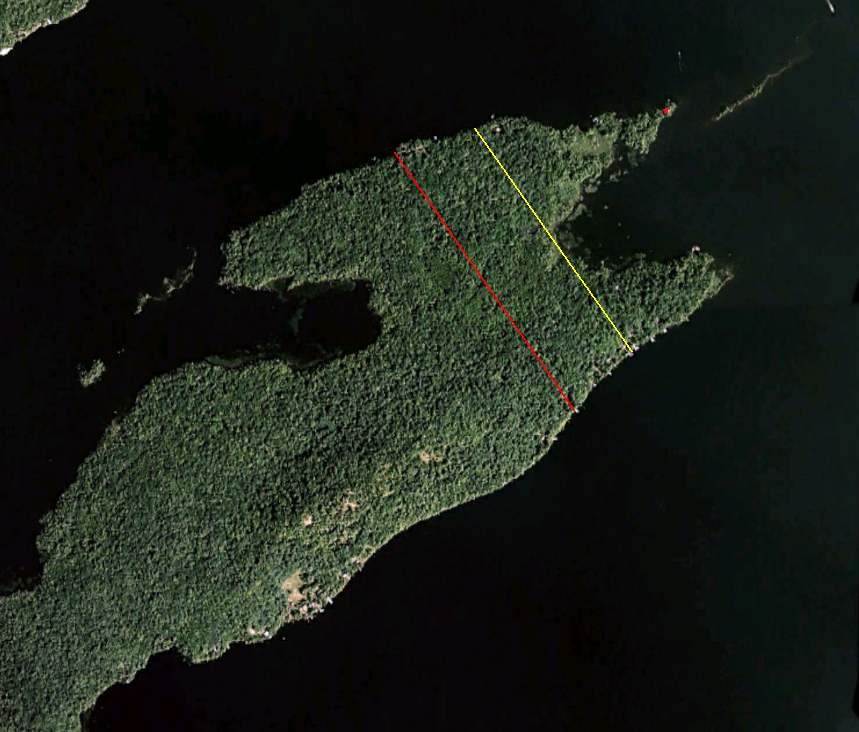
Matthew Beach and William Wood settled on the lands to the east of the red line. John Boyd Thacher purchased the portion to the east of the yellow line. The small red dot is the location of the little red cabin built in 1910.
Echoing across time, this question can be asked three ways. Who were the Indians of its namesake? Why did Matthew Beach and William Wood choose it for their home? Why was John Boyd Thacher enticed to buy these acres?
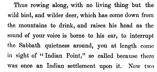
According to local lore, Indian Point was the site of an Indian settlement. The earliest such reference was made by Joel Tyler Headley in The Adirondack: or Life in the Woods, published in 1849.
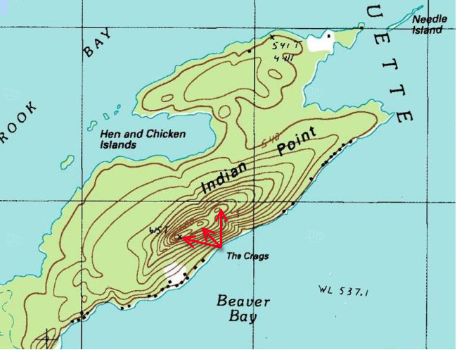
Most research does not support the idea of large, permanent Native American settlements within the Adirondacks. However, evidence points to the Adirondacks being used as a seasonal hunting ground for the Iroquois, Huron and Algonquin Indians. Four clues point to the area of Raquette Lake being under the control of the Mohawk Nation of the Iroquois Confederacy or Ho-dé-no-sau-nee (People of the Long House). This map of the Six Nations of the Iroquois shows the Mohawks’ territory beginning to the west of Raquette Lake and expanding east to Lake Champlain. (Enlarge the map by clicking on it and read the text to the right of the compass rose)
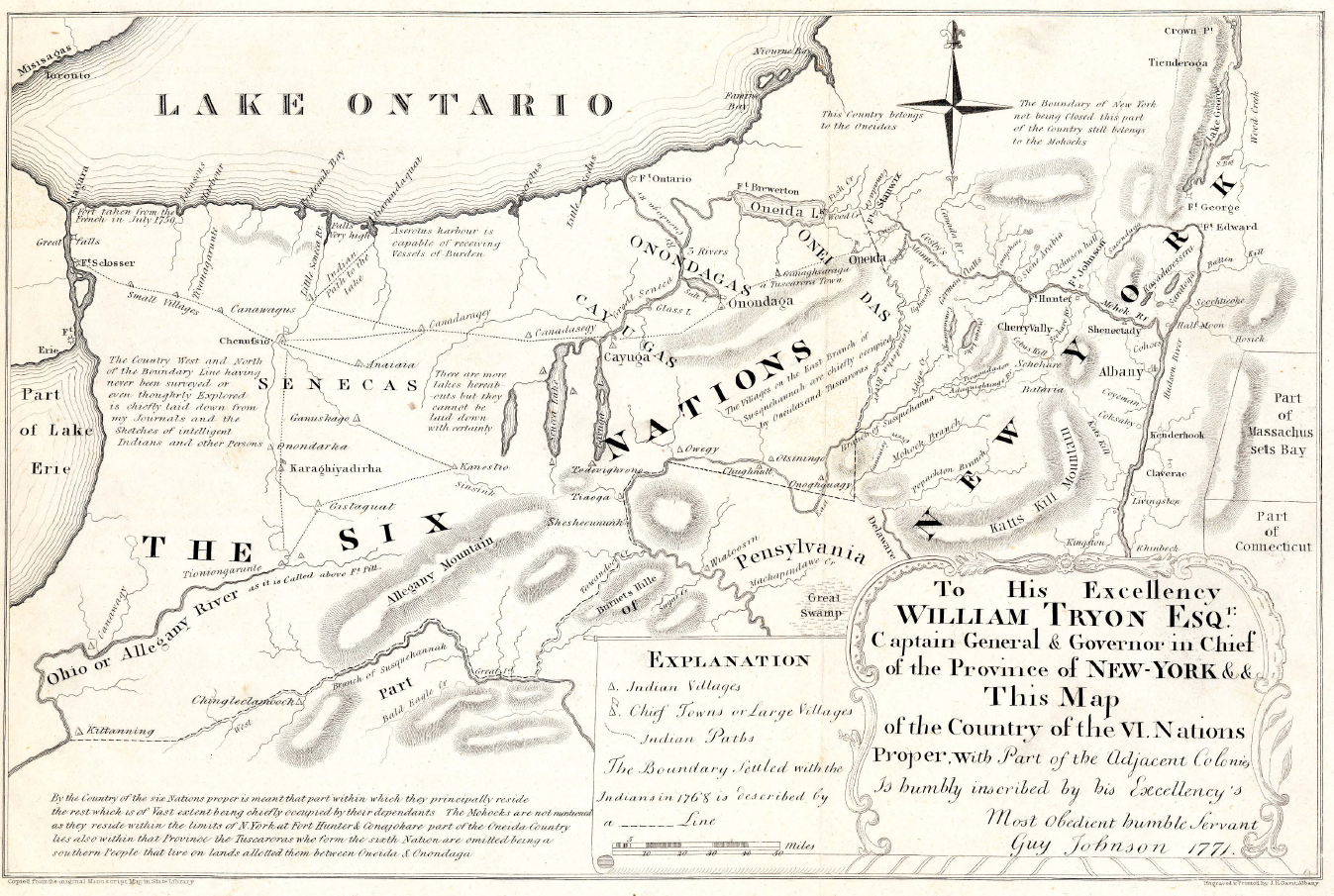
Guy Johnson’s 1771 Map of the Country of the VI Nations. New York State Museum.
Another clue is that the lands which would become the Totten & Crossfield Purchase (which includes Raquette Lake) were originally purchased by the British Crown from the Mohawk Nation in 1771. The British had purchased the lands from the Mohawks for 1,000 pounds and sold it to Totten & Crossfield for 40,000 pounds in the same year. (And you thought flipping real estate was a modern invention!) 1 Although this land sale took place, the Mohawk Nation later continued to claim the lands and use them until a peace treaty between the newly formed United States and the Iroquois was signed in 1794. 2
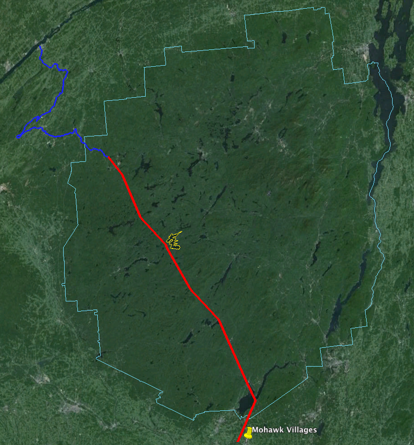
In Adirondack Pilgrimage, Paul Jamieson makes the argument that the Albany Road (sometimes referred to as the Old Military Road) constructed for the War of 1812 actually followed the path of an Iroquois trail which dates back to the 1600s. Jamieson mines the first person writing of a Jesuit Priest named Joseph Poncet who was captured by Mohawks in 1653. Poncet’s description combined with Jamieson’s research and that of Stephen B. Sulavik in Adirondack: Of Indians and Mountains 1535-1838 yields my approximation of the heavily travelled Mohawk trail which passed just to the west of Raquette Lake, traveling from the Mohawk River Valley to Canada. The foot path led through the forest to the Oswegatchie River by which the Indians canoed to the St. Lawrence River.
Beyond the evidence of this Mohawk trail passing close to Raquette Lake, the only other history which directly connects the Mohawk Indians with the lake is the escape of the Tory Sir John Johnson from Johnstown to Montreal in 1776. His Mohawk guides brought him through the woods to the shores of Raquette Lake and then by canoe north to Canada, a tale which will be retold in a future chapter.
This scant evidence implies that the Mohawks were well acquainted with Raquette Lake for over a century. But did they have an encampment on Indian Point? There are no contemporary written histories which specifically speak of the use of Indian Point by the Mohawks. My conjecture is based on descriptions of how large hunting parties of Mohawks would travel from their year-round villages along the Mohawk River to encampments in the Adirondacks from November to late January.
Father Isaac Jogues is another French Jesuit priest who was captured by the Mohawks in 1642, and his writings describe a hunting expedition departing from the Mohawk village of Ossernenon along the Mohawk River:
Saint Among Savages: The Life of St. Isaac Jogues by Francis Talbot S. J. 1935
If we can assume that such a winter hunting camp existed on Indian Point, why did the Mohawks choose this location along the almost one hundred mile shoreline of Raquette Lake? I believe it is the geography and topography which influenced their choice.
According to Lewis Morgan in the League of the Ho-De-Nau-Sau-Ne or Iroquois, “For three quarters of a century, from the year 1625 to the year 1700, the Iroquois were involved in almost uninterrupted warfare [with other Indian nations]…from about the year 1640 to the year 1700, a constant warfare was maintained between the Iroquois and the French.” The 18th century brought ever greater conflict between the Mohawks and Europeans over control of Adirondack territory for the lucrative beaver fur trade. 3
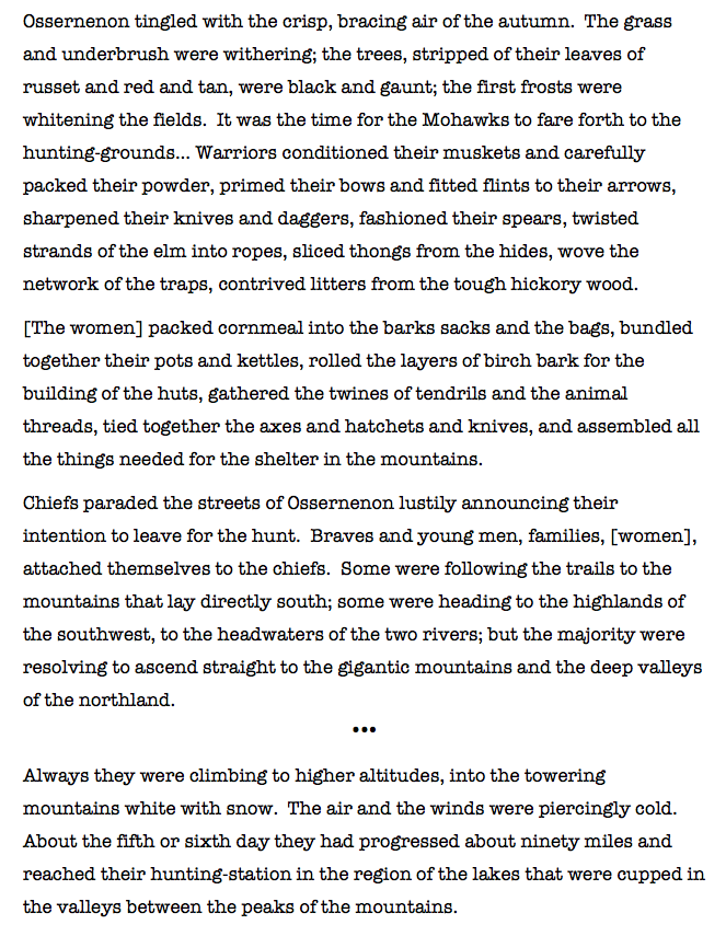
In this context, the Mohawks would have benefited from siting their winter hunting camp in a location on Raquette Lake which could be defended and from which they could observe any approaching enemies. Indian Point possesses a unique geological feature called the Crags, a series of three rock outcroppings at the top of the ridge line on the peninsula. At an elevation of 2000 feet, even today one can see all the way to South Inlet, and anyone approaching from the Marion River or Brown’s Tract Inlet would be seen at least an hour before they could land on the shores of Indian Point. To the northwest, one can see Sucker Brook Bay.
USGS Raquette Lake Quadrangle Map
While today the tree cover does not provide a view to the northeast, images from the 1800s indicate that the Crags were almost clear of trees and it is highly likely that a lookout stationed there in the 1600s and 1700s would have also been able to see anyone rounding Bluff Point to the northeast of Indian Point.
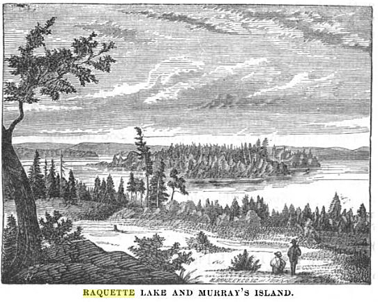
Looking South from the Crags – a wood cut printed in Wallace’s Descriptive Guide to the Adirondacks. 1872.
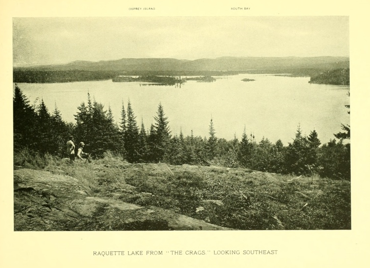
Photo from the Crags by Seneca Ray Stoddard. circa 1880.
While the Crags may have led the Mohawks to choose Indian Point, where along the shores of the peninsula was the hunting camp? As the camp would have been used mostly from November to late January, I suspect a location sheltered from the worst of the cold winds blowing across Beaver Bay or North Bay. Either of the two protective coves would have served well, the cove near Hen and Chickens Islands or the little bay between the two points on the eastern tip.
An understanding of the size and description of a hunting camp helps to create a theory as to where on the peninsula it was located. Father Jogues’ description implies that a family clan headed by a Chief would likely all relocate to the winter hunting grounds. The villages in the Mohawk River Valley would each have several Long Houses. Each Long House would be the home of a family clan. The length of the Long House and the number of fire pits within the Long House would relate to the number of families. An account of Dutch explorers encountering a Mohawk village in 1644 described one Long House of eighty paces in length being home to a Chief, 40 men and 17 women. 4
The Mohawks’ method of hunting deer illustrates the need for a very large hunting party. Father Jogues experienced the hunt firsthand, “They beat up the stags and the elks from their coverts, and drove them headlong toward the fences that strecthed between the trees and into the narrowing alleys of the traps, were they could easily be slaughtered. They tracked the animals over the rise and fall of the mountains, and had the zest of dropping them with musket or arrow or javelin.”
Morgan in League of the Ho-De-Nau-Sau-Ne or Iroquois, provides an even more detailed description of the hunting method:
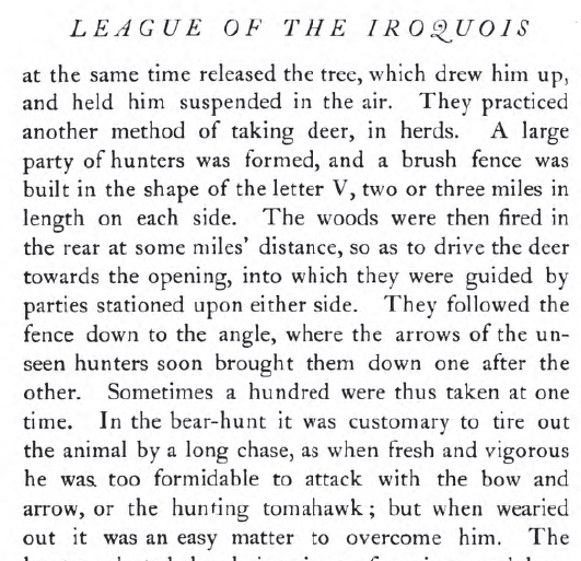
League of the Ho-De-Nau-Sau-Ne or Iroquois by Lewis Morgan. 1922.
The construction of a V-shaped fence that stretched two to three miles on a side would have required significant manpower. If the Indian “settlement” on Indian Point was a winter hunting camp, it likely was the temporary home to at least fifty or more people.
A young Mohawk woman named Kateri Tekawitha described one style of temporary shelter used in a winter hunting camp in the late 1600s.
This depiction has been faithfully recreated by Barry Keegan, an expert in primitive Native American structures, in his construction of a traditional wigwam on the shores of Prospect Point on Blue Mountain Lake.
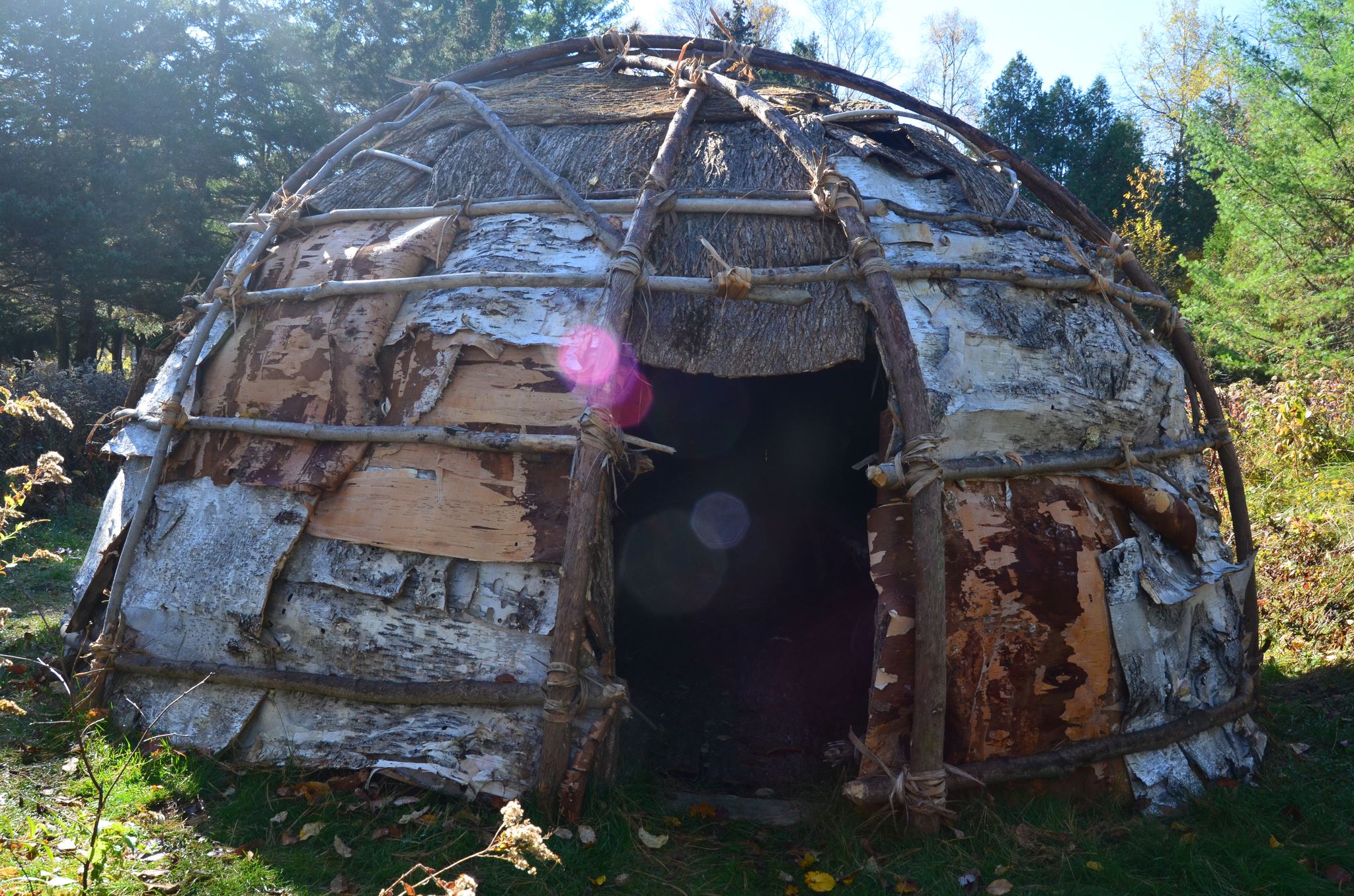
A traditional wigwam hunting-lodge constructed at Prospect Point on Blue Mountain Lake by Barry Keegan. Photo by Jerry Krasnick.
According to Keegan, “South of the Adirondacks, wigwams were usually dome shaped and often sided with elm bark; north of our region they tended to be conical, like squat-shaped tepees with birch bark as the siding of choice. The Adirondacks are right on the border between those two types and probably both were in use here, at the very least as seasonal hunting camps.” 5
Father Jogues’s writings appear to describe the second style, “There the [women], under the direction of the men, threw up the three slanting poles of the hunting-huts and tied them at the top and sewed the bark and skins firmly about the triangular frame.”
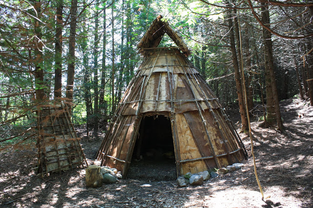
A conical teepee style hunting lodge from creaturehomes.blogspot.com
The “hunting-lodges of bark and close-woven boughs” referred to by Kateri or the bark tee pee style described by Jogues appear to have housed a small family of five to ten people. To accommodate upwards of fifty to one hundred people, the winter hunting camp on Indian Point would have required up to ten lodges. The annual construction of these lodges for over a century would have established significant forest clearings on Indian Point.
My theory that the hunting camp was on the shores of the little bay nestled within the eastern tips of Indian Point is tied to the reason I believe Matthew Beach and William Wood chose to settle at that spot. My theory echoes one regarding land use in the Adirondacks first promoted in the late 1800s in an article in the New York Times.
“The North Woods of Old” The New York Times. May 11, 1890.
The site of the Mohawk hunting camp would not have been open land by the 1840s. The majority of the Mohawk Nation relocated to the St. Lawrence River Valley on both sides of the New York/Canadian border after the Peace Treaty of Canandaigua in 1794 between the Iroquois Confederacy of the Six Nations and the new government of the United States. 6 Although Mohawks continued to come down from Canada into the Adirondacks for hunting in the early 1800s, it is likely that secondary forest regeneration began to take hold of the area of the hunting camp on Indian Point.
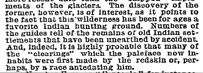
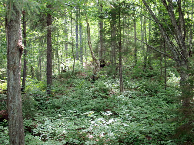
Beach and Wood were not simply hunters and trappers. They also cleared ten acres of cropland to grow potatoes and vegetables. When they first travelled the shores of Raquette Lake in search of where to stake their claim, Beach was nearly sixty years old and Wood was in his early forties. I am sure they had a strength and vigor beyond what this author is capable of at 46, and they were accustomed to hard physical work. Nonetheless, knowing that they intended to clear the land for farming, an area previously cleared by over a century of indigenous use yielding a young secondary forest would have been easier for Beach and Wood to clear with fire and axe than the surrounding primary forest of large diameter trees with deep rooted trunks.
Young secondary forest
Old growth primary forest

Beach and Wood chose the twin tips of Indian Point because of the land use potential derived from the remains of the Mohawk hunting camp. Conversely, the purchase of this land by John Boyd Thacher is puzzling in that it appears that he never really used the land. It was his father George Hornell Thacher who built and frequented the mysterious original cabin, and yet the title to the land was always only in JBT’s name. Could it be that JBT was motivated to buy the lands for their historical value?
JBT was an industrialist and politician but also an historian and scholar. He was a renowned authority on Christopher Columbus and a collector of over 5,000 books and manuscripts from the 15th century, which his widow donated to the Library of Congress. Among his varied interests, he showed a keen appreciation for the Iroquois Confederacy. His collection included the original 1630 signed contract between the Iroquois and the Dutch for the sale of the land upon which the city of Albany was built. 7 At Albany’s Bicentennial Celebration in 1886, then Mayor JBT gave an eloquent speech welcoming a delegation from the Caughnawaga tribe and honoring the Iroquois Confederacy as the blueprint for our democratic form of government. 8
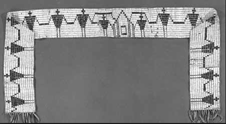
In 1893, he purchased four historically important Iroquois wampum belts. 9 The Hiawatha Wampum Belt was created in the 1500s to commemorate the union of the Five Nations of the Mohawks, Oneidas, Onondagas, Cayugas, and Senecas into the Ho-dé-no-sau-nee or Iroquois Confederacy. To the Iroquois, this wampum belt is equivalent to the original copy of the Constitution of the United States.
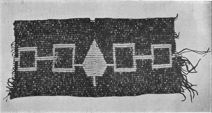
Hiawatha Wampum Belt
The George Washington Wampum Belt commemorates the Treaty of Canandaigua of 1794 which brought peace between the newly formed United State of America and the Iroquois Confederacy.
George Washington Wampum Belt
The other two wampum belts commemorated the first encounter between the Iroquois and European explorers in the 1500s and their encounter with Samuel Champlain in 1609.
Given John Boyd Thacher’s clear respect and appreciation for the culture of the Iroquois Confederacy in his later years, I do not think it unlikely that as a young man of thirty he would be attracted by the folklore of an “Indian settlement” that once graced the tips of Indian Point.

Interesting chapter Tom! Good work.
Jim
Tom theres a large rock in front of the cabin that my mother pointed out to me as a small boy and on it is true compas headings, north south east and west, and she told me that her Dad had shown her so she asked the question did you put that there dad, and his reply was nobody in our family knows who put that there that it had been there when he started coming to Raquette Lake and shown to him by a family member, and something that I have pointed out to my son and my brother to his family. Thats a question to be asked, who might have put that there but for obvious reasons surely, alittle trivia about the point.
Pingback: This Week’s New York History Web Highlights | The New York History Blog
Most interesting article. My Mohawk great-great-great-grandfather, Joseph Etienne Robidoux, was at one time a resident of La Raquette. He died there in 1823 and was buried in St. Regis.