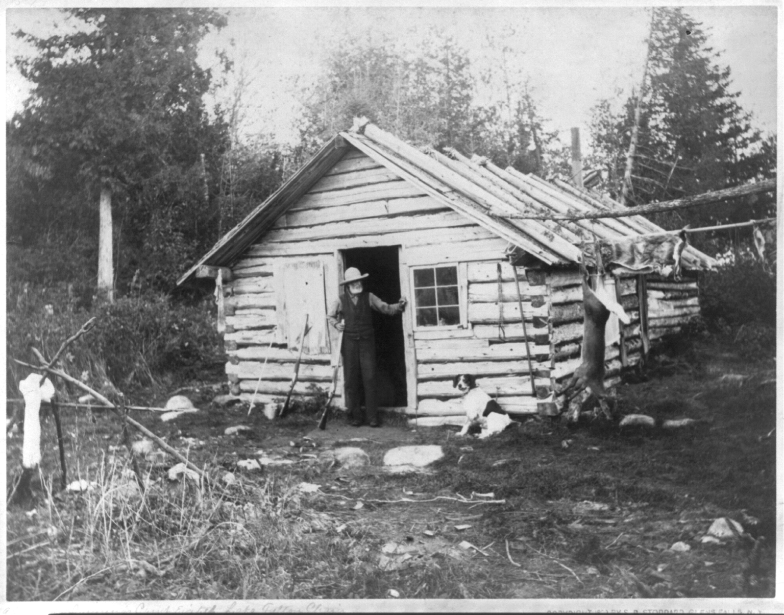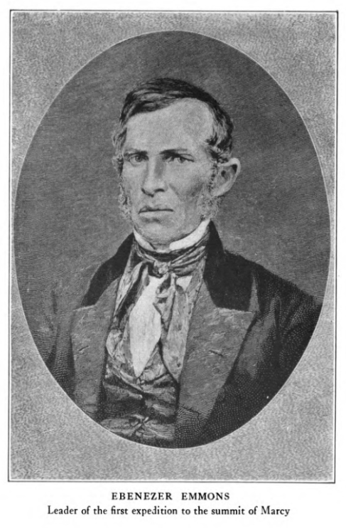
Courtesy of the Adirondack Museum
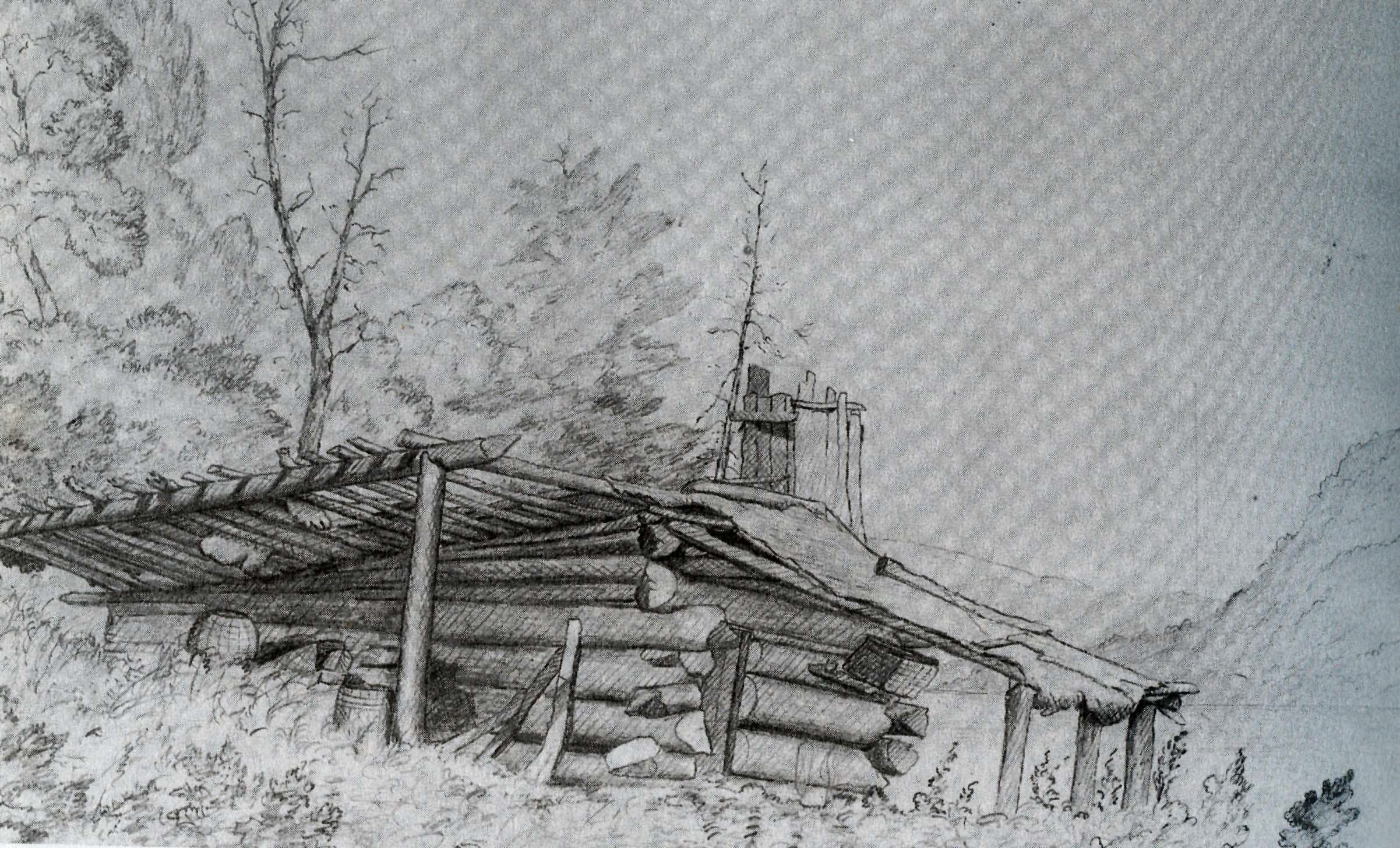
My last article identified the most likely location of the original cabin built by Matthew Beach and William Wood in the mid-1830s. Wood remained on Indian Point until 1859, but sometime between 1844 and 1846 he had a falling out with Beach and built a separate cabin (shown in this 1851 sketch from Jervis McEntee’s diary).
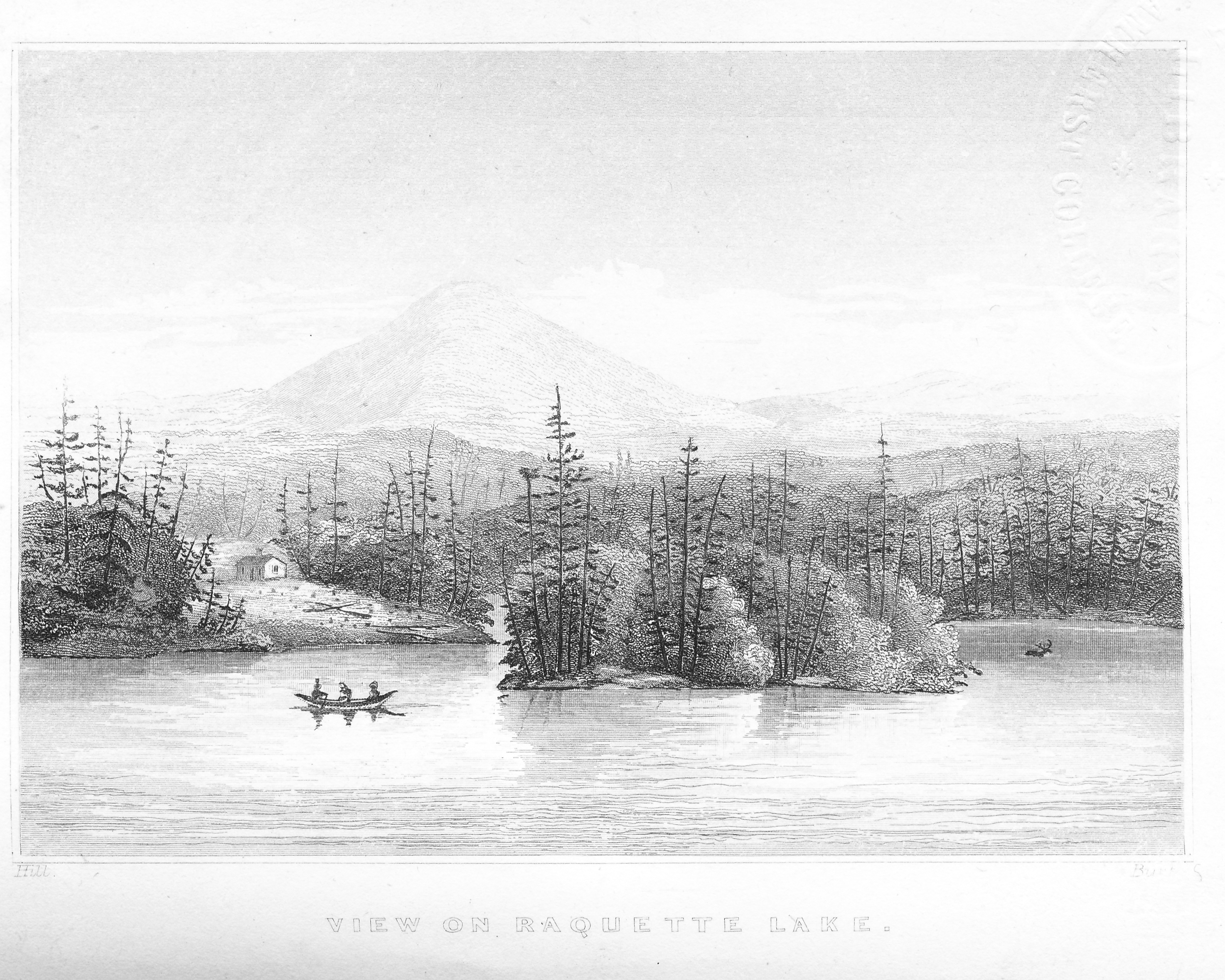
I began a new search to determine where Wood’s cabin had stood, using the 1851 sketch as a starting point. I feel confident in saying that the mountainscape in the background of the sketch is unmistakably Bluff Hill, which rises above the Bluff Point peninsula of Raquette Lake. So where would one see this particular view?
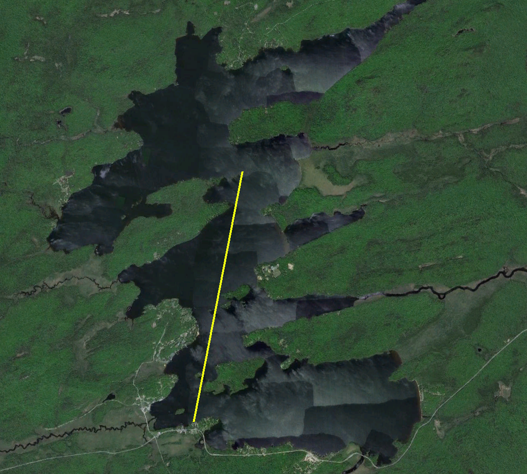
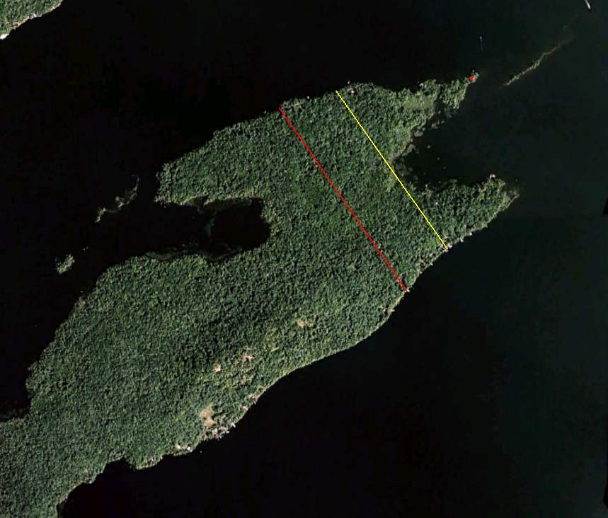
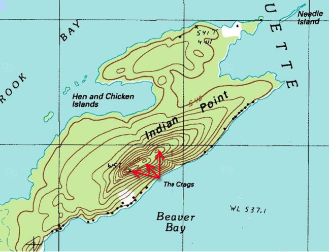
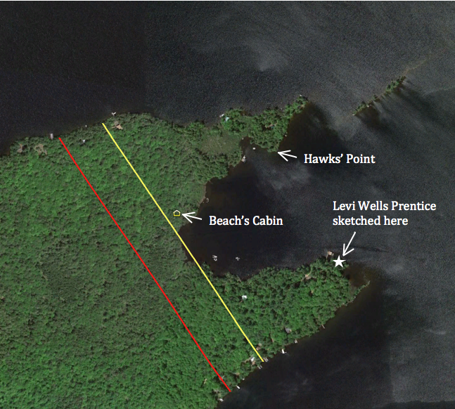
One might expect that each man’s cabin would have been located within their individual parcel when they obtained legal title to their lands in 1849. The image below shows that Beach was deeded 25 acres to the right of the yellow line, encompassing both tips of Indian Point. Wood was deeded 25 acres in a rectangular parcel between the red and yellow lines. My theory of the location of Beach’s cabin has it on Beach’s property, so Wood’s cabin should have been within his rectangular parcel.
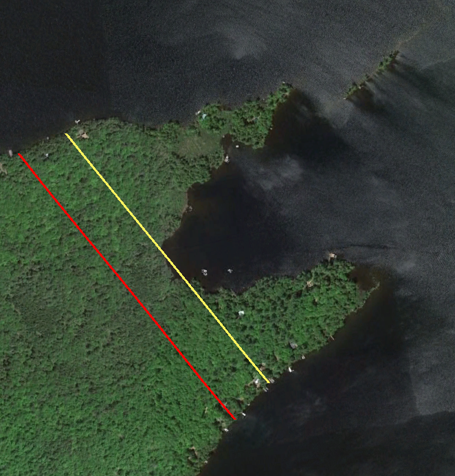
However, after carefully canoeing along the shores of the inner bay between the two tips of Indian Point and along the south shore of Indian Point, I can unequivocally state that the view captured in the McEntee sketch could not have been seen from within Wood’s 25 acre parcel. The only potential location would be at the very back of the inner bay but Needle Island obscures the view of Bluff Hill from that vantage point.
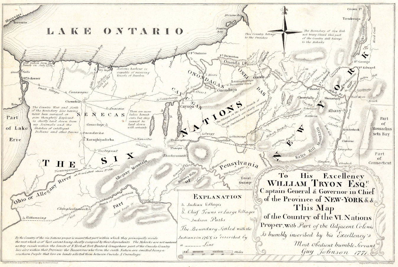
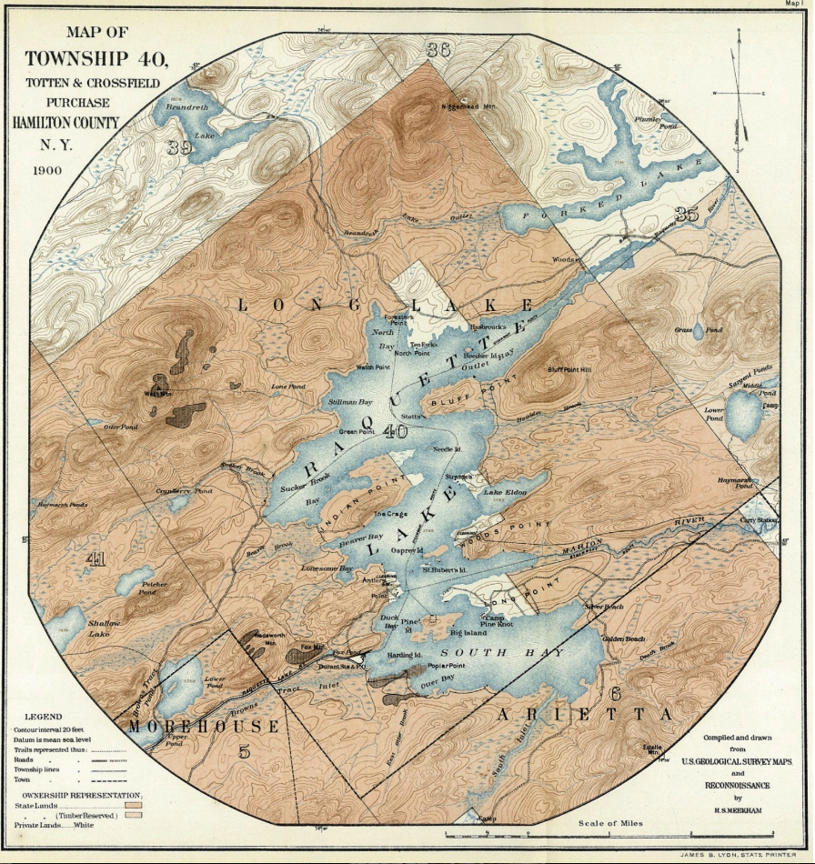
Why would Beach and Wood divide the end of Indian Point in a way that did not correspond to where the men’s cabins were located? The answer comes from looking at the Township 40 Map of 1900. Notice that most of the straight edges of the property parcels are all lines that run parallel to the diagonal boundaries of Township 40. In 1773, Ebenezer Jessup was charged with surveying the boundaries of the Totten & Crossfield Purchase and segmenting the area into townships. The reason why the township’s west and east boundaries run North 27◦ West rather than straight north-south has been lost to history. Nevertheless, it appears that in giving legal title to the men, Farrand Benedict and David Read chose an easier surveying technique to divide the land into equal 25 acre parcels, without regard to the location of the cabins.
This realization opens up the possibility that Wood’s cabin actually existed on what was legally Beach’s land. McEntee was not the only visitor who wrote about Wood’s cabin. In 1855, Henry Jarvis Raymond, the founder of The New York Times and NYS Lt. Governor, wrote of his visit to Indian Point.
[Wood] and Beach in course of time disagreed, for in any part of the earth, no matter how secluded, two persons are enough for a quarrel; and a clearing of ten acres, even in a wilderness a hundred miles through, affords ground enough for a local dissension. So finding they could no longer live together, they agreed to divide their fortunes and have nothing to do with each other. Wood moved into a hut, half logs and half bark, some fifty rods from Beach.
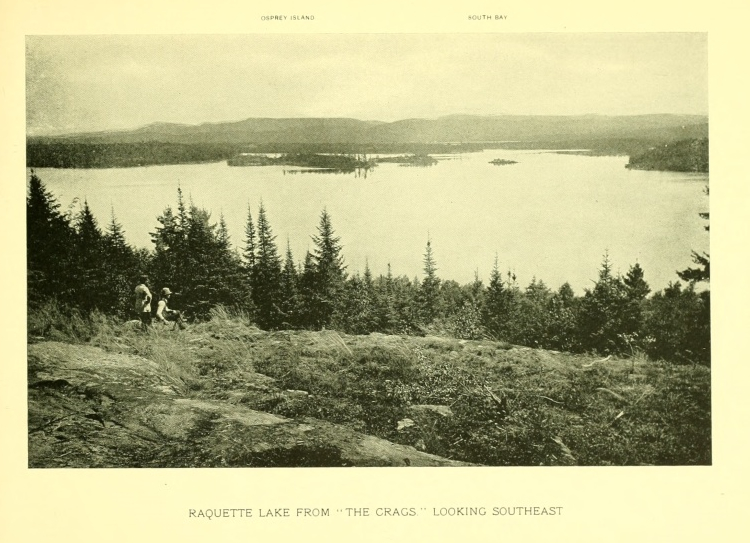
Fifty rods is 825 feet. From where I believe Beach’s cabin to have been, I ventured roughly that distance in each direction seeking to see if any point gave a view similar to the McEntee sketch. I found it at what our family calls Hawks’ Point (named for the family of Ken Hawks, current owners of Watch Point on North Bay, who camped here for many years). The view from here has a very close resemblance to the sketch.
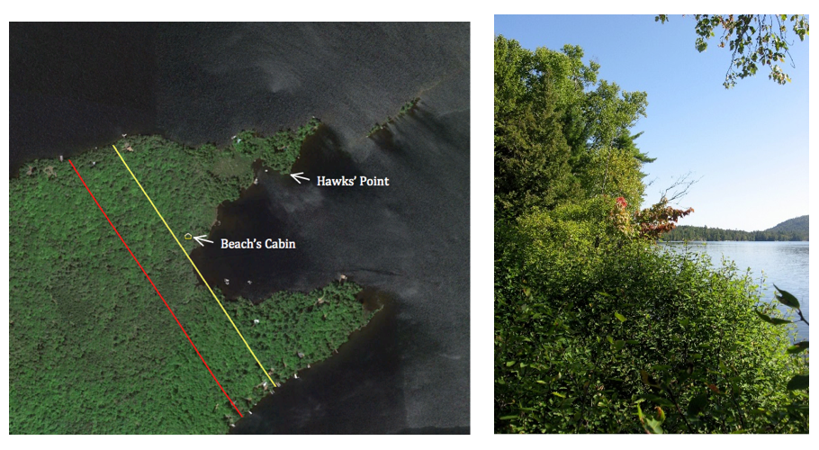
Surely this was the location of Wood’s cabin. I was convinced until I read the entirety of Jervis McEntee’s diary from his 1851 visit. McEntee said of Wood’s cabin, “The house is built of logs with a bark-covered porch in front, and standing on a gentle elevation about fifty yards from the lake.” A cabin 150 feet back from the lakeshore on Hawks’ Point would be in a marsh and no longer have a view of Bluff Hill.
McEntee also states that, “Wood was not at home but we saw him coming over the lake soon after we reached his house…he had just now returned from ‘Blue Mountain’.” This could be interpreted to mean that they were able to see Wood coming north across Beaver Bay up from the mouth of the Marion River. There is no such view from Hawk’s Point.
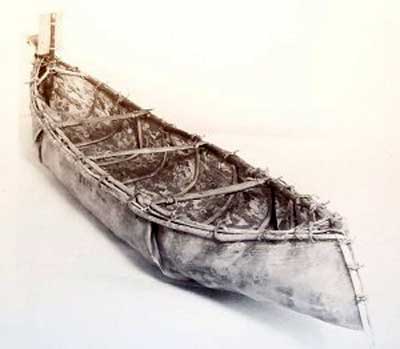
McEntee also commented that he had “stopped at Wood’s and got our clothes and some meal and potatoes. We heard three or four rifle shots in the direction of Beach’s, and rowing over there we found a skiff and a birch bark canoe and met Beach and an Indian at the landing.”
If Wood’s cabin had been on Hawks’ Point, Beach could have shouted over the water the short distance from his landing and would have not needed to fire gunshots in the air to get McEntee’s attention.
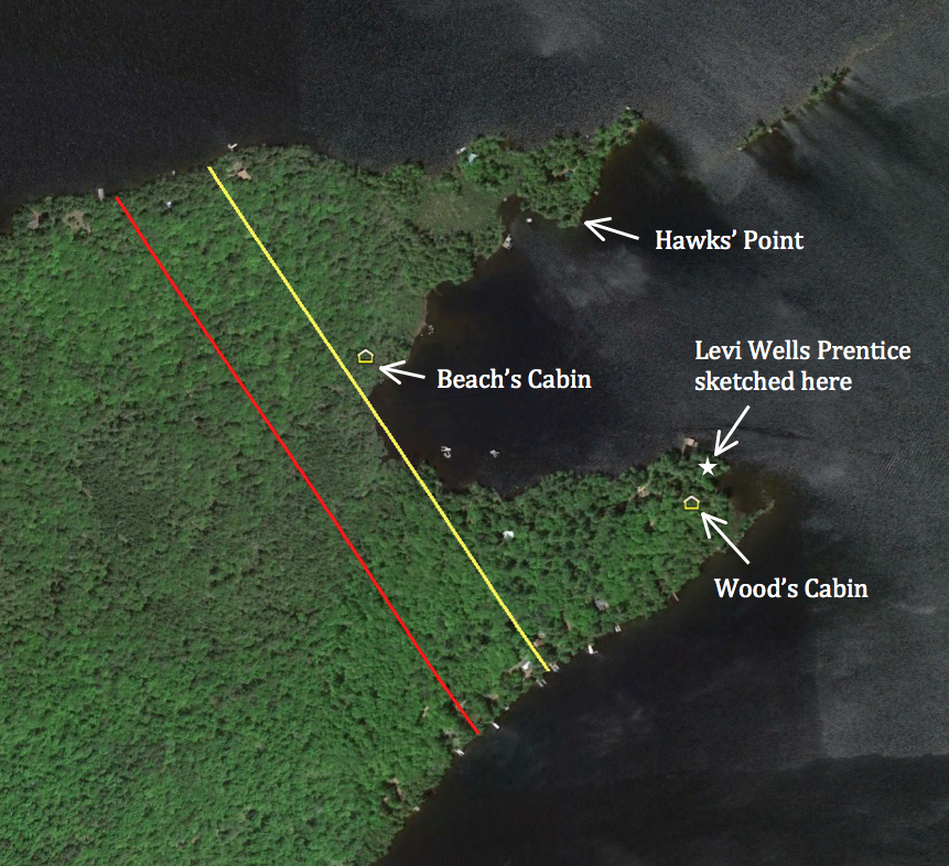
Levi Wells Prentice’s 1877 painting titled “Raquette Lake from Wood’s Clearing” alludes to another possible location for Wood’s cabin. Prentice actually painted at least three versions from the same sketch. I believe the one shown below helps to identify where the sketch was drawn.
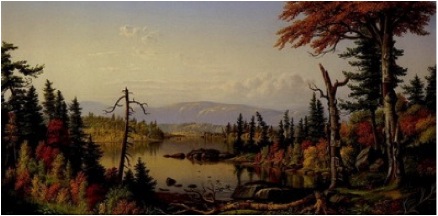
I believe the sketch was drawn at a spot (marked with a white star below) on a small inner cove at the far east end of the southern tip of Indian Point while looking south. The peninsula on the left of the painting is Woods Point, where William Wood’s brother Josiah lived. Osprey Island appears to the right across a small channel from Woods Point. The far shoreline is not actually the southern shore of Raquette Lake but rather Long Point. The mountainscape in the background shows the Blue Ridge, Wakley, and Metcalf mountain ranges that lie south of Raquette Lake.
If one looks due east rather than south from here, you do see a view of Bluff Hill similar to the McEntee sketch. Sitting on the porch and looking south from here, you would see William Wood “coming over the lake” as he “returned from Blue Mountain”. The distance from Beach’s cabin and the fact that I believe Wood left a windbreak of trees to the north of his cabin (seen in McEntee’s sketch) would explain why Beach had to fire gunshots in the air to get McEntee’s attention. Finally, there are stone piles that appear to be corner foundation points found where I believe Wood’s cabin to have been.
 My search would have ended here if not for two conflicting “facts”.
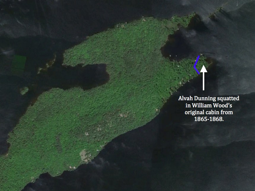
Warren Reynolds recalls his father showing him the remains of William Wood’s cabin when he was a small boy in the 1930s. Only a corner joint of rotting timbers remained. Warren’s father claimed that his friend Billy Wood, one of Wood’s descendants, originally showed him the site. These remains were not anywhere near the tip of the southern fork. Instead, this cabin had been located just to the west of the line dividing Beach and Wood’s properties on the southern fork but closer to the inner bay of Indian Point.
The second contradiction is Henry Jarvis Raymond’s 1855 comment that Wood’s cabin was “some fifty rods from Beach”. The location near the tip of the southern fork is almost 100 rods away from Beach’s cabin.
My research of our family’s property deed revealed a clue that might explain these contradictions. In 1854, Matthew Beach sold a 4.75-acre parcel to Albert and Gardner Eldred. The boundaries of this small parcel, in blue below, enclose the area where I believe William Wood had his first cabin. Either Beach forced Wood out of his cabin or perhaps by 1854 Wood had already begun to court Celia Ann Whitman, whom he married in 1858 after fathering their daughter Lydia in 1857. Did he choose to build a more suitable cabin to raise a family in, within the boundaries of his legal property?
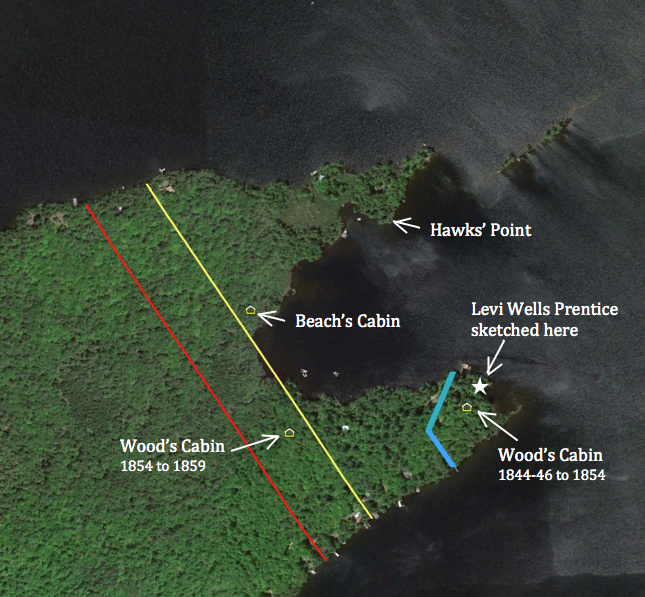
Based on Reynolds’ recollection and the supposition that Henry Jarvis Raymond visited this second cabin in 1855, I have marked an approximate location around fifty rods from Beach’s cabin. It is likely that Wood occupied this cabin from 1854 until 1859 when he moved to Elizabethtown. Today the sites have modern construction or disrupted landscapes that preclude a more in-depth ground search for evidence, but I feel confident in my conclusions.