The Triangulation of Verplanck Colvin

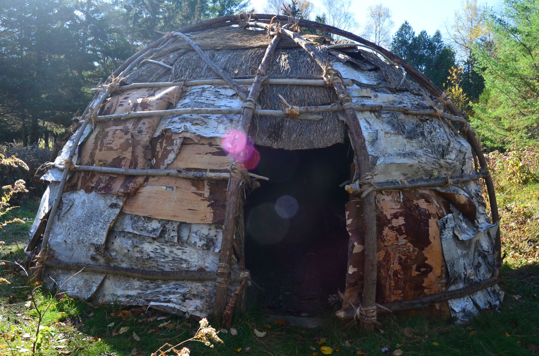
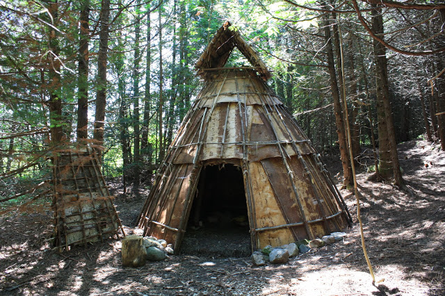
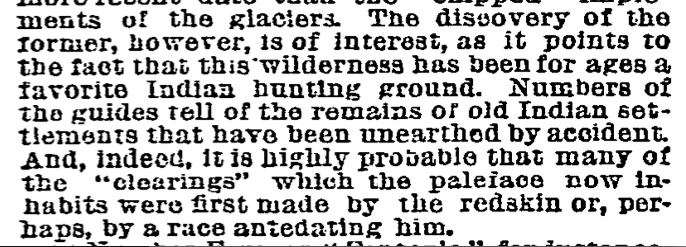
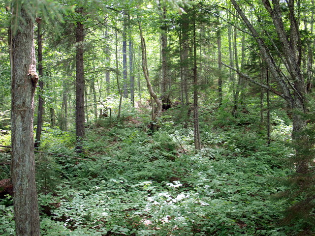
Few fully understand what the Adirondack wilderness really is. It is a mystery even to those who have crossed and recrossed it by boats along it avenues, the lakes; and on foot through its vast and silent recesses…In this remote section, filed with the most rugged mountains, where unnamed waterfalls pour in snowy tresses from the dark overhanging cliffs…the adventurous trapper or explorer must carry upon his back his blankets and heavy stock of food. Yet, though the woodsman may pass his lifetime in some of the wilderness, it is still a mystery to him. 1

 Verplanck Colvin, Superintendent of the Adirondack Survey

 Colvin oval photo


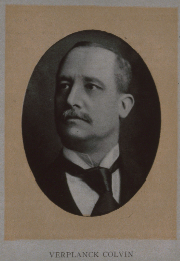
Between 1872 and 1900, perhaps no man traversed the Adirondacks more than Verplanck Colvin.  Russell Carson said, “With limitless enthusiasm and boundless devotion, he was exploring, surveying, mapping, and sketching the mountains, valleys, lakes and streams of the region, and writing voluminous reports and papers about them.” 2  Through his sheer personal will, he succeeded in lobbying the state legislature to appropriate funds for the Adirondack Survey and appoint him to the task. His explorations led to the discovery of Lake Tear of the Clouds as the source of the Hudson River and the first accurate elevations for Mt. Marcy and dozens of other regional peaks.

To map and describe this wonderful region, correcting the errors of early surveyors, and thus furnish a most important contribution to the physical geography of the State, is of course the primary purpose of undertaking the survey. But Mr. Colvin’s elaborate and interesting reports have been largely instrumental in calling the attention of the public to the attractions of the Adirondack wilderness both for the sportsman and the general tourist, and to the importance of taking any measures that may be necessary to preserve it forever as a mammoth pleasure ground. 3

1880 Editorial in The Cultivator and Country Gentleman

Indeed, Verplanck Colvin’s speech at Lake Pleasant in 1868 is credited as the first public advocacy for the preservation of the region as a state park. His later correspondences and reports illustrated his argument:

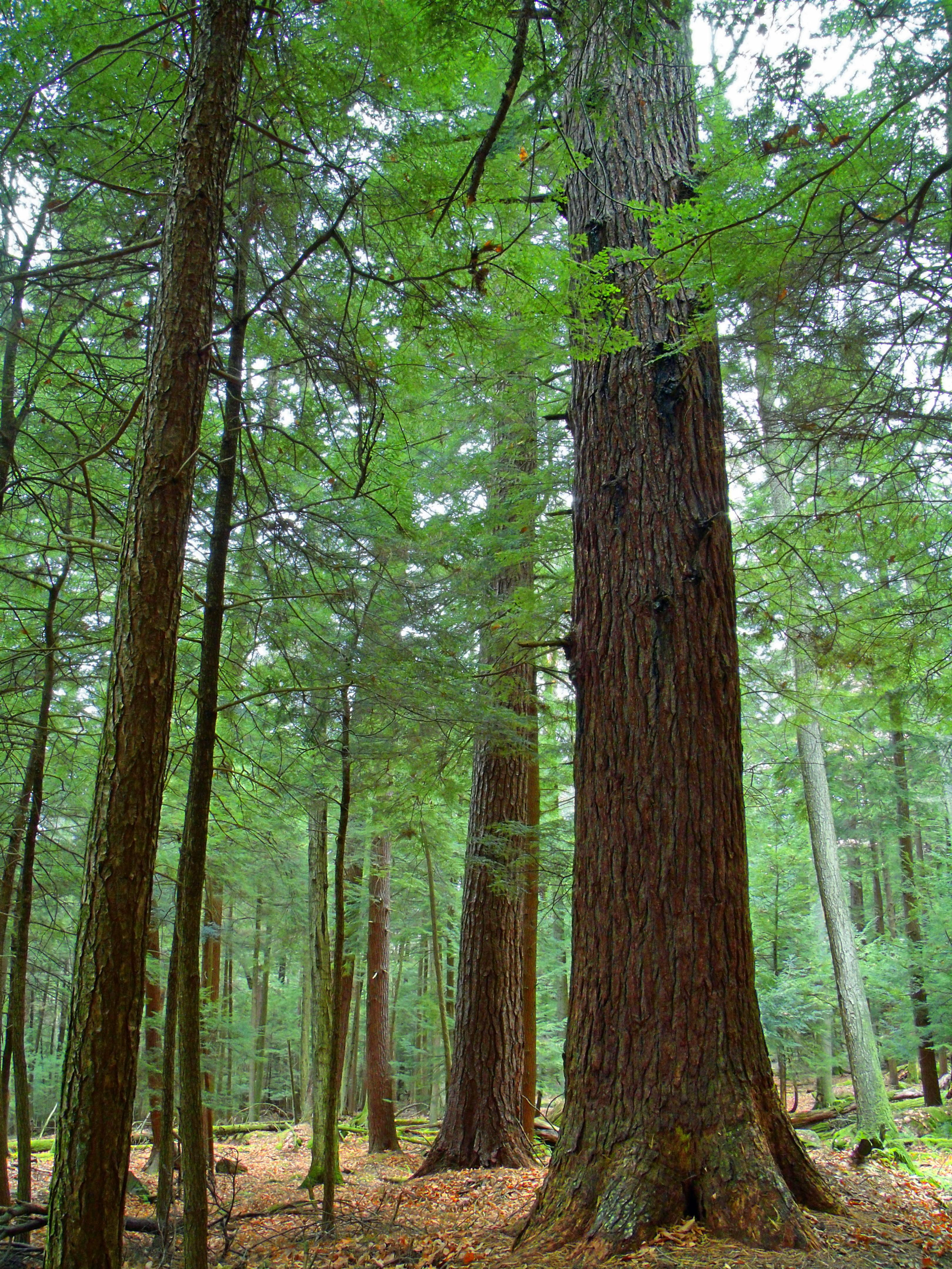
The Adirondack wilderness contains springs which are the sources of our principal rivers, and the feeders of the canals. Each summer the water supply for these rivers and canals is lessened…The immediate cause has been the chopping and burning off of vast tracts of forest in the wilderness, which have hitherto sheltered from the sun’s heat and evaporation the deep and lingering snows, the brooks and rivulets, and the thick, soaking sphagnous moss which, in times knee-deep, half water and half plant, forms hanging lakes upon the mountain sides…It is impossible for those who have not visited this region to realize the abundance, luxuriance and depth which these peaty mosses – the true source of our rivers – attain under the shade of those dark northern evergreen forests…The remedy for this is an Adirondack park or timber preserve. 4

While Colvin’s impact on the creation of the Adirondack Park is his most lasting achievement, his development of new survey techniques and technology should not be overlooked. It his efforts to unravel the mystery of the forest through detailed mapping that I find fascinating.

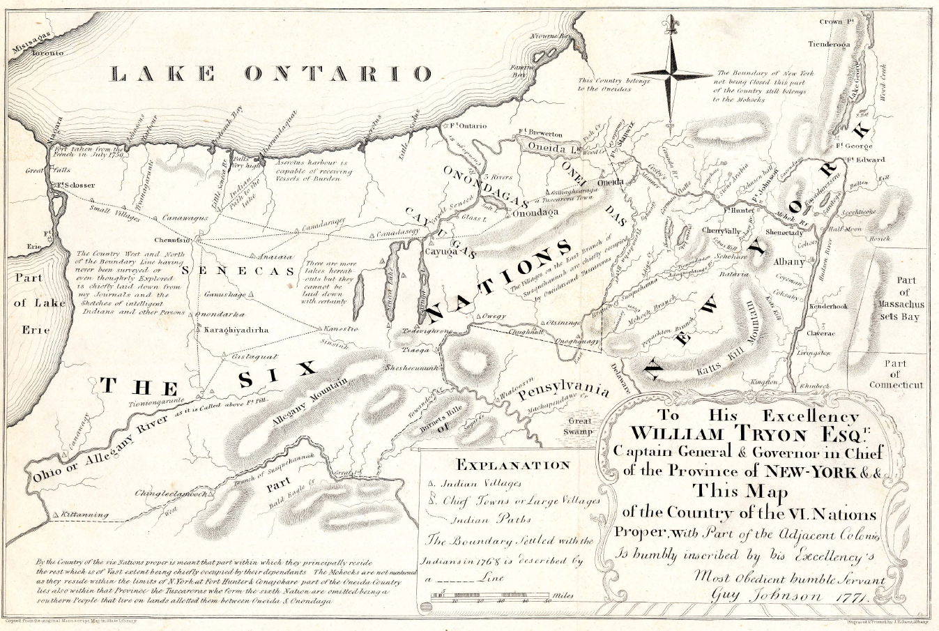
Triangulation is the process of determining the location of a point by measuring angles to it from known points at either end of a fixed baseline, rather than measuring distances to the point directly. Colvin used this method to map the Adirondacks using a series of mountain top signal stations.

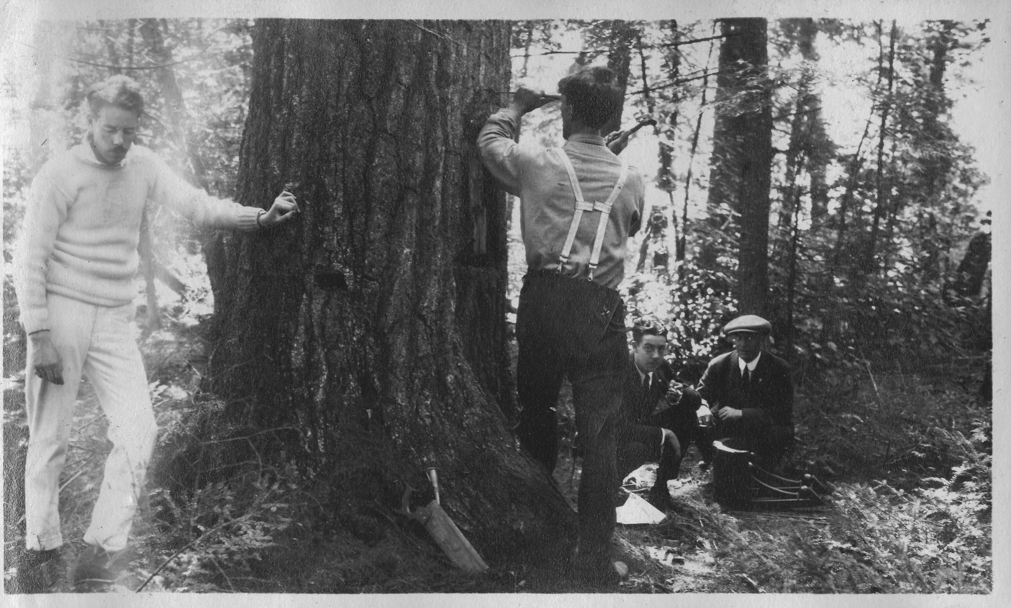
Colvin was not one to avoid harsh and arduous effort in his attempts to map the Adirondacks. Notably, he did not retire to his Albany office in the dead of winter but rather used the frozen lakes to his advantage.

Raq baseline old

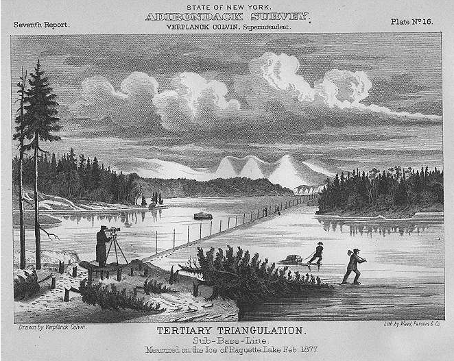
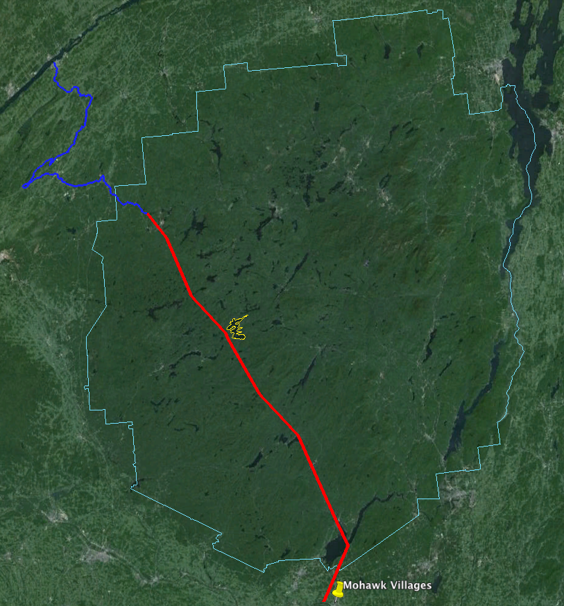
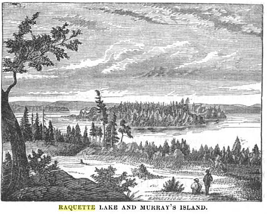
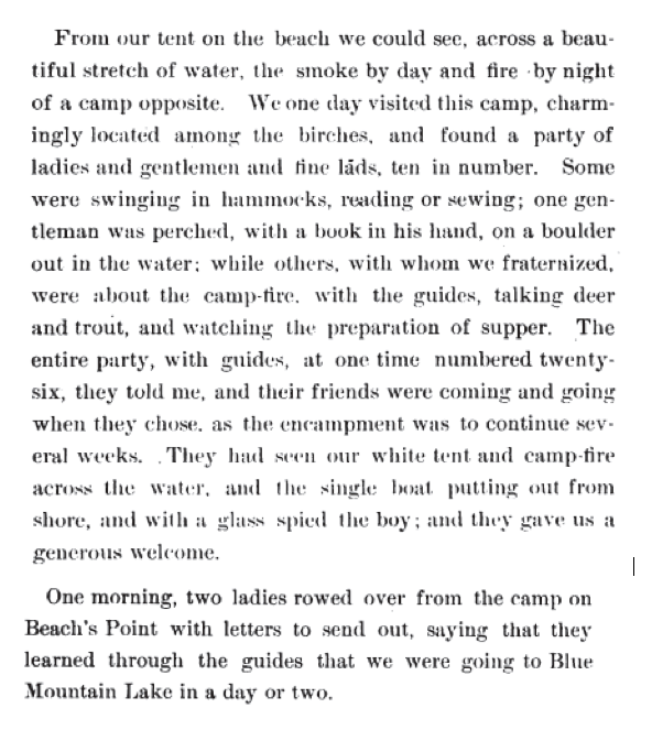
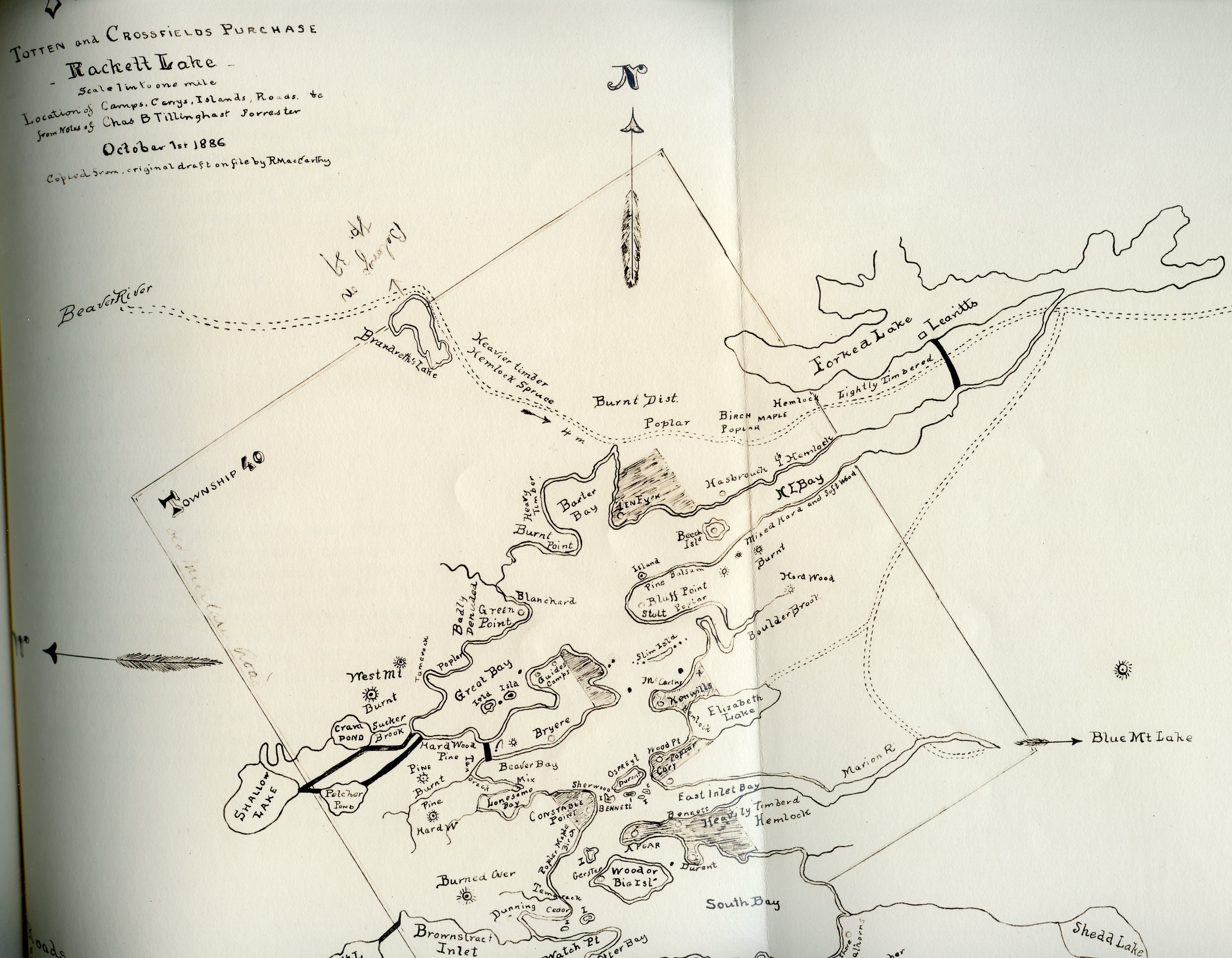
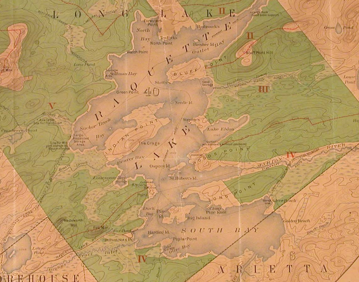
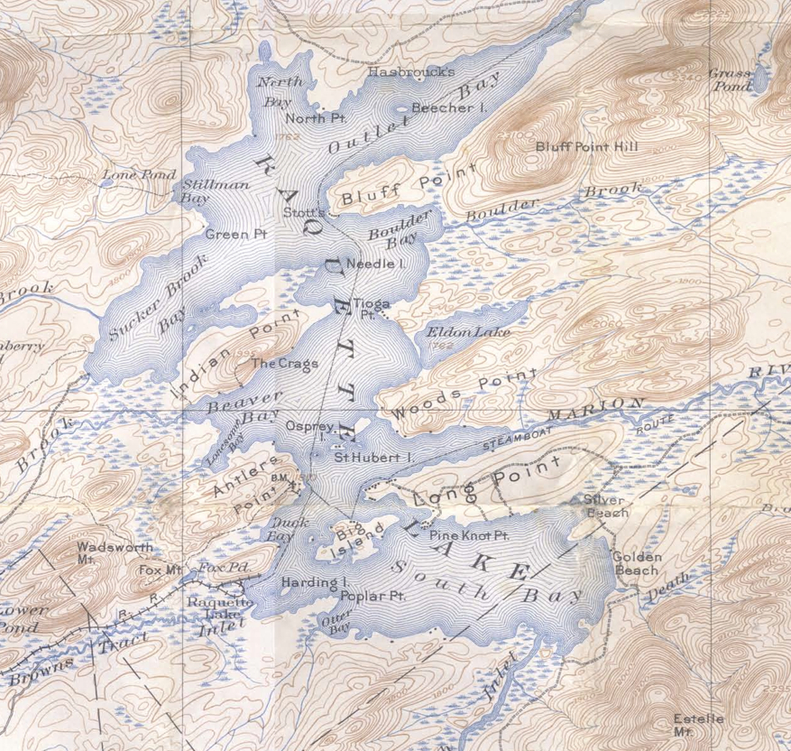
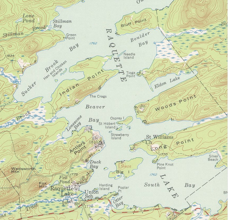
In February 1877, he came to Raquette Lake, as described by The Colvin Crew based on his field notes,

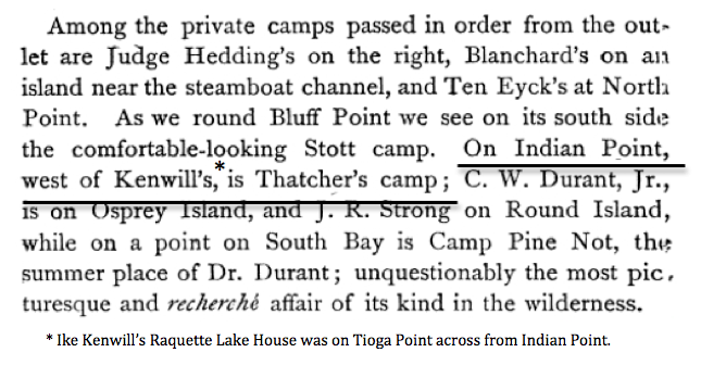
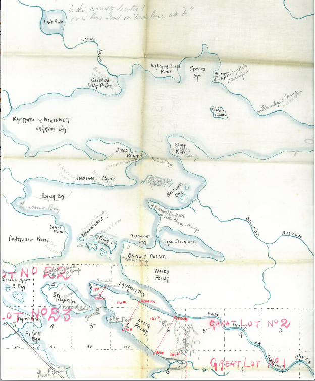
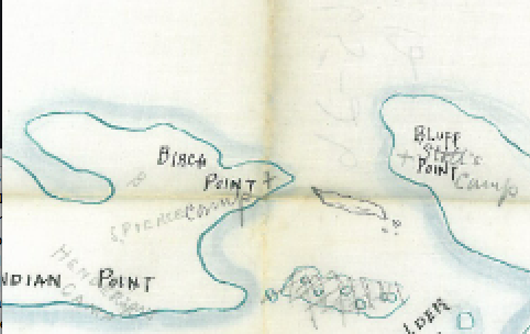
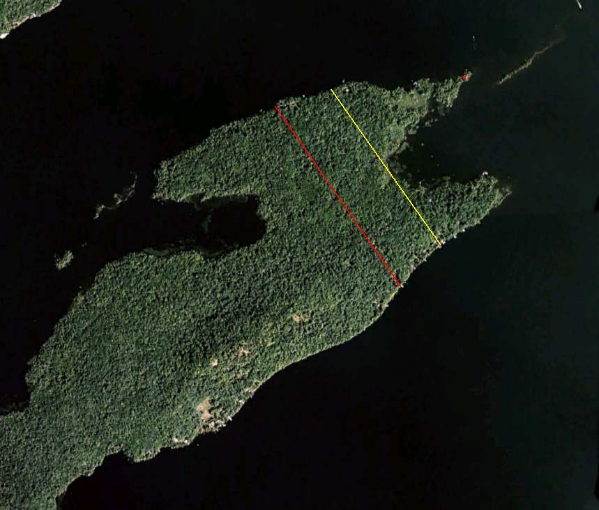
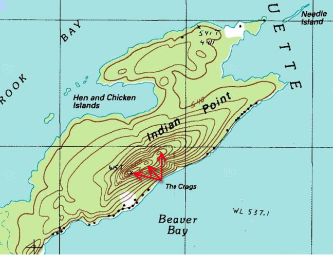
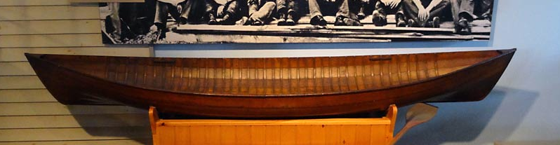
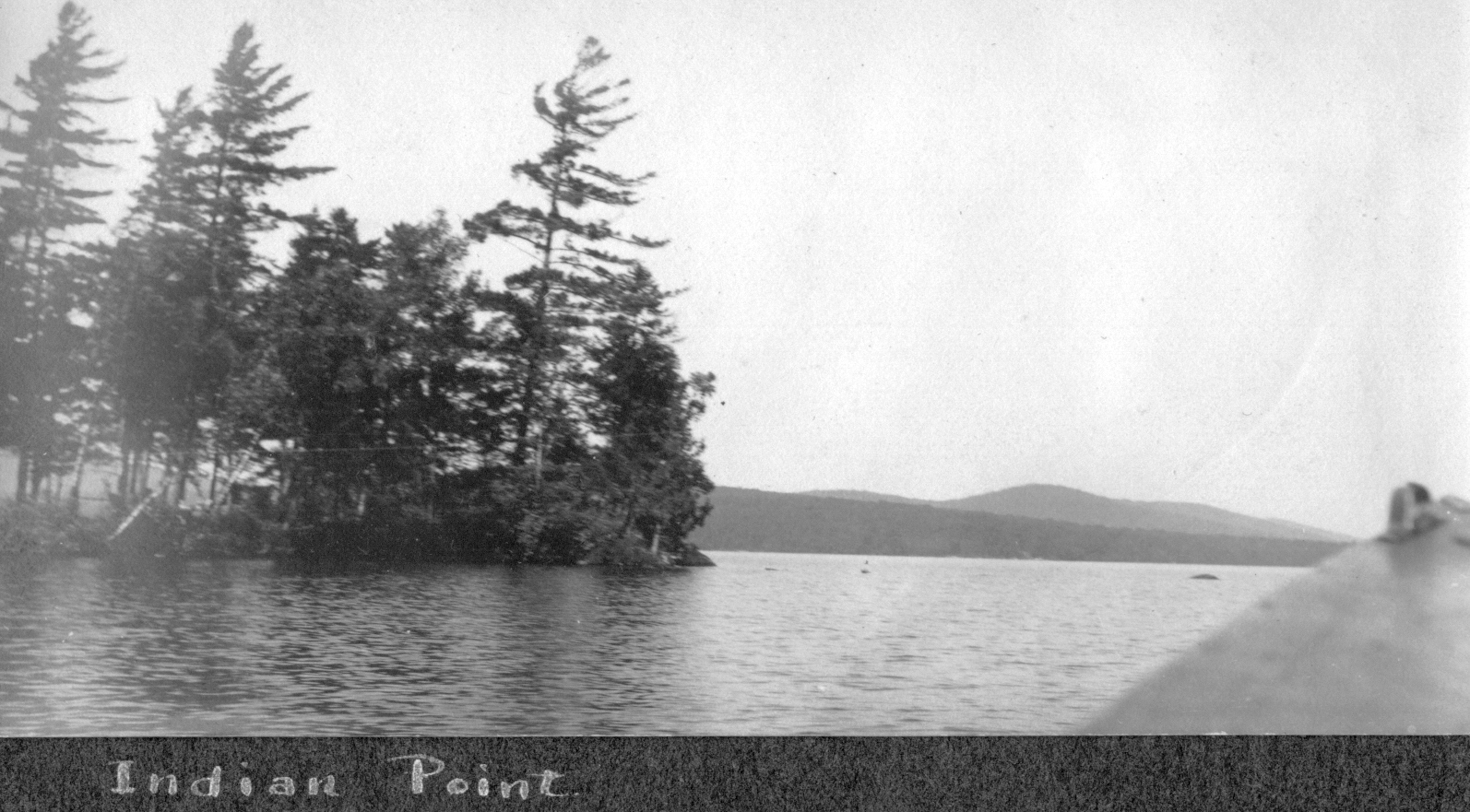
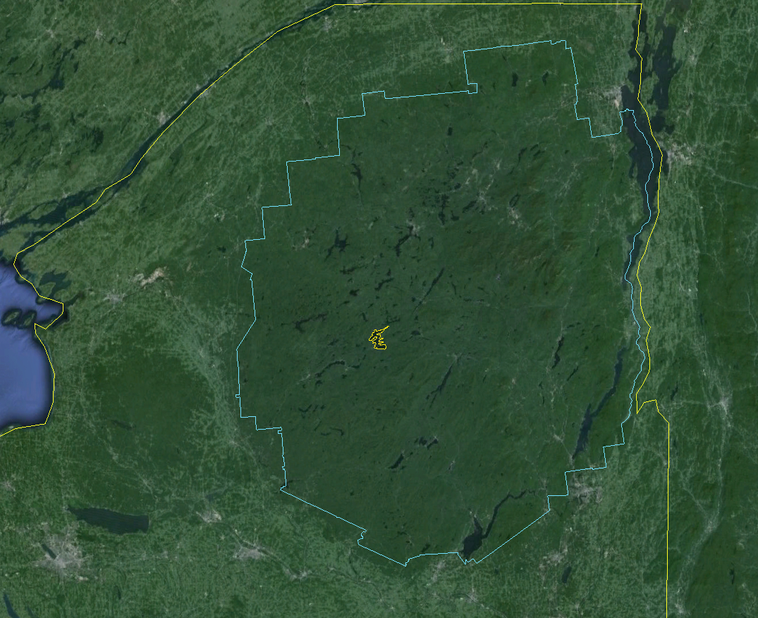
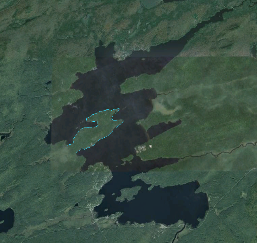
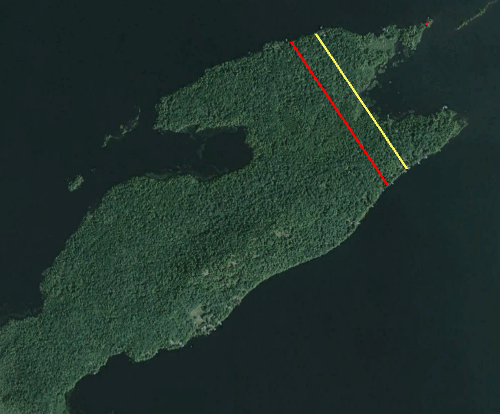
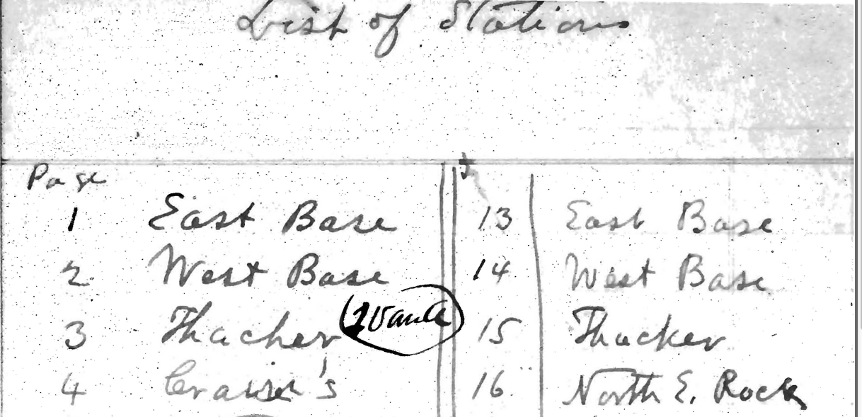
to establish a horizontally measured sub-baseline that could be used to strengthen his primary triangulation network of the Adirondack Mountains. This necessitated finding two points on the shore of Raquette Lake that would allow for the longest possible distance measured. Additionally, both points had to be visible from West Mountain and Blue Mountain. Following standard procedure, Bolt 69 was set on the south shore of Raquette Lake at a location known as Otter Point. With the ice cleared of snow, vertical wood stakes were set into the ice to act as guides in keeping the tape straight.   The 1,000 feet long steel “ribbon” was then stretched northerly with metal “ice blocks” being used at the intermediate chaining points for a total distance of 14,571.95 feet. The northerly terminus of this line was marked with a copper plug set in a small rock located at the northeast end of Needle Island. 5 [approximated in the author drawn map shown below]

Raq baseline google earth

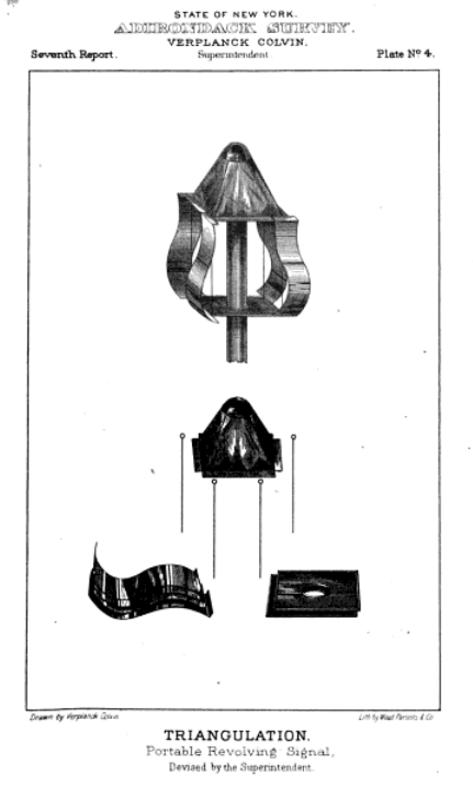
Observations from the end point of such baselines to the mountain top signal stations required Colvin to devise two tools that advanced the accuracy of his methods. The Stan Helio is a spinning pyramid of shiny tin plates that reflect sunlight, providing a bright flash that could be seen in the daytime from twenty-five to thirty miles away with the naked eye and even farther through a telescope.

stan helio

Being able to see the mountain top signal stations from wherever his surveying teams were working was one piece of the puzzle. The other is for the surveying teams to accurately know exactly where they were when they observed the nearest signal station.

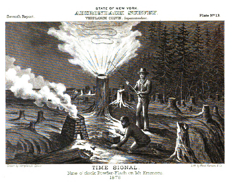
Determining a location’s longitude and latitude whether by the arc of the sun in day or by stars at night requires that one know the precise time of observation. The accuracy of Colvin’s surveying depended on all of his field teams synchronizing their timepieces to Albany’s Dudley Observatory time.

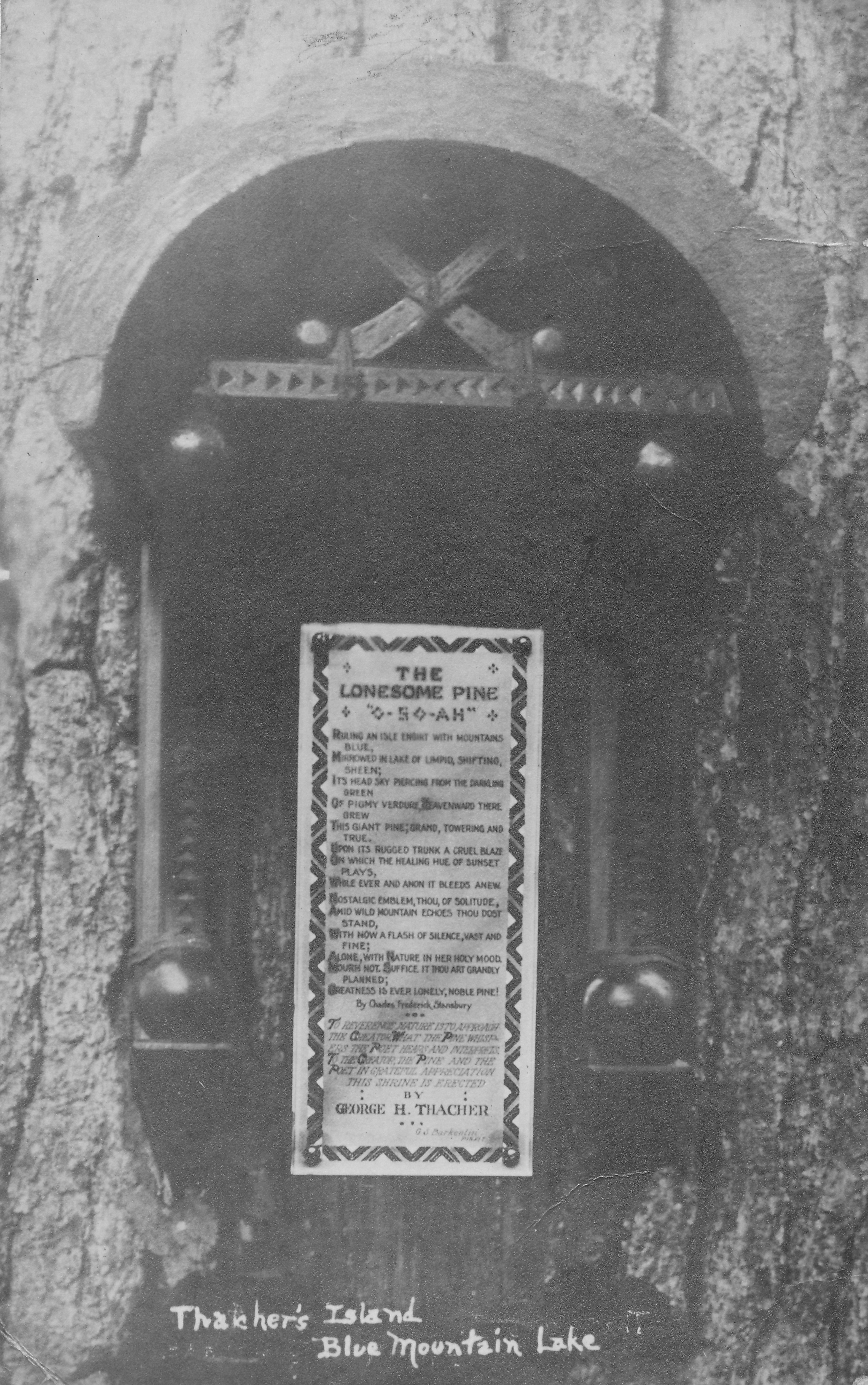
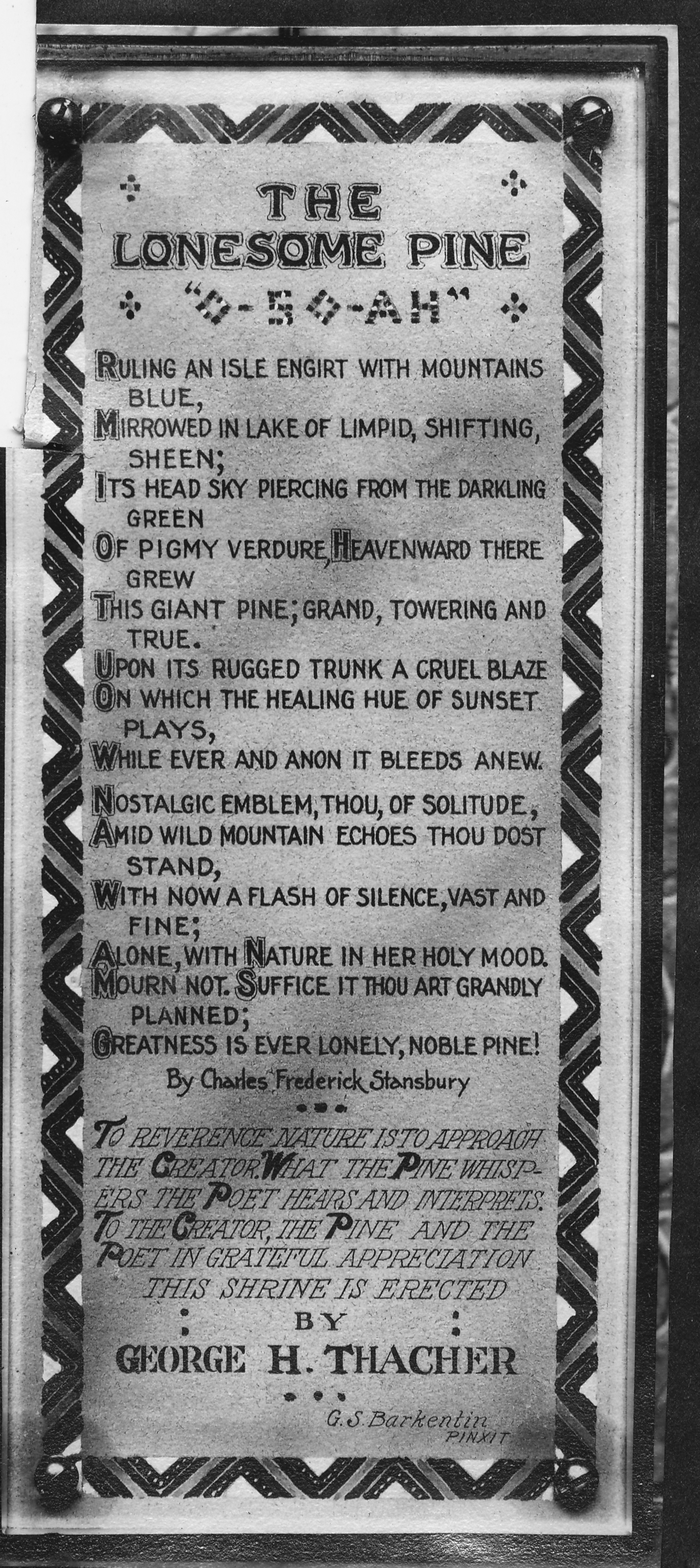
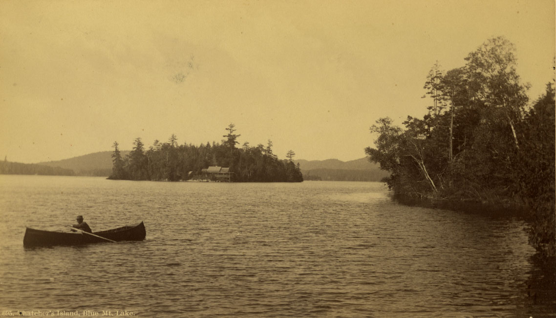
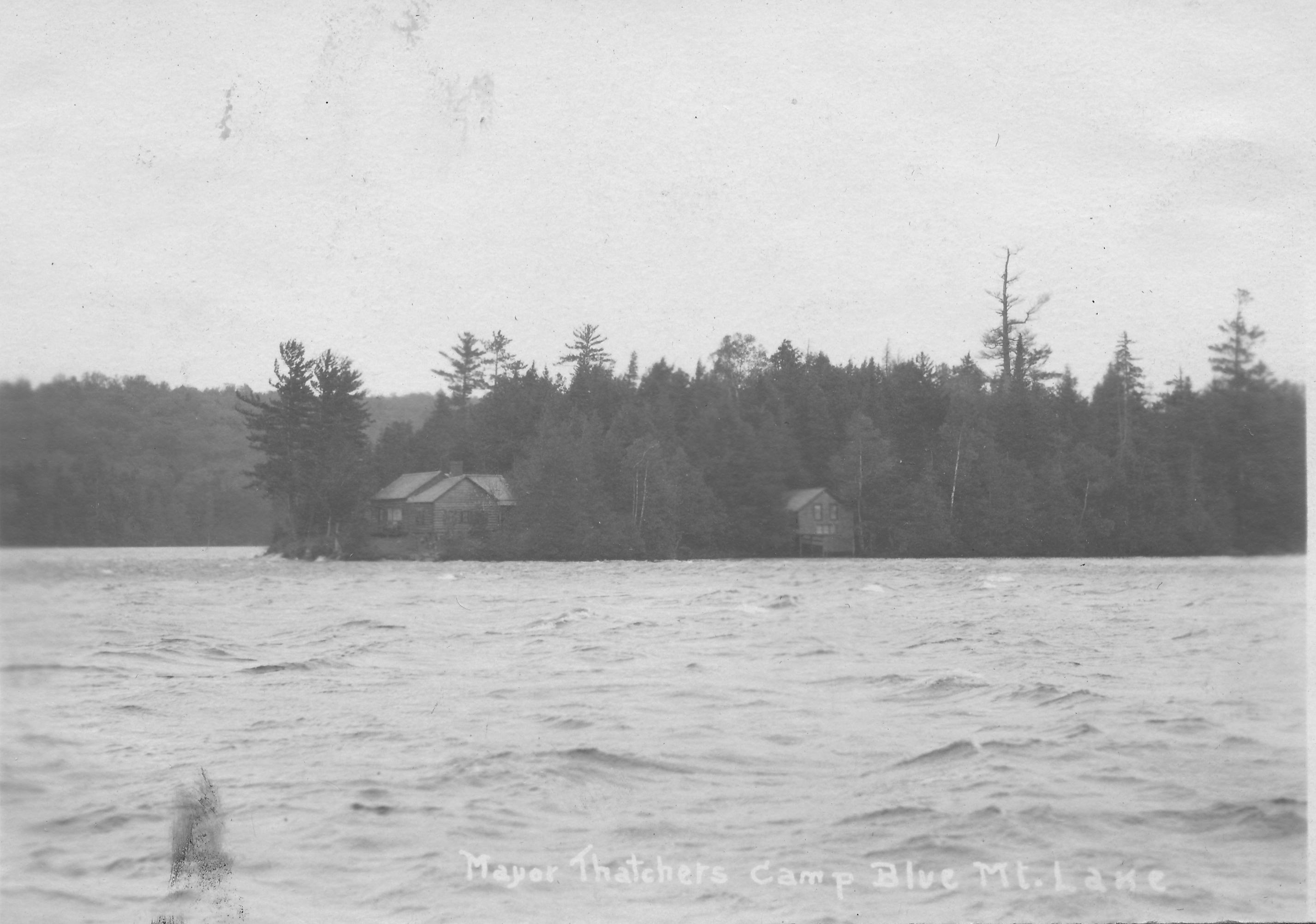
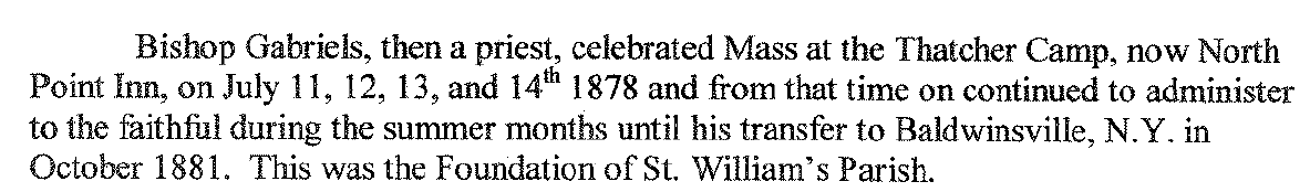
Here my research took an interesting turn when I discovered that Colvin’s solution to time synchronization involved my family. In August 1876, Colvin established an observation station on Thacher Island on Blue Mountain Lake. It was from here that he first observed the use of a nighttime powder charge flash signal that would communicate the accurate time to surveyors far afield. As he described

A supply of powder for the signal station time-flash had been sent to the mountain, and at a little before 9 P.M. we took up our station on a point commanding in the day-time view of the distant peak, and prepared to compare our watches with the chronometer signal. As we counted the seconds a bright flash illuminated the darkness, showing the mountain-top fairly, as lit by distant lightning. We found our time accurate, and were now satisfied that this method of distributing the Observatory time to the parties would be an entire success if the atmospheric conditions were favorable. 6

flash-signal

I was intrigued to know why Colvin would have used Thacher Island, when a point along the shoreline would have served just as well and eliminated the effort of rowing boxes of equipment out to the island. I knew that Colvin was from Albany, but did he know the Thacher family? My early hopes of a connection seemed dashed by viewing Colvin’s Reconnaissance Map of Tallow or Blue Mountain Lake, which incorrectly spelled our name as Thatcher. A family friend would never commit such an error.

Thatcher on map

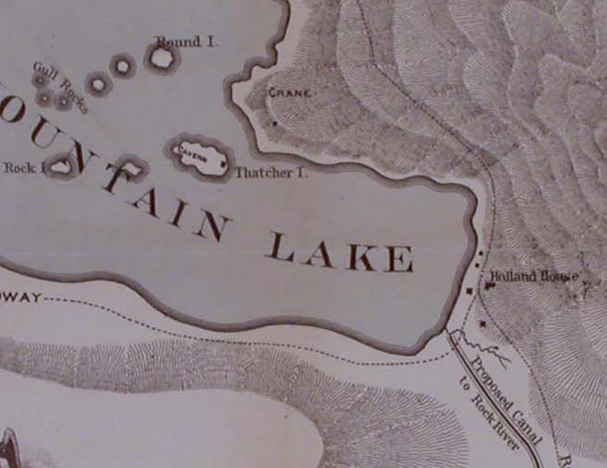
I delved deeper into the accuracy of the map and found that the spelling was an inaccurate correction made by the printer. In Colvin’s own handwritten field notebooks, he repeatedly spells the name correctly.

Thacher in Colvin notes

Triangulation uses math to discover what cannot be readily seen and measured by comparing different points in relation to a baseline. I wondered whether an analogous method of drawing connections between points in time in the lives of Verplanck Colvin and the Thachers might answer my question.

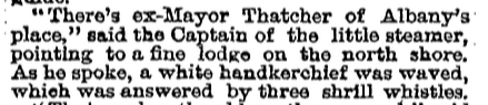
The history of Albany provided the first clues. Verplanck Colvin and John Boyd Thacher were both born in 1847. Colvin’s father Andrew J. Colvin was the State Senator from Albany in 1860-1861 (the same seat occupied by JBT twenty-three years later) at the same time that George Hornell Thacher was the Mayor of Albany; both were prominent Democrats. 7  So their fathers were clearly acquainted, but did the boys know each other? Hilary Johnson King, archivist of Albany Academy, discovered that both boys were classmates in a group of forty students for three years (1858-1861). 8

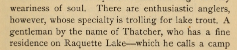
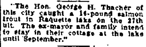
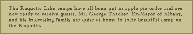
The Thachers began to explore the Adirondacks in 1862 and established their summer home on Blue Mountain Lake in 1867. Verplanck Colvin began his explorations of the region in 1865. We have no correspondence or other evidence that John Boyd Thacher and Colvin were more than acquaintances in their youth. Colvin does not make reference to the Thachers in describing his earliest camping trips to the region, and yet it is hard to believe he did not consult with the first family from Albany to establish a base in the region.

I found that JBT’s and Colvin’s lives repeatedly intersected throughout the years.

JBT and Colvin timeline2

All of these intersecting points prove that the two men knew each other, but were they friends? Only after JBT’s death do I find evidence that it would appear so.

In 1869, Colvin was the first to bring national attention to an area of scenic beauty and scientific value with his writing and hand-drawn illustrations in Harper’s Magazine 14

To those who desire to escape for a day from the oven-like city in summer; who wish to enjoy a scramble among the romantic cliffs, in shady woods, beside cool mountain brooks and waterfalls; to view spots sacred to legends of wild Revolutionary days, of Tory and Indian depredation, naming place, precipice, and mountain…

One might think that Colvin was once again writing about the Adirondacks here, but the quote continues…

to gather the fossil corals and shells… to visit and explore known caves… among the cliff ledges, the “Indian Ladder” region of the Helderbergs offers superior inducements.

Verplanck Colvin Escarpment Illustration

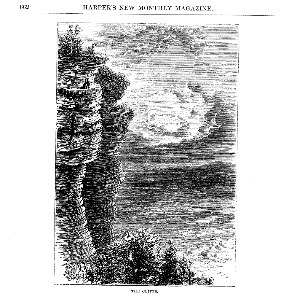
The Helderberg Escarpment lies about twenty miles to the west of Albany and a two hour drive in 1869 when Colvin used the site as his training ground. The cliffs and fields served as a laboratory where Colvin perfected the self-taught surveying techniques that he applied to the Adirondacks. 15

Beginning in 1903, John Boyd Thacher purchased 300 acres along this escarpment to preserve its invaluable fossil record and intrinsic scenic beauty. After his death, JBT’s wife, Emma Treadwell Thacher, donated the lands to create what today is known as John Boyd Thacher State Park. 16

We might easily assume that Colvin influenced JBT to preserve these lands. However, unlike my previous “triangulations”, no assumption is required here. Within the 1915 annual report of the American Scenic and Historic Preservation Society, a description of the 1914 Dedication Ceremony for the park lists Verplanck Colvin as one of eight dignitaries who enjoyed lunch with Mrs. Thacher at her Altamont estate prior to the ceremony. 17

This is notable for two reasons. None of the numerous daily newspaper articles describing the ceremony mention Colvin’s presence, and he did not speak at the ceremony itself. Having been unceremoniously and a bit scandalously fired from his state position in 1900 by Governor Teddy Roosevelt, Colvin faded into a life of obscurity, became depressed and lived in hermit-like seclusion in his home in Albany. 18

His respected place of inclusion in Mrs. Thacher’s plans for the dedication is, I believe, proof of a lifelong friendship with John Boyd Thacher and furthermore, evidence that Verplanck Colvin deserves credit as the father of two glorious state parks.


Thacher Island Revisited

GHTSr & TomYou see me here standing where my great-great grandfather George Hornell Thacher Sr. once stood on the porch of the family lodge built in 1867 on Thacher Island on Blue Mountain Lake.   The photo is not dated but given his aged appearance (no, the guy on the left), I believe it to be from the early 1880s.

My father spoke of visiting his uncle on the island as a young boy in the 1940s.   No Thacher has had the opportunity to walk the island since then. It had always been a dream of mine to visit my family’s first summer home. A dream fulfilled thanks to the hospitality of John and Janet O’Loughlin, whose family has owned the island for over two decades.

I am extremely grateful to John who, after discovering my writing, sought me out and extended an invitation for my family and me to visit their island.

The island holds a special place in the hearts of the O’Loughlins and their extended family.   Janet and her brother spent many childhood summers lodging at Potter’s.   She often visited the Anderson family, who owned the island at that time. She and her brother always fought over just which one of them would one day buy the island and make it theirs. In the end, it was Janet’s beloved, late brother who made the island part of their legacy.

Their family has lovingly restored and expanded the lodge.   The original walls of the 1867 lodge still remain within newly finished interior and exterior walls, noticeable by the almost one-foot-thick door jambs. Just as the original cabin remains, albeit hidden, on the island, I wondered what other traces of my family remained on Thacher Island.

When I researched my family’s time on the island, I came across this interesting 1920 postcard showing a wooden plaque affixed to a tree.

Thacher lonesome pine postcard

Was this still there?

The postcard intrigued me because the lettering is too small to discern anything other than “The Lonesome Pine”. I assumed the meaning would be lost to posterity until I made a find in my cousin’s family photo album.

erecting

In this photo, four of the five Thacher brothers are seen erecting the shrine in September of 1919. My grandfather Kenelm is at left, GHT 3rd is hammering, and Edwin (whom some of you may know as Ebby T.) and Thomas are crouching on the right.

Another photo shows a close-up of the text of the shrine.

the poem

It is the poem “The Lonesome Pine”, written by Charles Frederick Stansbury.   The words of the poem evoke a tall pine tree on the island that towers over all the others.

In this 1870s photo of the island by Seneca Ray Stoddard, one pine tree eclipses its neighbors by more than thirty feet, located about one hundred feet behind the lodge.

Thacher island lone pine

A different vantage appears to show the same tree not looking very healthy in a postcard from the 1930s.

Thacher Isle 1927-1940 AZO Postcard


Alas, the tree is no more. Whether it succumbed to old age or the July 1995 microburst is not clear. John said that the island lost hundreds of trees in the microburst and it took him and the family weeks to clean up the destruction.

Momentarily dejected by this discovery, my spirits rose when John revealed that another part of our family legacy has indeed survived on the island. John mentioned having seen a photo in one of my earlier articles of John Boyd Thacher 2nd rowing a guide boat off the north shore of the island.

1922 JBT2 in guideboat

John led me along a path through the woods from the cabin to their boathouse.   As we entered the boathouse, John pulled away a large tarp and there she was.

JBT2 guideboat

The photo of JBT2 is from 1922, but it could be that this guide boat dates back to the Thachers’ earliest times on the island in the 1870s.   (Perhaps a guide boat historian would like to take on the challenge of determining the age of this boat!)

As we prepared to leave the island, I realized that I misspoke when I said we were the first Thachers in over seventy years to walk the island’s paths. John and Janet’s two-year old grandson, who now explores these shores, carries on the island’s name as legacy to their family and ours.

Searching for the 1878 Thacher Cabin on Indian Point

In my last piece regarding when the mysterious Thacher Cabin was built, I cited numerous newspaper articles and books that referenced the cabin’s existence.   However, none of them clarified where the cabin was built. Previously reviewed maps of Raquette Lake gave no indication and no photos or drawings of the cabin have been found.

I chose to begin my search by focusing on the one visitor to the cabin for whom historical records might exist.   In Aber and King’s History of Hamilton County, it is written that the priest Rev. Henry Gabriels performed Catholic Mass at the Thacher Camp from July 11th to the 14th in 1878. Gabriels later became the Bishop of Ogdensburg. In the hope that this early mass in the Adirondacks might be of historical significance, I contacted the archivist of the Diocese of Ogdensburg looking for any original documents or photos of Gabriels’ visit.

Imagine my surprise when the archivist sent me the following photocopy from notes that he found:

Gabriels North Point Inn

“North Point Inn”? Could I be wrong in my assumption that the 1878 cabin was built on our family’s land on Indian Point? The North Point Inn was located across North Bay from Indian Point. My mind raced as I retraced my steps looking at all of the newspaper articles and books.

One New York Times article had said “There’s ex-Mayor Thatcher of Albany’s place,’ said the Captain of the little steamer, pointing to a fine lodge on the north shore.”   Did he mean the north shore of Raquette Lake and not the north side of Indian Point?

I then realized that when Nessmuk wrote of visiting the cabin, he simply wrote “a gentleman by the name of Thatcher (sic) who has a fine residence on Raquette Lake.” No mention of Indian Point whatsoever, just my assumption.

Fortunately, my heart rate eventually was calmed, after a day of frantic research turned up this from Seneca Ray Stoddard’s 1880 edition of The Adirondacks Illustrated:

Screen Shot 2014-08-04 at 5.09.25 PM

Once again confident of the cabin’s existence on Indian Point, I now tried to discover where on the land it was situated. I began by reviewing the property deeds. In 1876, John Boyd Thacher purchased two parcels on the tips of Indian Point. He paid nine dollars an acre to Marshal Shedd for roughly 25 acres. This first parcel is all the land to the east of the yellow line shown below, except for the area to the east of the blue lines.   JBT paid twenty-two dollars per acre to a William W. Hill for this second parcel of only 4.5 acres.

William H Hill Parcel arial

Eureka! Why would JBT pay more than twice per acre for the second parcel? Could it be that it contained an existing cabin? Was this the location of what became known as the Thacher Camp?

Alas, let me just say that there exists another explanation as to why JBT paid a high price for the second parcel. As the deed indicated that William W. Hill was from Albany, I thought it best to see if there was any connection between Hill and the Thacher family. Perhaps a higher price was paid as a favor to a friend.

Indeed, I found that William W. Hill and John Boyd Thacher were 33 degree Freemasons and both members of the Albany Chapter of the Rose Croix.   William W. Hill was an amateur entomologist whose collection of over 10,000 specimens of butterflies and moths was donated to the New York State Museum. Hill was also an officer of the Albany Institute. JBT had much in common with Hill’s scientific and preservationist inclinations and I have no doubt in claiming them to be more than mere acquaintances.

This explanation does not completely eliminate the possibility that there was an existing cabin within Hill’s parcel.   However, an epiphany came to me that argues against George Hornell Thacher establishing his camp on the southern shore of Indian Point.

No fewer than five newspaper articles and Nessmuk’s book speak of George Hornell Thacher’s love of lake trout fishing. Anyone who knows Raquette Lake understands that in summer, one fishes for lake trout exclusively in North Bay, where the depth provides the cold water desired by the trout. It is logical that GHT would have built his cabin along the north shore of Indian Point.

Indeed, a fish tale would prove to be the conclusive clue. On July 10, 1879, the Weekly Saratogian published:

Alvah fish

So clearly the Thacher Cabin was somewhere along the north side of Indian Point, but where?

Early in my research, the Adirondack Museum Librarian Jerry Pepper had shown me a hand-drawn map of Raquette Lake.  The museum did not know who created the map or when it was created.

Raquette 1881-1882 map cropped

The map has an X marked next to the word “Camp”, written in cursive, on the end of Birch Point.

Raquette 1881-1882 map close up


As this is the location of our family’s little, red one room cabin built in 1910, I assumed at first that this map was from the early nineteen teens.   However, further analysis revealed a different conclusion.

In addition to the geographic locations marked in ink, the map has the names of various camps written in pencil along the shore. There are two distinct sets of handwritten notations, one in cursive and one in block letters.   Based on the time period in which each of the named landmarks existed, the cursive notations predate those in block letters. The comparison of the dates reveals that the notation for the “Camp” on Birch Point reflects the year 1881 or 1882.

It would appear that the first Thacher Cabin was built in 1878 very near if not actually on the same ground where our little red cabin still stands today. What I would give for any photos that show the tip of Birch Point, even in the background, taken between 1878 and 1885.


Why Indian Point?

6 Indian Point red yellow and cabin

Matthew Beach and William Wood settled on the lands to the east of the red line. John Boyd Thacher purchased the portion to the east of the yellow line. The small red dot is the location of the little red cabin built in 1910.

Echoing across time, this question can be asked three ways.  Who were the Indians of its namesake?  Why did Matthew Beach and William Wood choose it for their home? Why was John Boyd Thacher enticed to buy these acres?

According to local lore, Indian Point was the site of an Indian settlement.  The earliest such reference was made by Joel Tyler Headley in The Adirondack: or Life in the Woods, published in 1849.

Screen Shot 2014-01-28 at 8.52.39 PM

Most research does not support the idea of large, permanent  Native American settlements within the Adirondacks.   However, evidence points to the Adirondacks being used as a seasonal hunting ground for the Iroquois, Huron and Algonquin Indians.  Four clues point to the area of Raquette Lake being under the control of the Mohawk Nation of the Iroquois Confederacy or Ho-dé-no-sau-nee (People of the Long House).  This map of the Six Nations of the Iroquois shows the Mohawks’ territory beginning to the west of Raquette Lake and expanding east to Lake Champlain. (Enlarge the map by clicking on it and read the text to the right of the compass rose)

Screen Shot 2014-01-26 at 2.28.39 PM

Guy Johnson’s 1771 Map of the Country of the VI Nations. New York State Museum.

Another clue is that the lands which would become the Totten & Crossfield Purchase (which includes Raquette Lake) were originally purchased by the British Crown from the Mohawk Nation in 1771.   The British had purchased the lands from the Mohawks for 1,000 pounds and sold it to Totten & Crossfield for 40,000 pounds in the same year.  (And you thought flipping real estate was a modern invention!)   Although this land sale took place, the Mohawk Nation later continued to claim the lands and use them until a peace treaty between the newly formed United States and the Iroquois was signed in 1794. 2

In Adirondack Pilgrimage, Paul Jamieson makes the argument that the Albany Road (sometimes referred to as the Old Military Road) constructed for the War of 1812 actually followed the path of an Iroquois trail which dates back to the 1600s.  Jamieson mines the first person writing of a Jesuit Priest named Joseph Poncet who was captured by Mohawks in 1653.  Poncet’s description combined with Jamieson’s research and that of Stephen B. Sulavik in Adirondack: Of Indians and Mountains 1535-1838 yields my approximation of the heavily travelled Mohawk trail which passed just to the west of Raquette Lake, traveling from the Mohawk River Valley to Canada.   The foot path led through the forest to the Oswegatchie River by which the Indians canoed to the St. Lawrence River.

Screen Shot 2014-01-26 at 4.32.19 PM

Beyond the evidence of this Mohawk trail passing close to Raquette Lake, the only other history which directly connects the Mohawk Indians with the lake is the escape of the Tory Sir John Johnson from Johnstown to Montreal in 1776.   His Mohawk guides brought him through the woods to the shores of Raquette Lake and then by canoe north to Canada, a tale which will be retold in a future chapter.

This scant evidence implies that the Mohawks were well acquainted with Raquette Lake for over a century.  But did they have an encampment on Indian Point?  There are no contemporary written histories which specifically speak of the use of Indian Point by the Mohawks.  My conjecture is based on descriptions of how large hunting parties of Mohawks would travel from their year-round villages along the Mohawk River to encampments in the Adirondacks from November to late January.

Father Isaac Jogues is another French Jesuit priest who was captured by the Mohawks in 1642, and his writings describe a hunting expedition departing from the Mohawk village of Ossernenon along the Mohawk River:

If we can assume that such a winter hunting camp existed on Indian Point, why did the Mohawks choose this location along the almost one hundred mile shoreline of Raquette Lake?  I believe it is the geography and topography which influenced their choice.

According to Lewis Morgan in the League of the Ho-De-Nau-Sau-Ne or Iroquois, “For three quarters of a century, from the year 1625 to the year 1700, the Iroquois were involved in almost uninterrupted warfare [with other Indian nations]…from about the year 1640 to the year 1700, a constant warfare was maintained between the Iroquois and the French.”  The 18th century brought ever greater conflict between the Mohawks and Europeans over control of Adirondack territory for the lucrative beaver fur trade. 3

In this context, the Mohawks would have benefited from siting their winter hunting camp in a location on Raquette Lake which could be defended and from which they could observe any approaching enemies.  Indian Point possesses a unique geological feature called the Crags, a series of three rock outcroppings at the top of the ridge line on the peninsula.  At an elevation of 2000 feet, even today one can see all the way to South Inlet, and anyone approaching from the Marion River or Brown’s Tract Inlet would be seen at least an hour before they could land on the shores of Indian Point.  To the northwest, one can see Sucker Brook Bay.

Screen Shot 2014-02-01 at 8.51.14 PM

USGS Raquette Lake Quadrangle Map

While today the tree cover does not provide a view to the northeast, images from the 1800s indicate that the Crags were almost clear of trees and it is highly likely that a lookout stationed there in the 1600s and 1700s would have also been able to see anyone rounding Bluff Point to the northeast of Indian Point.

Drawing from Craggs

Looking South from the Crags – a wood cut printed in Wallace’s Descriptive Guide to the Adirondacks. 1872.

Seneca Photo from Craggs

Photo from the Crags by Seneca Ray Stoddard. circa 1880.

While the Crags may have led the Mohawks to choose Indian Point, where along the shores of the peninsula was the hunting camp?  As the camp would have been used mostly from November to late January, I suspect a location sheltered from the worst of the cold winds blowing across Beaver Bay or North Bay.   Either of the two protective coves would have served well, the cove near Hen and Chickens Islands or the little bay between the two points on the eastern tip.

An understanding of the size and description of a hunting camp helps to create a theory as to where on the peninsula it was located.  Father Jogues’ description implies that a family clan headed by a Chief would likely all relocate to the winter hunting grounds.  The villages in the Mohawk River Valley  would each have several Long Houses.  Each Long House would be the home of a family clan.   The length of the Long House and the number of fire pits within the Long House would relate to the number of families.  An account of Dutch explorers encountering a Mohawk village in 1644 described one Long House of eighty paces in length being home to a Chief, 40 men and 17 women. 4

The Mohawks’ method of hunting deer illustrates the need for a very large hunting party.  Father Jogues experienced the hunt firsthand, “They beat up the stags and the elks from their coverts, and drove them headlong toward the fences that strecthed between the trees and into the narrowing alleys of the traps, were they could easily be slaughtered.  They tracked the animals over the rise and fall of the mountains, and had the zest of dropping them with musket or arrow or javelin.”

Morgan in League of the Ho-De-Nau-Sau-Ne or Iroquois, provides an even more detailed description of the hunting method:

The construction of a V-shaped fence that stretched two to three miles on a side would have required significant manpower.  If the Indian “settlement” on Indian Point was a winter hunting camp, it likely was the temporary home to at least fifty or more people.

A young Mohawk woman named Kateri Tekawitha described one style of temporary shelter used in a winter hunting camp in the late 1600s.

This depiction has been faithfully recreated by Barry Keegan, an expert in primitive Native American structures, in his construction of a traditional wigwam on the shores of Prospect Point on Blue Mountain Lake.

1415364_10201061516442946_2004213794_o

A traditional wigwam hunting-lodge constructed at Prospect Point on Blue Mountain Lake by Barry Keegan. Photo by Jerry Krasnick.

According to Keegan,  “South of the Adirondacks, wigwams were usually dome shaped and often sided with elm bark; north of our region they tended to be conical, like squat-shaped tepees with birch bark as the siding of choice. The Adirondacks are right on the border between those two types and probably both were in use here, at the very least as seasonal hunting camps.” 5

Father Jogues’s writings appear to describe the second style, “There the [women], under the direction of the men, threw up the three slanting poles of the hunting-huts and tied them at the top and sewed the bark and skins firmly about the triangular frame.”

IMG_0344

A conical teepee style hunting lodge from creaturehomes.blogspot.com

The “hunting-lodges of bark and close-woven boughs” referred to by Kateri or the bark tee pee style described by Jogues appear to have housed a small family of five to ten people.   To accommodate upwards of fifty to one hundred people, the winter hunting camp on Indian Point would have required up to ten lodges.  The annual construction of these lodges for over a century would have established significant forest clearings on Indian Point.

My theory that the hunting camp was on the shores of the little bay nestled within the eastern tips of Indian Point is tied to the reason I believe Matthew Beach and William Wood chose to settle at that spot.  My theory echoes one regarding land use in the Adirondacks first promoted in the late 1800s in an article in the New York Times.

Screen Shot 2014-02-02 at 6.27.40 PM

“The North Woods of Old” The New York Times. May 11, 1890.

The site of the Mohawk hunting camp would not have been open land by the 1840s. The majority of the Mohawk Nation relocated to the St. Lawrence River Valley on both sides of the New York/Canadian border after the Peace Treaty of Canandaigua in 1794 between the Iroquois Confederacy of the Six Nations and the new government of the United States. 6   Although Mohawks continued to come down from Canada into the Adirondacks for hunting in the early 1800s, it is likely that secondary forest regeneration began to take hold of the area of the hunting camp on Indian Point.

Beach and Wood were not simply hunters and trappers.  They also cleared ten acres of cropland to grow potatoes and vegetables.  When they first travelled the shores of Raquette Lake in search of where to stake their claim, Beach was nearly sixty years old and Wood was in his early forties.  I am sure they had a strength and vigor beyond what this author is capable of at 46, and they were accustomed to hard physical work.  Nonetheless, knowing that they intended to clear the land for farming, an area previously cleared by over a century of indigenous use yielding a young secondary forest would have been easier for Beach and Wood to clear with fire and axe than the surrounding primary forest of large diameter trees with deep rooted trunks.

young secondary forest

Young secondary forest

Old growth primary forest

Old growth primary forest

Screen Shot 2014-02-03 at 10.12.44 PM

Beach and Wood chose the twin tips of Indian Point because of the land use potential derived from the remains of the Mohawk hunting camp.  Conversely, the purchase of this land by John Boyd Thacher is puzzling in that it appears that he never really used the land.  It was his father George Hornell Thacher who built and frequented the mysterious original cabin, and yet the title to the land was always only in JBT’s name.  Could it be that JBT was motivated to buy the lands for their historical value?

JBT was an industrialist and politician but also an historian and scholar.  He was a renowned authority on Christopher Columbus and a collector of over 5,000 books and manuscripts from the 15th century, which his widow donated to the Library of Congress.  Among his varied interests, he showed a keen appreciation for the Iroquois Confederacy.  His collection included the original 1630 signed contract between the Iroquois and the Dutch for the sale of the land upon which the city of Albany was built.   At Albany’s Bicentennial Celebration in 1886, then Mayor JBT gave an eloquent speech welcoming a delegation from the Caughnawaga tribe and honoring the Iroquois Confederacy as the blueprint for our democratic form of government. 8

In 1893, he purchased four historically important Iroquois wampum belts. 9   The Hiawatha Wampum Belt was created in the 1500s to commemorate the union of the Five Nations of the Mohawks, Oneidas, Onondagas, Cayugas, and Senecas into the Ho-dé-no-sau-nee or Iroquois Confederacy.  To the Iroquois, this wampum belt is equivalent to the original copy of the Constitution of the United States.

Screen Shot 2014-02-02 at 9.04.41 PM

Hiawatha Wampum Belt

The George Washington Wampum Belt commemorates the Treaty of Canandaigua of 1794 which brought peace between the newly formed United State of America and the Iroquois Confederacy.

Screen Shot 2014-02-02 at 8.24.24 PM

George Washington Wampum Belt

The other two wampum belts commemorated the first encounter between the Iroquois and European explorers in the 1500s and their encounter with Samuel Champlain in 1609.

Given John Boyd Thacher’s clear respect and appreciation for the culture of the Iroquois Confederacy in his later years, I do not think it unlikely that as a young man of thirty he would be attracted by the folklore of an “Indian settlement” that once graced the tips of Indian Point.

Nessmuk Comes to Visit

Nessmuck Woodcraft p63

Published on page 63 of Woodcraft by Nessmuk in 1884.

Whenever and wherever the original Thacher cabin was built on Indian Point is my holy grail.  Delving into the details of the few literary mentions of the cabin might yield clues.  This visit by Nessmuk was published in 1884; however, it makes no mention of when the encounter actually occurred.  I needed to learn about this man called Nessmuk.

Screen Shot 2013-12-14 at 11.50.52 AM

Title Page of Woodcraft. George Washington Sears. 1884.

Nessmuk was the pen name of George Washington Sears.  In his youth, he had been befriended by a young Narragansett Indian named Nessmuk (“wood drake”) who taught him hunting, fishing, and camping.  Later he took the Indian name for his pen name and its English translation for the name of his first canoe.   His book Woodcraft was first published in 1884 and remains in print today as one of the most widely read guides for the bushcraft and wilderness survival community.

According to the editor Dan Brenan in The Adirondack Letters of George Washington Sears, “At the age of 59, a little more than 5 feet tall, weighing less than 105 pounds, and weak with acute pulmonary tuberculosis, Sears decided to see if the Adirondack lakes and forests could improve his health. Since Sears was so small and weak, he could not carry the usual heavy guide boat over the carries between the lakes of the Fulton Chain. He persuaded J. Henry Rushton to build him solo canoes that he could carry.”

Nessmuk published accounts of his three trips through the lakes and streams of the Adirondacks  in a series of letters to Forest and Stream magazine: “Cruise of the Wood Drake” (1881), “Cruise of the Susan Nipper” (1882), and “Cruise of the Sairy Gamp” (1883).     

The high regard and esteem in which Nessmuk was held by his readers is evident in the editorial published by Forest and Stream to promote the creation of a memorial for him.

Screen Shot 2013-12-14 at 2.07.27 PM

Forest and Stream. February 9, 1893.

Nessmuk photo

George Washington Sears – “Nessmuk”


So when did this renowned writer meet my great-great-grandfather George Hornell Thacher at his “fine residence” on Raquette Lake? Three clues appear to reveal a possible date.

Nessmuk’s habit appears to have been to write not about what transpired on the day he put pen to paper, but about his adventures in the preceding days.  This combined with the fact that often only the date of publication in Forest and Stream is known for most letters, makes it a challenge to date the actual occurrences of which he writes.

In a letter published on August 9, 1883, he describes his travels through the Fulton Chain prior to his arrival at Raquette Lake.  That letter does identify that it was written at Raquette Lake on July 27, 1883.  If one is to assume that Nessmuck would choose a day of idle and not a day of arduous paddling to compose his letters, it is likely that his letter of July 27th was written on the day he later described in his letter published on August 16th.

Screen Shot 2013-12-15 at 9.46.15 PM

Forest and Stream. August 16. 1883.

In a letter written while at Paul Smith’s and published August 23, 1883, Nessmuk tells of his visits to various private camps on Raquette Lake.

Screen Shot 2013-12-15 at 8.31.05 PM

Forest and Stream. August 23, 1883.

Notice the repetition of the text in bold within both letters.  I believe Nessmuk is describing the same day in two different letters.  Given that the Raquette House was directly across from the original Thacher Camp on Indian Point, I am fairly confident that the two men made their acquaintance on July 27, 1883.

The Sairy Gamp that carried Nessmuk to this rendezvous with my ancestor is described by Forest and Stream fisheries editor Fred Mather:

Nessboat

My Angling Friends. Fred Mather. 1901.

Screen Shot 2013-12-14 at 4.49.17 PM

The Sairy Gamp on display at the Adirondack Museum.

I can only imagine that this fateful visit might once have been the topic of an encounter between Fred Mather and John Boyd Thacher, GHT’s son.  Although no evidence exists to corroborate it, I suspect such an encounter did happen and would have been described like this in Forest and Stream,

Screen Shot 2013-12-16 at 5.20.21 AM

A fictional but historically accurate allusion to facts.

To entice you to seek out Nessmuk’s writings, I have reproduced one of his stories,

Screen Shot 2013-12-14 at 1.55.24 PM

Screen Shot 2013-12-14 at 1.55.46 PM

Screen Shot 2013-12-14 at 1.56.15 PM

Screen Shot 2013-12-14 at 1.56.34 PM

Enjoy one of his poems from his book of poetry Forest Runes published in 1887.

Screen Shot 2013-12-14 at 3.09.13 PM

Screen Shot 2013-12-14 at 3.09.41 PM

Screen Shot 2013-12-14 at 3.09.58 PM

Found and Lost

Discovery brings with it a joy and a moment of satisfaction which spurs fresh pursuit of the truth.  My cousin Stephen FitzPatrick was afflicted with curiosity by these initial blog postings, a compulsion to learn truths that our ancestors lived but failed to share with us.  A piece of the puzzle had always been in his hands but he did not know it.  Prompted by my last chapter, Stephen searched through boxes of his mother’s memorabilia and found this:

SONY DSC

Courtesy of Stephen FitzPatrick

The photo is dated 1910, the year of construction according to our family’s oral history.  Could this be the first photo of the little red cabin?  Our previous research had narrowed the window in time to between 1905 and 1918.  This would appear to squeeze the date of construction to a mere five year period between 1905 and 1910.

It was time to see what evidence I could find of the Thachers on Indian Point between the pages of books, newspaper articles and letters.  Screen Shot 2013-11-23 at 5.47.05 AM

The power of the internet still amazes me with its ability to bring over 100 years of history into focus in the comfort of my “fortress of solitude”, the name given by my wife to the corner of our dining room where the iMac sits with stacks of books, photos and articles cluttered around it.  Through hours of endless searching, a strong trail of evidence emerges which charts the family’s footprint on Indian Point and describes the cabin.

The earliest hint of the family’s use of Indian Point comes in this account from an adventurer camping on Tioga Point.  He speaks of a camping party across the water enjoying the summer of 1877.  I believe it must refer to George Hornell Thacher Jr., who at the time would have been 26 and single, and his friends.

Screen Shot 2013-11-23 at 6.08.27 AM

Excerpt from Camps and Tramps in the Adirondacks. A. Judd Northrup. 1880.

As both points at the tip of Indian Point were once owned by Matthew Beach, the reference to Beach’s Point does not clarify where this encampment was.  However, “charmingly located among the birches” is an apt description of its namesake and the “boulder out in the water” clearly describes what we call “The Big Rock” on the north side of Birch Point.

Big Rock

An encampment of twenty-six must have covered what little ground exists on Birch Point with tents and primitive lean-tos, leaving no room for a one room cabin that sleeps only two.   The little red cabin came thirty-three years later, but the breadcrumbs are there in the pages.

My great grandfather George H. Thacher, father to the five brothers, hosted two prominent clergymen at the cabin.

Exhibit B

Exhibit A – Troy Daily Times

I found an article which appears to refer to the first John Boyd Thacher and a “fine lodge” on Indian Point.

Exhibit A - An article in the New York Times describing a steamboat tour of Raquette Lake

Exhibit B – From an article in the New York Times describing a steamboat tour of Raquette Lake

The famous wilderness writer George Washington Sears, who used the pen name Nessmuk, spoke of visiting the cabin in his book Woodcraft.

Exhibit B - From the book Woodcraft by Nessmuk (George Washington Sears)

Exhibit C – From the book Woodcraft by Nessmuk (George Washington Sears)

What incredible luck to find actual contemporary newspaper and literary evidence that corresponds to the time period of the cabin’s photographic evidence.  On first impression, that is exactly what I thought I had found.  Alas, nothing is ever simple.

Exhibit A was published in 1880 and George H Thacher is not my great grandfather but my father’s great grandfather, the patriarch of the Thacher family.   Exhibit B was published in 1881.  “Ex-Mayor Thacher of Albany” refers also to the patriarch of the family and not his son John Boyd Thacher, who likewise was mayor.  Exhibit C was published in 1884.

Further research turned up…

Albany Evening Journal. June 5, 1881.

Albany Evening Journal. June 5, 1881.

Essex County Republican. May 26, 1884.

Essex County Republican. May 26, 1884.

Despite our love of the little red cabin, it strikes me as odd that a one room structure would be described as “a fine lodge”, a “fine residence”, a “cottage” and a “beautiful camp”.   The lodging described in these excerpts appears to have accommodated a family and hosted prominent guests.  And what of the photographic evidence that shows no cabin existed in 1905?  Our family knows of no stories, nor paintings, nor photos of this previous Thacher cabin on Indian Point.

I began with a search for the origins of the little red cabin and have satisfied my curiosity with the photo from 1910.  Now a new mystery emerges.   When and where was this newly discovered original cabin built and what happened to it?

The Search Begins…

While this book hopes to expand  beyond simple stories of my family, it is through our history that I became aware of the heritage of Indian Point both before and during our tenancy.

red cabin

To be clear, “our” tenancy speaks not solely of those named Thacher.  My father’s sister Ellen married Michael FitzPatrick.  Both families enjoyed summers together sharing the cabin and two lean-tos until 1981 when our family built a new place on the north shore of the peninsula.  Each summer, a growing brood of FitzPatrick cousins continues to inhabit the little, red one-room cabin at the point’s tip.

My journey began with a desire to learn when this cabin was built.   As a child I would fall asleep in the lean-to that sits just to the right of this cabin, being driven to sleep by the flames dancing in the stone fireplace and the hypnotic pulsing of the green and red lights which adorned the channel buoys in the Needles.  My father is shown here as a boy in the same lean-to.

1945 Ken in Indian Pt

Kenelm R. Thacher Jr. in 1945.

By the fire, my father and aunt would tell stories of their times here and on Blue Mountain Lake.  Originally, the main family summer home was on Thacher Island on Blue Mountain Lake.  The island lodge was the first and only privately owned summer home on the lake for a decade beginning in 1867.  The island was purchased by John Boyd Thacher, who built a lodge for the use of his father, George Hornell Thacher.

Photo by Seneca Ray Stoddard 1880's    Courtesy of the Adirondack Museum.

Photo by Seneca Ray Stoddard 1880’s Courtesy of the Adirondack Museum.

The island lodge remained in the family until the 1940s while the lands on Indian Point, purchased in 1876, were always referred to as the “hunting and fishing” grounds.  We have always considered ourselves extremely lucky to still possess these wonderful acres on Indian Point.  Yet we wonder what transpired here between 1876 and now.

The oral history speaks of John Boyd Thacher and his brother George Hornell Thacher Jr. using Indian Point for guided camping adventures, with their father remaining at the island in Blue Mountain Lake.  Family lore holds that the red cabin was the first thing to be built on the point.  We have vague memories of our parents claiming that the cabin dates to 1910.  My challenge is to prove them right.

A review of several historic maps of Raquette Lake show no indication of a cabin at the point between 1886 and 1903.

Survey  Map Raquette Lake in 1886 shows the Thacher property in gray but no structure on the point.

Survey Map Raquette Lake in 1886 shows the Thacher property in gray but no structure on the point.

1890 Map of Raquette Lake by Seneca Ray Stoddard makes no mention of a Thacher cabin.

1890 Map of Raquette Lake by Seneca Ray Stoddard makes no mention of Thacher at Raquette but identifies Thacher Island on Blue Mt. Lake.

Map of Township 40 in 1900 shows the Thacher property line traversing Indian Point, but no cabin   location.

Map of Township 40 in 1900 shows the Thacher property line traversing Indian Point, but no cabin.

1903 USGS Raquette Lake Quadrangle shows numerous structures on the lakeshore and nothing on the point.

1903 USGS Raquette Lake Quadrangle shows numerous lakeshore structures but nothing on the point.

A 1905 photo from the family of Donna Phinney Geisdorf (owners of Sunny Cliff Camp deep in Sucker Brook Bay) shows Birch Point.   It shows no cabin and no dock.

1905 photo of Birch Point

1905 photo of Birch Point. Courtesy of the Geisdorf Family.

It is unclear if the photo shows any structure, but when blown up larger, there is an image that might be a primitive, makeshift lean-to.   It has oddly straight edges and corners that would seem unlikely to be natural trees.   I have highlighted the lines in red.

Possible evidence of a lean-to at the Point in 1905.

Possible evidence of a lean-to at the Point in 1905.


The only map that I have found to date which does indicate a structure in the location of the little red cabin is the 1954 USGS Raquette Lake Quadrangle.   Unfortunately, there appear to be no USGS surveys done between 1903 and 1954.

USGS Raquette Lake 1954

USGS Raquette Lake 1954

So the cabin was built sometime after 1905 and before 1954.   Couldn’t we narrow it down a little better than that?  Perhaps it was time to talk with the locals of Raquette Lake to see what they knew of the cabin’s history.

Fortunately, there is one person with direct personal knowledge of the cabin.  Warren Reynolds was born and raised at Raquette Lake.  His family rented the little red cabin for the summer of 1938 and then lived there for a whole year beginning in the summer of 1939.  He shared stories with me of his family living through the winter of ’39-’40 in the small one room cabin.  Warren travelled to school by boat when the water was open and by dogsled over the ice in winter.

His father worked as a guide in season and hunted, fished and trapped for his family’s sustenance.   The family could not have survived if his father had obeyed the Game Warden’s regulations.  To hide his illicit bounty of fish and venison taken out of season, Warren’s father dug a 6′ by 4′ hole six feet deep and set 350 feet back in the woods to the west of the cabin with a wooden cover camouflaged with pine pitch, sticks and leaves.  The remains of this “ice box” are still there today.

I next approached the local Raquette Lake historian, Jim Kammer, to see what he might know of the cabin.  He produced a photo that is part of a collection from the Carlin Boat Livery, one of the first marinas on the lake, located near the present day dock of the Raquette Lake Navigation Co.’s W. W.  Durant.

The Carlin Boat Livery was in operation from 1900 to 1935 and dates the photo of the cabin to within those years.

Earliest photo of little red cabin.  Courtesy of Jim Kammer.

Earliest photo of the little red cabin. Courtesy of Jim Kammer.

We know from the previous photos that this has to be after 1905.  When I showed Warren Reynolds this photo, he remarked that the boat appears to be a row boat without motor moored off shore with no dock visible.  In 1938 there was a dock and the Thacher’s gave Warren’s family use of a boat with a small outboard engine.  The photo is also missing a tool shed that Warren remembered being between the little red cabin and the lean-to.  Lastly, Warren commented that the cabin was far from brand new when his family lived there.  He thought it was about twenty years old at the time, which would date it to 1918.

Given all that we know – the local lore, photographic and map evidence – we can say that the little red cabin was built sometime between 1905 and 1918.   While this does not contradict the family oral history, I strive to narrow the window in time.  Perhaps through reviewing historical newspapers and contemporary literature, I might glimpse proof of this alleged 1910 date….

Timeline

Events on these Fifty Acres of Beach and Wood

These points in time reveal some of the stories, of import and of good sport, that are yet to unfold in this blog.

1650-1794

Indian Point is used as a Winter hunting encampment by the Mohawk tribe.

1776  

The tory Sir John Johnson camps at Indian Point during his harrowing 19 day escape to Canada.

1837

At a pond northwest of Indian Point (Lone Pond or Cranberry Pond?), William Wood traps the last beaver seen alive in the Adirondacks until they were reintroduced in the beginning of the 20th century.

1837-40

Matthew Beach and William Wood became the first permanent settlers of Raquette Lake with their cabin built on Indian Point.  Exact date undetermined.

1840-43

Professor Ebenezer Emmons, first surveyor and the person to give the region the name “Adirondacks”, repeatedly stays with Beach and Wood while surveying the area.

1844-46

Joel Tyler Headley writes in his 1849 book The Adirondac – Life in the Woods of visits with Beach and Wood during his earlier explorations with guide Mitchell Sabattis.

1845

J.H. Young publishes the first map of New York State that shows a body of water in the location of Raquette Lake.  Only Long Lake to the north is named on the map and the drawing of Raquette Lake is almost completely inaccurate except for the detailed, near accurate depiction of Indian Point.

1849

Beach and Wood purchase from Farrand Benedict legal land titles giving them each an equal share of the 50 acres they have occupied on Indian Point.

1854

Beach deeds his 25 acres to Amos Hough of Long Lake contingent on Hough taking care of Beach until his death.

1856

Hough sells the 25 acres to land speculator Marshall Shedd Jr. allowing Beach to still reside there.

1859

John Plumley, -“Honest John” – famed guide of Adirondack Murray purchases William Wood’s 25 acres.

1860

Matthew Beach goes to live in Long Lake in the home of John Plumley, who as Amos Hough’s son-in-law has taken over the family obligation to care for Beach.

1861

In July at the South Inlet of Raquette Lake, William Wood shoots and kills the last moose seen alive in the Adirondacks until they were reintroduced by W. Seward Webb on his private preserve at the end of the 19th century.

1862

Mitchell Sabattis guides George Hornell Thacher on his first exploration of Blue Mt. Lake and Raquette Lake at the suggestion of Joel Tyler Headley, Thacher’s old friend from Union College days.

1865-1868

Alvah Dunning – one of the most notable of Adirondack Guides – squats on the south side of the southern fork of Indian Point.

1867 

John Boyd Thacher purchases an island in Blue Mt. Lake to build a lodge for the use of his father George Hornell Thacher.

1868

Verplanck Colvin, Superintendent of the Adirondack Land Survey from 1872-1900, as a 21 year old seeks the advice of his old childhood friend John Boyd Thacher as he plans his early explorations of the Adirondacks.

1869

Renowned landscape artist Arthur Tait spends the summer in Matthew Beach’s old cabin. He sketches here the paintings he named “The Adirondacks” and “Deer in the Woods”.

1873

Amanda Benedict, the sister-in-law of Farrand Benedict, organizes the first major all female expedition of the Adirondacks.   Four groups of women botany students traverse different routes starting from Schroon River, Saranac, Lake Pleasant and Moose River to converge at Indian Point.  The women and 16 of the most famous Adirondack Guides are brought together at one time on these acres.

1876

John Boyd Thacher purchases Matthew Beach’s 25 acres from Marshall Shedd Jr.

1876

Verplanck Colvin establishes an observation station for the Adirondack Land Survey on Thacher Island in Blue Mt. Lake.  He uses it to test a new technique for synchronization of time among survey field teams separated by great distance within the Adirondacks.

1877

First written description appears of George Hornell Thacher Jr., age 26, camping on Birch Point with a large group of young friends.

1877

Levi Wells Prentice, famed landscape artist, sketches from a vantage point within these acres the scene later depicted in his painting “Raquette Lake from Wood’s Clearing”.

1878

Reverend Henry Gabriels conducts Catholic Mass at the “Thacher Camp” on July 11, 12, 13, 14.  This is one of the earliest Catholic missions within the central interior of the Adirondacks.  At the time, Rev. Gabriels is the President of the St. Joseph Seminary in Troy, NY.  He later became the Bishop of Ogdensburg – the Diocese covering all of the Adirondack region.

1879

The Map of the New York Wilderness by Colton-Ely in the 1879 edition superimposes the name “Thatcher” written across the whole of Indian Point.  Earlier editions of the same map lack this detail.

1880

George Hornell Thacher Sr. begins his annual summer visits to the Thacher Camp staying in a “fine lodge” that pre-exists the current little red, one room cabin that is there today.  The location of the original cabin and its subsequent disappearance by 1886 is a mystery that drives my on-going research.

1883

George Washington Sears – a famous outdoorsman and author who penned articles and books under the name Nessmuck – visits with George Hornell Thacher at Thacher Camp during his Cruise of the Sairy Gamp.  This exchange is included in Nessmuck’s book titled Woodcraft.

1883

John Boyd Thacher, as New York State Senator representing Albany, fights for funding to expand Verplanck Colvin’s role to oversee an expanded New York State Land Survey.

1885

John Boyd Thacher in his role as Senator joins a unanimous vote to pass the Forest Preserve Act which is the first step toward the eventual creation of today’s Adirondack Park.

1887

George Hornell Thacher Sr. dies.

1893

John Boyd Thacher invites the Spanish Duke of Veragua, a direct lineal descendant of Christopher Columbus, to attend the World’s Columbian Exposition in Chicago and arranges for him to travel through the Raquette Lake and Blue Mt. Lake region on a trip hosted by Verplanck Colvin.

1909 

John Boyd Thacher dies.

1910

George Hornell Thacher Jr. inherits the Thacher lands on Indian Point and builds the little red, one room cabin.

1915

George Hornell Thacher Jr. donates the use of the land for the month of August to the first annual State Forestry Camp of the State College of Forestry at Syracuse.

1939 

Two young boys of British Aristocracy are hosted at Thacher Camp and their guide is later paid with a barrel full of fine English china which legend says now lies at the bottom of the Needles Channel.

Where in the world…

Before I write more stories of the history of these fifty acres of Beach and Wood, I think it may help to show you where they are.

Where shall I start.  Those who have had the privilege of gracing her waters will not accuse me of grandiosity when I claim that Raquette Lake is the most beautiful place on Earth.  Better writers than I  have extolled her virtues as the Queen of the Adirondacks.

The beauty of Raquette Lake has been sung by poets; and the charm of its clustering islands, bright gleaming bays, and jutting points are now famous throughout the land yet, few would know that out of the thousands of acres of dense forest, which reach from its shores to the encircling mountains, only here and there a point has private owners, and that all the rest is public domain.

Verplanck Colvin 1884 Report of the State Land Survey

So let us begin with the proper perspective and start here

1 world jpeg

As we come down to Earth, we see the State of New York.  Notice how even from space the lush forests of the Adirondacks are a verdant green in the northern one third of New York State.

2 NYS

The Adirondack Park is the largest protected area in the contiguous United States, encompassing 6.1 million acres of both private (55%) and public lands (45%).    The park covers a land area roughly the size of Vermont and is larger than the Yellowstone, Yosemite, Grand Canyon, Glacier and the Great Smokey Mountains national parks combined.  The public lands were forever protected by an amendment to the New York State Constitution in 1894.  However, these lands are unique because 137,000 Adirondackers make their home here year-round.  It is not and hopefully never shall be a land without its people.  These lands are bounded by the famous blue line, which is visible from the International Space Station (ok…perhaps not).

3 Adirondack Park Blue Line

Raquette Lake is found in the West Central Adirondacks, a golden curve of bays and coves that stretches a shoreline of ninety nine miles. She is the largest natural lake within the original Adirondack Forest Preserve.

4 Raquette in yellow line

Jutting out from the western shore is Indian Point.  Although this peninsula encompasses hundreds of acres, the “Indian Point” written about here and in many Adirondack histories refers to the twin tips at the northeastern end.

5 Indian Point in blue

Within the years of 1837 and 1840, Matthew Beach and William Wood became the first permanent settlers of Raquette Lake, building a cabin and clearing land for crops on the fifty acres to the east of the red line.  In 1876, John Boyd Thacher purchased the lands to the east of the yellow line.  The little red, one room cabin stands at the extreme eastern edge of the northern fork of Indian Point which our family named Birch Point.

Screen Shot 2014-08-04 at 7.22.48 PM