Thacher Island Revisited

GHTSr & TomYou see me here standing where my great-great grandfather George Hornell Thacher Sr. once stood on the porch of the family lodge built in 1867 on Thacher Island on Blue Mountain Lake.   The photo is not dated but given his aged appearance (no, the guy on the left), I believe it to be from the early 1880s.

My father spoke of visiting his uncle on the island as a young boy in the 1940s.   No Thacher has had the opportunity to walk the island since then. It had always been a dream of mine to visit my family’s first summer home. A dream fulfilled thanks to the hospitality of John and Janet O’Loughlin, whose family has owned the island for over two decades.

I am extremely grateful to John who, after discovering my writing, sought me out and extended an invitation for my family and me to visit their island.

The island holds a special place in the hearts of the O’Loughlins and their extended family.   Janet and her brother spent many childhood summers lodging at Potter’s.   She often visited the Anderson family, who owned the island at that time. She and her brother always fought over just which one of them would one day buy the island and make it theirs. In the end, it was Janet’s beloved, late brother who made the island part of their legacy.

Their family has lovingly restored and expanded the lodge.   The original walls of the 1867 lodge still remain within newly finished interior and exterior walls, noticeable by the almost one-foot-thick door jambs. Just as the original cabin remains, albeit hidden, on the island, I wondered what other traces of my family remained on Thacher Island.

When I researched my family’s time on the island, I came across this interesting 1920 postcard showing a wooden plaque affixed to a tree.

Thacher lonesome pine postcard

Was this still there?

The postcard intrigued me because the lettering is too small to discern anything other than “The Lonesome Pine”. I assumed the meaning would be lost to posterity until I made a find in my cousin’s family photo album.

erecting

In this photo, four of the five Thacher brothers are seen erecting the shrine in September of 1919. My grandfather Kenelm is at left, GHT 3rd is hammering, and Edwin (whom some of you may know as Ebby T.) and Thomas are crouching on the right.

Another photo shows a close-up of the text of the shrine.

the poem

It is the poem “The Lonesome Pine”, written by Charles Frederick Stansbury.   The words of the poem evoke a tall pine tree on the island that towers over all the others.

In this 1870s photo of the island by Seneca Ray Stoddard, one pine tree eclipses its neighbors by more than thirty feet, located about one hundred feet behind the lodge.

Thacher island lone pine

A different vantage appears to show the same tree not looking very healthy in a postcard from the 1930s.

Thacher Isle 1927-1940 AZO Postcard


Alas, the tree is no more. Whether it succumbed to old age or the July 1995 microburst is not clear. John said that the island lost hundreds of trees in the microburst and it took him and the family weeks to clean up the destruction.

Momentarily dejected by this discovery, my spirits rose when John revealed that another part of our family legacy has indeed survived on the island. John mentioned having seen a photo in one of my earlier articles of John Boyd Thacher 2nd rowing a guide boat off the north shore of the island.

1922 JBT2 in guideboat

John led me along a path through the woods from the cabin to their boathouse.   As we entered the boathouse, John pulled away a large tarp and there she was.

JBT2 guideboat

The photo of JBT2 is from 1922, but it could be that this guide boat dates back to the Thachers’ earliest times on the island in the 1870s.   (Perhaps a guide boat historian would like to take on the challenge of determining the age of this boat!)

As we prepared to leave the island, I realized that I misspoke when I said we were the first Thachers in over seventy years to walk the island’s paths. John and Janet’s two-year old grandson, who now explores these shores, carries on the island’s name as legacy to their family and ours.

The Case of the Indian Arrow Etched in Stone

My cousin Stephen Fitzpatrick showed me a mark that is chiseled into a rock just outside the front door of our family’s little red one-room cabin on Indian Point.

Screen Shot 2014-09-08 at 8.12.24 PM

The mark vaguely appears like an arrow but with a crosshair at the top instead of a point. Stephen applied an ink dye to the mark so it is more visible in this photo.

rock wide shot

Stephen remembers asking his mother about the mark, and she said that her father claimed it was there when he first came to the Point in 1910.

The mark itself is intriguing, but the mystery deepened when Stephen explained that the crosshair is actually a compass rose.   The large line runs almost perfectly north-south, and the smaller line is nearly east-west.

rock closeup

Curiosity piqued, I firmly slapped on my amateur sleuth’s cap.

I sent the photograph of the mark to Jim Vianna of the Colvin Crew to determine if it might be a surveyor’s mark. The Colvin Crew is a group of 140 surveyors dedicated to preserving the memory of Verplanck Colvin and rediscovering the exact locations of Colvin’s landmarks throughout the Park.   Jim dashed any thought of its being the work of a surveyor, suggesting that it simply was the result of someone with lots of time on their hands during a lazy summer day.

This led me to ask Warren Reynolds if he might have been the engraver. He had lived in the little red cabin over seventy years ago, when he was eight years old. He said neither he nor his family created the mark.

I consulted with John Fadden of the Six Nations Indian Museum to see if the symbol meant anything within the Iroquois culture. John did not recognize the mark as being the work of Native Americans.

When I say that the crosshair is a compass rose, it is important to note that it does not reflect true north; rather it is close to magnetic north. The difference between magnetic north and true north is called declination, and the position of magnetic north has changed over time.  Could the declination lead me to when the mark was made?

Today, the declination at Raquette Lake is 13° 34‘ west of true north.   A careful review of the photo that I had taken showed that the mark has a bearing of 5° west of magnetic north.   If we assume an uncertainty of one degree either side of this bearing, we could estimate that the mark was made at a time when magnetic declination was between 7° 34’ and 9° 34’.

I consulted a table of magnetic declination data from 1750 to 2010 for the latitude and longitude of Raquette Lake. It would appear that the mark was chiseled between approximately 1850 and 1880. Perhaps it is the work of Beach and Wood or the Thachers around the time of constructing their first cabin.   Or so I thought.

Given that my wife is an astrophysicist and a big stickler for scientific accuracy, this past weekend I went back and did more careful measurements of the bearing while keeping the compass elevated and level above the mark, rather than lying on the mark which is an uneven surface.   The bearing appears to be either dead on or less than one degree away from current magnetic north.  Not the 5° that my earlier photo showed.

While the declination in the last century has increased by about a quarter of a degree every year, it has not always been the case that the declination has been increasing. This chart shows that the declination at Raquette Lake has increased and decreased over time with a minimum declination of 5° 20’ west of true north. The dotted lines are one degree above and below the current declination.

raq mag declination

Prior to my grandfather’s use of the cabin starting in 1910, the last time the declination was within one degree of its current value was between 1600-1620. Could it be that the mark was made by the earliest of French Jesuit explorers of the region?

What a fantastic discovery! Or should I say “fantastical”, as in fantasy.   With my compass in hand, I made another discovery. I measured the bearings of the red one-room cabin’s walls. They too were aligned almost exactly north-south and east-west with today’s magnetic north.   We know the cabin was not built recently, nor was it built between 1600-1620.

I think my wife is correct when she says the conclusion is that 1) we have no idea of the accuracy of the magnetic compass that was used by the person who created this mark and 2) there is limited accuracy in the compass that I have been using to measure the bearing, thus leading to the conclusion that we can safely say the mark was made between 1600 and 2014.

If we were paleontologists, we would be raising a glass to toast right now. In this case, it goes to show that an armchair historian can get himself in a lot of trouble when he plays armchair scientist.

Of course, please do let me know if you recognize this mark.


Searching for the 1878 Thacher Cabin on Indian Point

In my last piece regarding when the mysterious Thacher Cabin was built, I cited numerous newspaper articles and books that referenced the cabin’s existence.   However, none of them clarified where the cabin was built. Previously reviewed maps of Raquette Lake gave no indication and no photos or drawings of the cabin have been found.

I chose to begin my search by focusing on the one visitor to the cabin for whom historical records might exist.   In Aber and King’s History of Hamilton County, it is written that the priest Rev. Henry Gabriels performed Catholic Mass at the Thacher Camp from July 11th to the 14th in 1878. Gabriels later became the Bishop of Ogdensburg. In the hope that this early mass in the Adirondacks might be of historical significance, I contacted the archivist of the Diocese of Ogdensburg looking for any original documents or photos of Gabriels’ visit.

Imagine my surprise when the archivist sent me the following photocopy from notes that he found:

Gabriels North Point Inn

“North Point Inn”? Could I be wrong in my assumption that the 1878 cabin was built on our family’s land on Indian Point? The North Point Inn was located across North Bay from Indian Point. My mind raced as I retraced my steps looking at all of the newspaper articles and books.

One New York Times article had said “There’s ex-Mayor Thatcher of Albany’s place,’ said the Captain of the little steamer, pointing to a fine lodge on the north shore.”   Did he mean the north shore of Raquette Lake and not the north side of Indian Point?

I then realized that when Nessmuk wrote of visiting the cabin, he simply wrote “a gentleman by the name of Thatcher (sic) who has a fine residence on Raquette Lake.” No mention of Indian Point whatsoever, just my assumption.

Fortunately, my heart rate eventually was calmed, after a day of frantic research turned up this from Seneca Ray Stoddard’s 1880 edition of The Adirondacks Illustrated:

Screen Shot 2014-08-04 at 5.09.25 PM

Once again confident of the cabin’s existence on Indian Point, I now tried to discover where on the land it was situated. I began by reviewing the property deeds. In 1876, John Boyd Thacher purchased two parcels on the tips of Indian Point. He paid nine dollars an acre to Marshal Shedd for roughly 25 acres. This first parcel is all the land to the east of the yellow line shown below, except for the area to the east of the blue lines.   JBT paid twenty-two dollars per acre to a William W. Hill for this second parcel of only 4.5 acres.

William H Hill Parcel arial

Eureka! Why would JBT pay more than twice per acre for the second parcel? Could it be that it contained an existing cabin? Was this the location of what became known as the Thacher Camp?

Alas, let me just say that there exists another explanation as to why JBT paid a high price for the second parcel. As the deed indicated that William W. Hill was from Albany, I thought it best to see if there was any connection between Hill and the Thacher family. Perhaps a higher price was paid as a favor to a friend.

Indeed, I found that William W. Hill and John Boyd Thacher were 33 degree Freemasons and both members of the Albany Chapter of the Rose Croix.   William W. Hill was an amateur entomologist whose collection of over 10,000 specimens of butterflies and moths was donated to the New York State Museum. Hill was also an officer of the Albany Institute. JBT had much in common with Hill’s scientific and preservationist inclinations and I have no doubt in claiming them to be more than mere acquaintances.

This explanation does not completely eliminate the possibility that there was an existing cabin within Hill’s parcel.   However, an epiphany came to me that argues against George Hornell Thacher establishing his camp on the southern shore of Indian Point.

No fewer than five newspaper articles and Nessmuk’s book speak of George Hornell Thacher’s love of lake trout fishing. Anyone who knows Raquette Lake understands that in summer, one fishes for lake trout exclusively in North Bay, where the depth provides the cold water desired by the trout. It is logical that GHT would have built his cabin along the north shore of Indian Point.

Indeed, a fish tale would prove to be the conclusive clue. On July 10, 1879, the Weekly Saratogian published:

Alvah fish

So clearly the Thacher Cabin was somewhere along the north side of Indian Point, but where?

Early in my research, the Adirondack Museum Librarian Jerry Pepper had shown me a hand-drawn map of Raquette Lake.  The museum did not know who created the map or when it was created.

Raquette 1881-1882 map cropped

The map has an X marked next to the word “Camp”, written in cursive, on the end of Birch Point.

Raquette 1881-1882 map close up


As this is the location of our family’s little, red one room cabin built in 1910, I assumed at first that this map was from the early nineteen teens.   However, further analysis revealed a different conclusion.

In addition to the geographic locations marked in ink, the map has the names of various camps written in pencil along the shore. There are two distinct sets of handwritten notations, one in cursive and one in block letters.   Based on the time period in which each of the named landmarks existed, the cursive notations predate those in block letters. The comparison of the dates reveals that the notation for the “Camp” on Birch Point reflects the year 1881 or 1882.

It would appear that the first Thacher Cabin was built in 1878 very near if not actually on the same ground where our little red cabin still stands today. What I would give for any photos that show the tip of Birch Point, even in the background, taken between 1878 and 1885.


The Roots of a Classic Adirondack Guide Joke

Did you hear the one about the guide who took his wealthy client out trolling for lake trout? His customer paid more attention to his bottle of whiskey than his fishing line, finishing off the quart while sharing not a drop with the guide. Looking at his empty bottle, the gentleman remarked to his guide, “I am sorry not to have offered you any, but I never let my guide drink on a trip.” To which the guide retorted, “You are quite right sir; one drunk in a boat is enough.”

It is rare that one can trace a joke back to its origins, but in this case, my family is the butt of the joke. Harold K. Hochschild, the founder of the Adirondack Museum, wrote the following in his 1962 book Township 34:

The genial Mayor John Boyd Thacher, 1st, of Albany used to tell a story on himself… The mayor came up one April in the 1870’s to fish for lake trout. He engaged Mike McGuire as his guide. One bitter cold windy morning, Mike was rowing his patron around Blue Mountain Lake. Thacher, seated in the stern, swathed in a heavy overcoat and rug, pulled out a flask of whiskey and took a swig.

“I’m sorry not to pass this to you, Mike,” he observed as he replaced the flask in his pocket, “but I never let my guide drink on a trip like this.” Mike rowed on in silence. An hour later, Thacher again helped himself to his flask. “You’ll have to excuse me for not offering you any, Mike,” he said apologetically, “but you know how I feel about it.” “Ye’re quite right Mr. Thacher,” rejoined Mike quickly, “one drunken man in a boat is quite enough.

When I first came upon this story, I thought it quite funny. However, something did not seem quite right. In the 1870’s, John Boyd Thacher was still a strong young man in his twenties. Wouldn’t he be quite capable of rowing himself around while trolling for lake trout? My research of him also lacks any evidence that he was particularly fond of fishing. And while not a teetotaler, there also is no indication he was a heavy drinker.

Hochschild did not come by his knowledge directly from JBT, who died in 1909. However, the author did personally know John Boyd Thacher 2nd, who summered on Thacher Island on Blue Mountain Lake. Undoubtedly, the story was told to Hochschild by JBT2, who had heard it as part of our family’s oral history.

Like the childhood game of telephone, family oral history is susceptible to the warping of fact caused by the passing of hearsay. I thought perhaps JBT1 was not the true protagonist of this humorous story. His father George Hornell Thacher, who often fished on Raquette Lake, is a more probable suspect.

GHT portrait

George Hornell Thacher Sr. circa 1870s

My first clue was a letter written from the Thacher Camp on Raquette Lake on June 1st, 1878. George Hornell Thacher, writing to his other son George Jr., commented:

 I adhere to my rations of whisky and cigars the same as before I left.

GHT wrote of his lake trout fishing in each letter we have from Thacher Camp. In this excerpt from June 30, 1883, he either caught a trophy fish or tells a heck of a fish tale:

GHT 23 lb trout

“I caught a 23 pound lake trout on Monday last, one yard and half an inch long and 20 inches in girth.”

I would suspect a tall tale if not for the wilderness writer Nessmuk’s attesting that the largest trout recorded in GHT’s logbook came in at 28 pounds.

To ferret out whether my suspicion was correct, I sought to learn what I could about the guide Mike McGuire. My first discovery agreed with Hochschild’s tale, as the earliest directory of the Adirondack Guide Association in the 1890s identified McGuire as a guide for Blue Mountain Lake.

However, two clues point to his operating on Raquette Lake in earlier years. In Aber and King’s History of Hamilton County, a description of Alvah Dunning states

Now it was time to withdraw from any semblance of civilization and Alvah had selected the wilds of Raquette Lake. It was just one year before ‘Adirondack’ Murray began frequenting the locality during summers. Alvah later told that, at the time of his arrival [circa 1865], Mike McGuire and Bill Nash were at hand, making a living by providing deer and trout to the fashionable hotels at Saratoga Springs.

The diaries of Dr. A. G. Gerster speak of Mike McGuire serving as a guide for the family on Raquette Lake. McGuire is seen on the far right of this 1888 photo with the Gerster family and fellow guide Jerome Wood on the far left.

Mike McGuire with Gersters

Photo Courtesy of the Adirondack Museum


Clearly, McGuire did work as a guide on Raquette Lake during GHT’s occupation of the Thacher Camp from 1878 to 1885. Can we know if it was GHT in that fateful boat with the quart of whisky?

My intuition was proven correct when I discovered the origin of the story in “Notes on the Adirondacks” published on August 25, 1881 in Forest and Stream magazine.

082581 Forest and Stream p 66


George Hornell Thacher would have been an “old gentleman” of 63, whereas his son John was only 34 in 1881.   The author’s choice to not publish the Thacher name was probably out of respect for the four-time Mayor of Albany. John Boyd Thacher was not yet a known, respected public figure in a way that would justify anonymity.

John Boyd Thacher 2nd likely told Hochschild a story of Mayor Thacher, and as both GHT and JBT1 had been Albany mayors, Hochschild simply assumed the wrong protagonist.

I graciously accept on behalf of my great-great-grandfather his rightful place in this humorous heritage.

The Capture and Death of Charles Parker

Our family has two large metal boxes filled with George Hornell Thacher’s handwritten letters.   We are fortunate to have three letters written from the Thacher “Camp” on Indian Point.

GHT’s correspondence to his son George Jr. dated August 7, 1881 is a unique piece of history. He references a tragic affair which became the talk of the major NY newspapers.

GHTLetter

                                                                                                Camp, Aug. 7th, 1881

Dear George,

My health is about as usual. Nothing new here of importance except the recapture of Parker yesterday, the desperado, the man who outraged a lady on the carry between Forked and Long Lakes. He was arrested at Lowville while fleeing to Canada and taken back to Long Lake where he got away from the constable. Yesterday the same officer overhauled him on Forked Lake near the outlet, shot and broke his arm and recaptured him. The lady was a sister of the wife of U.S. Senator Platt of Connecticut. Parker was a newcomer here and took up the business of guiding. He was guiding her to Long Lake and perpetrated the deed near Butter Milk Falls.

                                                                           Father

P.S. Parker was shot through the arm and breast. The Doctor says he will die probably before night. The way of the transgressor is hard. 10 A.M.

The Troy Press said, “Probably no event occurring in the Adirondack region has caused as much comment and excitement as the crime that is attributed to Charles Parker.”

On July 23, 1881, Charles Parker was guiding Mrs. George Bull, the wife of a prominent Philadelphia politician, from Blue Mountain Lake to Long Lake via Raquette and Forked lakes. Upon arriving at Senator Platt’s Camp on Long Lake, Mrs. Bull became hysterical and fainted. In the confusion and before she was able to accuse him of sexual assault, Parker fled. He quickly returned to his cabin on Forked Lake, sold his boat and used the proceeds to flee north through Lowville to Kingston, Canada.

Owing to the prominence of the Bull and Platt families, the manhunt for Parker was extensive and rapid. Canadian authorities captured him and returned him to Long Lake’s Constable Cole in Watertown. Cole and the son of Senator Pratt transported Parker to Long Lake, arriving on Tuesday August 2nd. Parker was lodged at Helms Hotel in the physical custody of Constable Cole.

Parker was handcuffed to Cole’s wrist as they lay down to sleep that night in their hotel room’s one bed. In the morning, Cole awoke to find Parker gone with the handcuff still attached to Cole’s wrist. Cole alleged that Parker must have had accomplices for his escape.

The events of the next few days and Parker’s eventual death vary depending on the news source that reported it. What is not in dispute is that Charles Parker was shot near the outlet of Forked Lake on Friday August 5th.

Today we expect our news to travel the world in the blink of an eye as our twitter feed updates. News sometimes took days to reach our ancestors’ ears in the 19th century, and in a rush to put out the news of a rapidly changing story, the facts seemed to change.

The earliest report of the escape, which occurred in the night of Tuesday August 2nd, was in The Syracuse Daily Courier on Monday August 8th. The article makes no mention of his recapture.

On Tuesday August 9th, the Albany Evening Times finally published the news of Parker’s wounding and recapture on the previous Friday. In this account,

At eleven o’clock this morning [Aug 5th], the constable with another man went to the foot of the [Forked] lake, where an interview had been arranged to be held between him and Parker, the constable promising to not arrest or detain the latter when he wished to leave. Parker came to the place of the meeting at the head of the outlet, accompanied by his wife, Cole and his deputy being on the opposite bank. Parker advanced to the center of the river in his boat to speak with the constable. After some conversation, Parker began to pull back to the far shore. Cole called to him, ordering him to surrender or he would shoot. Parker increased the speed of his boat and swung it around so that his wife came between him and the constable. As the boat struck shore, Parker jumped out, and as he was reaching down in the boat for his gun, Cole fired one shot at him…[which] struck Parker’s left arm, about an inch below the shoulder, badly shattering the bone and completely disabling him. It seems that the ball, after striking the arm, entered the breast near the nipple and took a downward course. Dr. Woodruff, who is summering at Raquette Lake, attended the wounded man as quickly as he possibly could, and he states that Parker has but a bare possibility of recovery.

This early account of a negotiation for Parker’s surrender was quickly replaced by a different narrative in subsequent days. The Utica Observer published a letter on August 11th written by James Platt, the senator’s son [who was not a witness] describing Parker’s recapture. Platt claimed,

News was soon had of him as having been seen on his way to Forked Lake. Justice Shaw, Mr. Bull, Cole and others at once started for Forked Lake. After reaching there it became evident that Parker was hidden in the woods and fed by some of his old cronies who live in that vicinity. Friday evening Cole, who had been on watch, discovered Parker in a boat with his wife near the foot of Forked Lake. Cole stepped upon a rock near the shore and called upon Parker to stop and surrender. Parker pulled rapidly toward the opposite shore; Cole repeated his command several times, saying that he would shoot if Parker did not stop…Parker lifted up his rifle from the bottom of the boat. As soon as Cole saw the rifle he fired at Parker’s shoulder, which was the only portion of his body not covered by his wife

Not surprisingly, the Philadelphia Times account published on August 16th embellishes the prominent Philadelphian’s role.

Mr. Bull, who returned to Philadelphia Friday night, brought the first intelligence of the miscreant’s death. He says he would not have left the place with Parker alive, but seeing his lifeless body before him and the coroner’s jury in the act of holding an inquest, he departed satisfied. It was Mr. Bull who tracked Parker to his lair on Friday. During the three days, Mr. Bull had officers and guides scouring the lake, but Parker, from his hiding place on shore, could see their every movement. Mr. Bull finally located him near the foot of Long Lake and stationed Cole and another constable, both armed, at the only point where he could pass in getting away.

The official coroner’s inquest accepted witness testimony which agrees with James Platt’s account while making no mention of Mr. Bull’s direct involvement. It concluded “That he, the said Charles Parker, came to his death on the 9th day of August, 1881, caused by a gun-shot wound fired from a gun in the hands of Warren W. Cole while in discharge of his duties as constable in and for the Town of Long Lake in the County of Hamilton.”

The news of Parker’s recapture reached GHT sometime on August 6th as he wrote about it on August 7th and then I believe added his postscript on the morning of August 8th (hence the 10 AM notation). The Doctor in the letter surely was the Dr. Woodruff mentioned in the newspaper article and perhaps the direct source of GHT’s information.

While the news took days to reach the reading public outside the region, my great great grandfather’s letter shows that local news travelled quite quickly among the guides and summer residents of the region. Word of mouth was almost as rapid as today’s social media but limited to face to face rather than Facebook communication.

Matthew Beach and William Wood

Yonder comes the boat of Woods and Beach, the two solitary dwellers of this region. It is rather a singular coincidence that the only two inhabitants of this wilderness should be named Woods and Beach. I should not wonder if the next comers should be called ‘Hemlock’ and ‘Pine’.

Joel Tyler Headley, The Adirondack or Life in the Woods 1

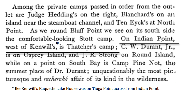
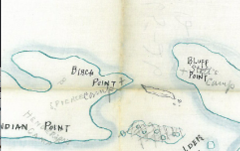
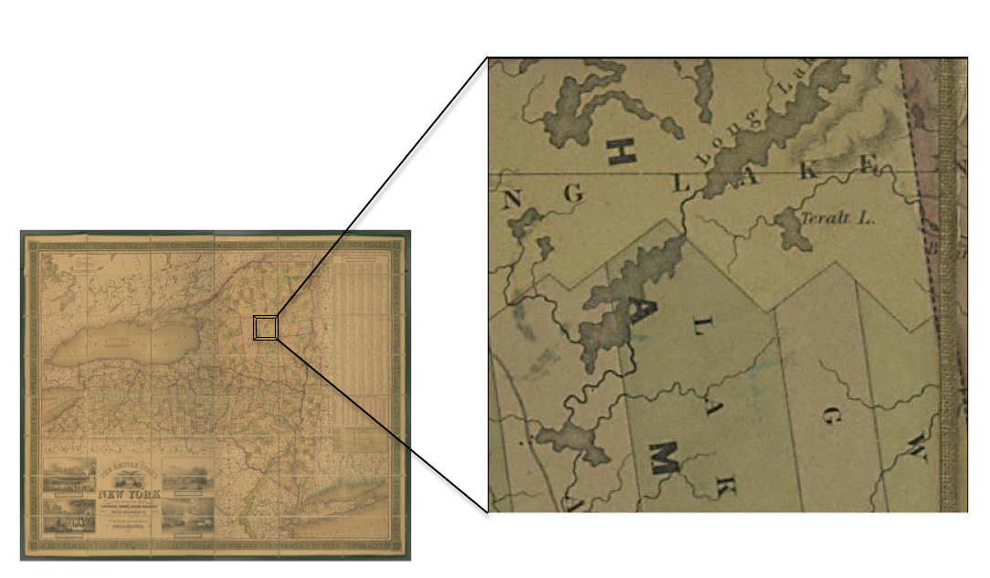
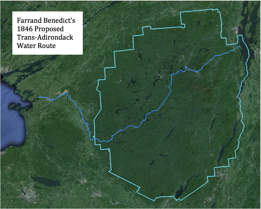
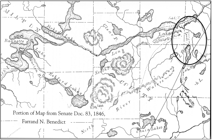
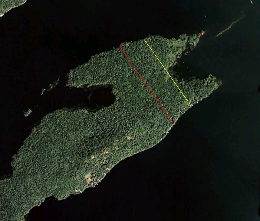
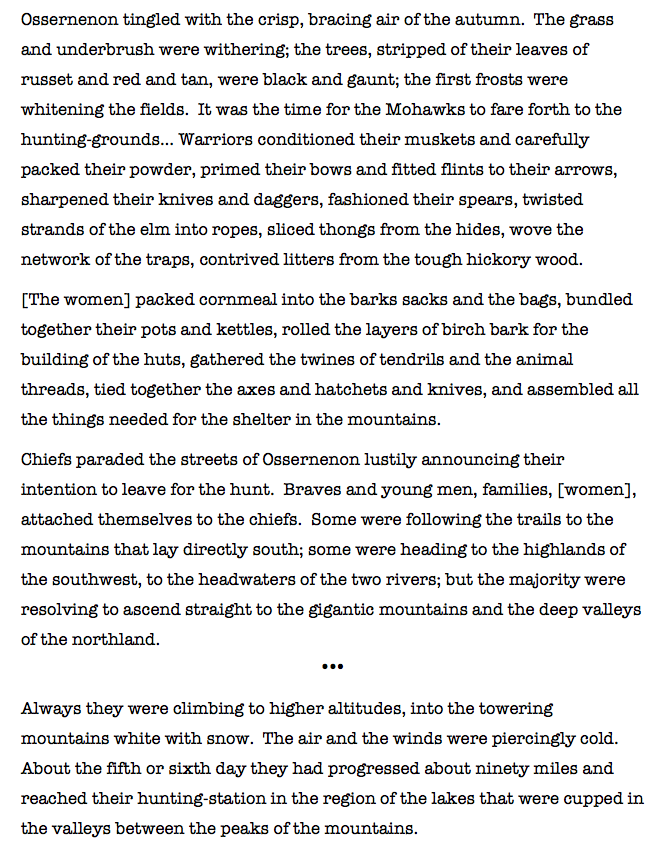
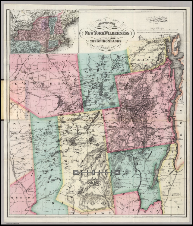
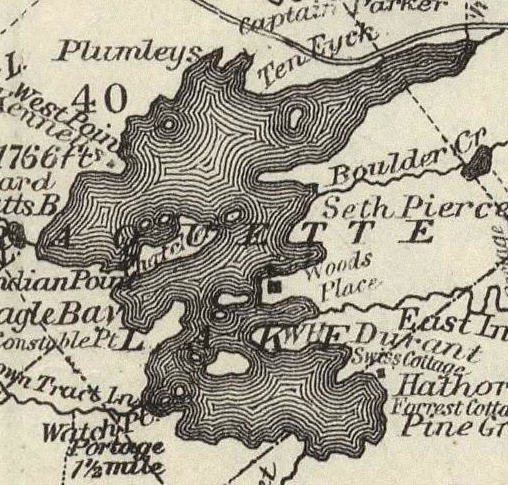
Beach and Wood’s presence on Indian Point literally put Raquette Lake on the map.  A fact revealed by one of the earliest depictions of Raquette Lake in J. H. Young’s 1845 map of New York State.   The map shows an almost wholly inaccurate depiction of an un-named Raquette Lake, to the southwest of Long Lake. However, it contains a nearly accurate rendering of Indian Point prominently jutting out from the west side of the lake.

1845 Map and Insert

Indian Point was the focal point of the first map of Raquette Lake because Beach and Wood were the center of hospitality for the earliest adventurers travelling through the region. Professor Ebenezer Emmons in 1840, John Todd in 1843, Joel Tyler Headley in 1844-1846.  The tales told by these writers and the early surveys drawn by them undoubtedly contributed to this depiction of Indian Point on the 1845 map. Our knowledge of Beach and Wood come from the writings of these and later prestigious visitors.

Pioneering Settlers

Matthew Beach was the elder of the pair, nearing sixty and almost two decades senior to William Wood when they settled on Indian Point. Both men were Vermonters who appear not to have sought out the Adirondacks as much as fled civilization in the early 1830’s. Headley noted that:

One of them was once a wealthy manufacturer; but overtaken by successive misfortunes, he at length fled to the wilderness, where he has ever since lived. There is also a rumor, of some love adventure—of blasted affections followed by morbid melancholy—being the cause of this strange self-exile. 2

They originally made their livelihood in the region as trappers, according to Henry Jarvis Raymond. Raymond [founder of The New York Times newspaper and Lt. Governor of New York at the time] visited with them in 1855, remarking “They became so fond of the country and the life that they finally settled there, –clearing their land gradually, never troubling about securing their title *, living together in a bark shanty, which with progress of the age grew into a log hut, and obtaining their living mainly by hunting and fishing.” 3  Screen Shot 2014-05-31 at 7.32.48 AM


I have yet to find any photographs of Beach and Wood. However, a vivid picture of each is drawn from the writings of their visitors.

C.W. Webber’s describes Beach in The Spirit of the Times in 1849 as:

The old white haired veteran, yet stalwart and hearty, whose step is still elastic, and eye—eagle-like—bright as ever—coarsely dressed, with a true hunter like air…appeared, indeed, no ordinary woodsman…I found Beach quite intelligent, he has picked up much information in one spot or another, and, no doubt, no small amount from Naturalists who, having occasion to visit that country for the sake of geological exploration…have made his hut their quarters. 4


William James Stillman, describing an 1855 visit in The Crayon said Beach:

is a man of very interesting character, the noblest example of the backwoodsman I have ever seen, simple and pure in feeling as a child. He was a volunteer at the [War of 1812] Battle of Plattsburg, the bloody character of which contrasted strangely with his quiet and gentle deportment. 5

In 1868, B. F. De Costa wrote in a history of Beach:

Matthew Beach, though possessing little book-learning, had nevertheless, acquired a valuable kind of culture. He was a shrewd observer of character, and seldom erred in his judgment of men. He studied closely the habits of animals of the forest, and was a careful student of nature. 6

References to William Wood in the region, place him living with two other bachelors in a house at Herreshoff settlement to the west of Old Forge in 1832. Wood was a witness to the 1833 infamous murder of an Indian named Drid by Nat Foster (a story for another time). 7  At this early date, Wood was a whole man, given that court testimony during Nat Foster’s trial make no reference to the unusual physique and manner of mobility noted in later histories of the man.

In 1849, David Read (co-owner with Farrand Benedict of Township 40) wrote in a letter to Joel Tyler Headley: 8

David Read W Wood description


Raymond remarked about Wood that, “He wears immense shoes—more like boats than brogans—and with these, stumps through the woods at a marvelous pace.” A letter to The Spirit of the Times describing a Constable family trip through Raquette Lake in 1843 said Wood was, “frequently carrying 70 lbs. on his back, and in winter had rather the advantage of him, as with a thick covering of moose hide, his knees answered the purpose of snow-shoes.” 9

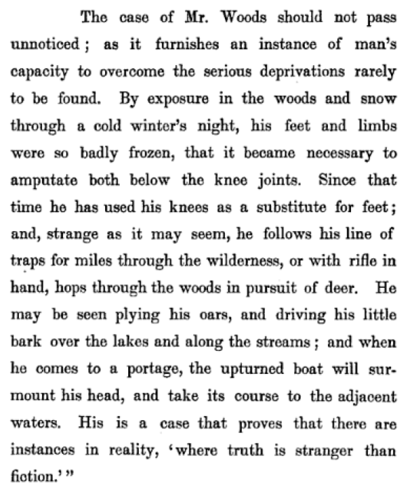
The year of Wood’s accident is a mystery. The historian Edith Pilcher claims the accident occurred when Wood fell into the Independence River while returning to his home near Old Forge. Pilcher attributes his survival to being found half-frozen by the very same Nat Foster, whose life Wood had perhaps spared with his evasive testimony during Foster’s murder trial. Local Indian friends of Wood are said to have amputated his legs and nursed him back to health. 10  Given he was whole at the time of the Nat Foster-Drid incident, Wood’s misfortune must have occurred after 1833. The absence of Beach’s character in these stories leads me to conclude that this tragedy befell Wood prior to their joint residence on Indian Point.

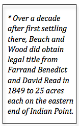
The exact year of Beach and Wood’s arrival on Indian Point is also unknown, but it appears to have been between 1835 and 1839. The 1843 Constable family trip described in The Spirit of the Times mentions the “two old hunters who had lived here about eight years” –meaning 1835. Joel Tyler Headley wrote extensively of his 1846 visit with Beach and Wood stating “the two hunters that occupy [two huts] the only inhabitants that are or have been on the shore for the last nine years.” This would correspond to 1837. Stillman in 1855 states that “Mr. Beach has lived here seventeen years”, fixing 1838 as the date. At the second-ever town meeting of Long Lake in 1839, William Wood was elected Assessor and Matthew Beach was elected Commissioner of Common Schools. 11   It is likely that the two were then living together on Indian Point. Therefore, I believe Wood’s accident occurred sometime between 1833 and 1838.

A Hut in the Woods

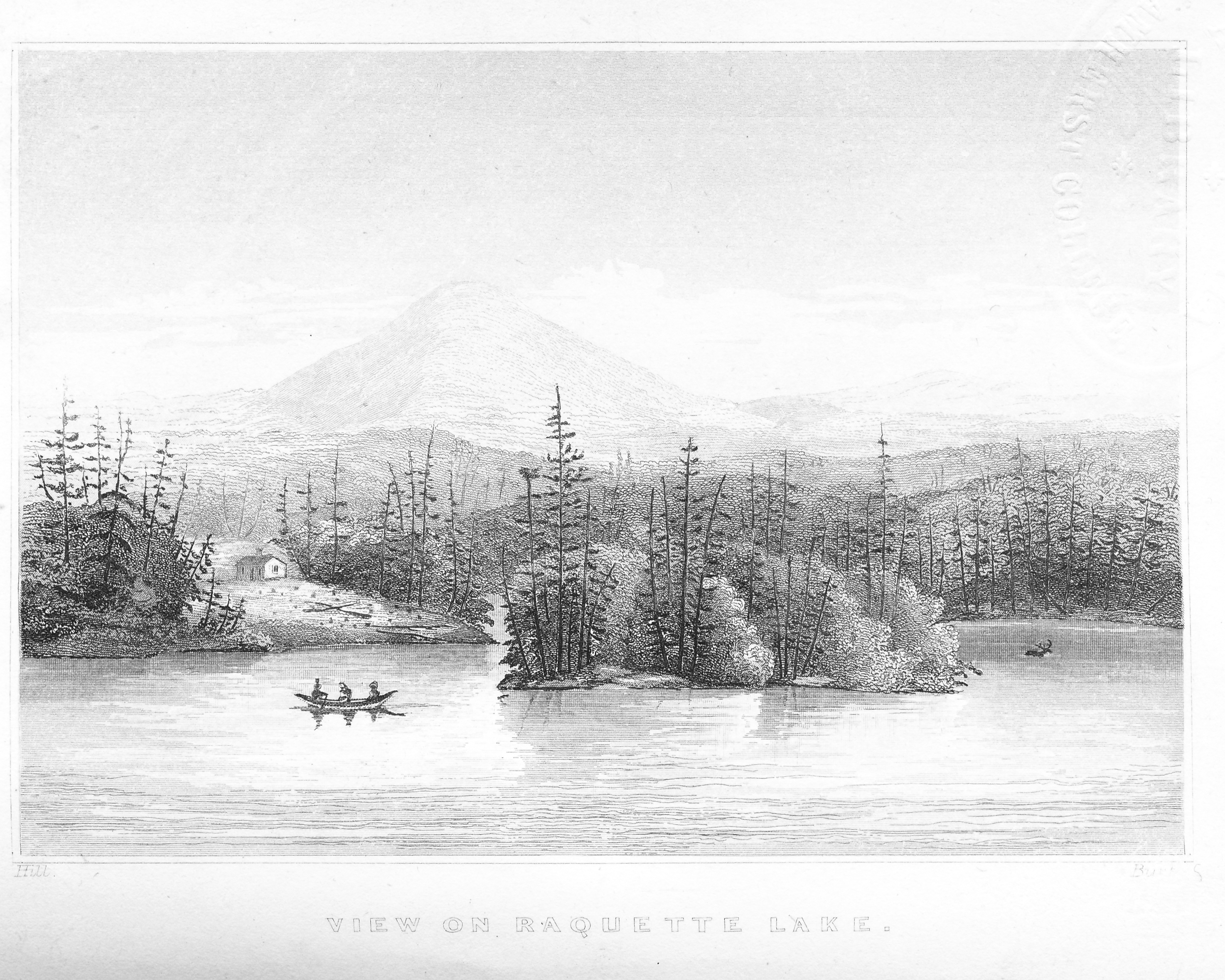
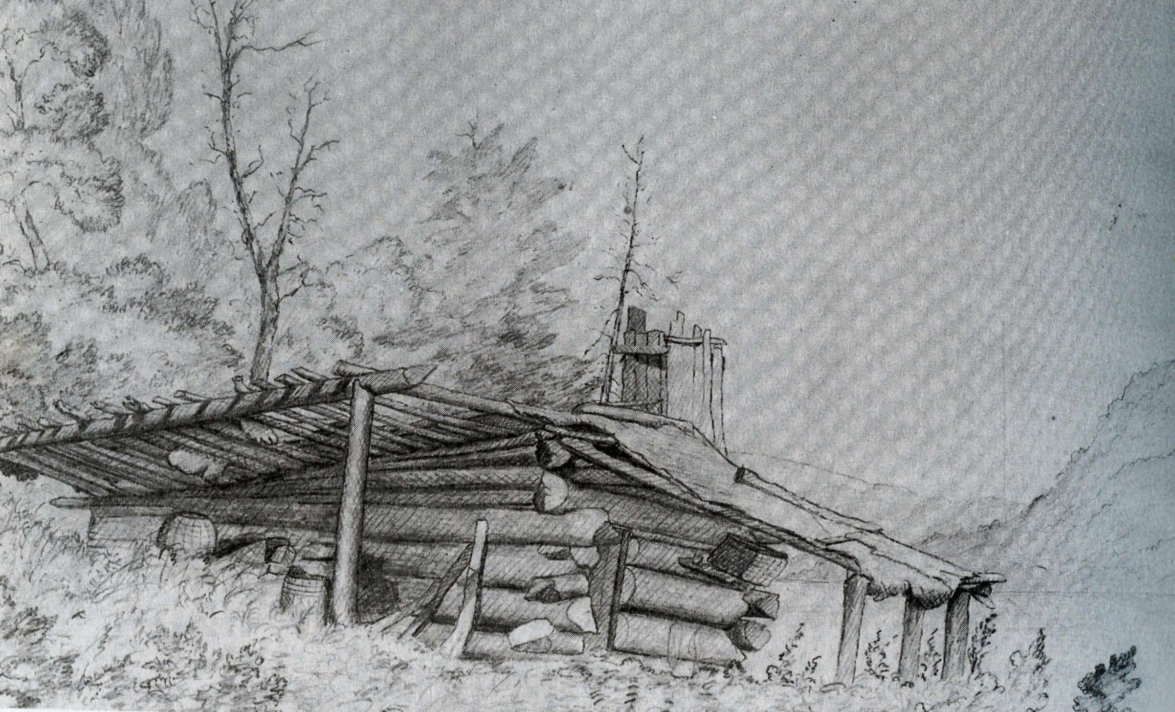
In 1840, Prof. Ebenezer Emmons and J. W. Hill stayed with Beach and Wood in their hut while surveying the Raquette Lake region for the Survey of the Second Geological District of New York State. 12  During this survey, Hill drew a sketch of their hut that was later published in Headley’s book.

1849 Birch Pt sketch

Various visitors described the hut shown here in their Adirondack writings. In 1843, John Todd wrote in Simple Sketches, “They have built the hunter’s lodge of bark, and adorned it with the antlers of many an old stag, and many a trophy of the art and skill of man over the instincts of the forest.”

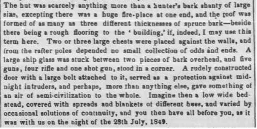
Webber said the hut was “of such peculiar and original construction that few would imagine it, at first sight, a human habitation.” Webber provides this description of the hut’s interior:

Webber hut interior

Stillman later noted by 1855 “The rude cabin which he [Beach] first built has grown gradually into a comfortable house.”

Hunters and Trappers

As one of today’s summer folk, it is hard for me to imagine the almost solitary year-round life of Beach and Wood on Indian Point. Their existence depended upon the land as revealed by Webber’s description of “a shed, connected with the hut, presented within a goodly array of deer skins, barrels of salted ‘lakers’, and strings of the same kind of fish, smoked; while lying around on different sides, were traps of all sizes, from such as were capable of holding a bear, to mink traps.”

Contemporary newspaper articles write of Beach and Wood hunting wolves, deer and moose. In The Mammals of the Adirondack Region, a story appears told by John Constable of Wood “trapping a very large beaver in the fall of 1837, in a pond northwest of Indian Point on the Raquette. Wood carried his boat to the pond and paddled twice around it, searching carefully for signs, without going ashore. At last he discovered fur upon the root of an old birch that projected into the water. Here he placed the trap, attached to a float, and on the second day found the beaver in it.” 13   This was noted, at the time, to be one of the few remaining beavers in the Central Adirondacks.

In 1861, William Wood played a part in killing off the last (at the time) family of moose in the State of New York. In July of that year, a sow moose was killed at the South Inlet of Raquette Lake and the artist A. F. Tait wounded a bull calf moose while jacking deer at night on the Marion River.   This wounded moose eluded Tait in the darkness but was later killed in August by Wood. That fall, the last of this moose family was felled along the Marion River near Raquette Lake by a shot from a Long Lake guide named Palmer. 14

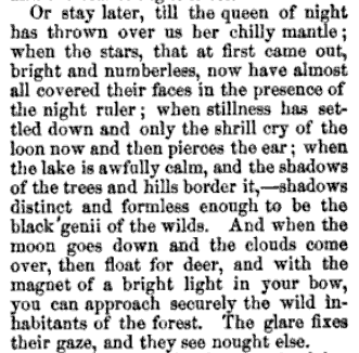
Headley described their long, harsh winters:

When the snow is five feet deep on the level, and the ice three and four feet thick on the lake, and not the sign of a human footstep any where to be seen, the smoke of their cabin rises in the frosty air like a column in the desert—enhancing instead of relieving the solitude. The pitch pine supplies the place of candles, and the deep red light from their humble window, at night, must present a singular contrast with the rude waste of snow, and the leafless forest around them.

Their leisure hours they spend in preparing the furs they have taken, and in tanning the deer skins, of which they make mittens…When a quantity of these mittens are made up, Beach straps on his snow shoes, and with his trusty rifle in his hand, carries them out to the settlements.

Adirondack Farmers

Reading of these exploits brings back childhood memories of watching Grizzly Adams on TV, but they did not subsist on hunting, fishing, and trapping alone. What truly astounds me is that they cleared a ten-acre farm on Indian Point.

Webber described their farm in 1849:

I observed quite a respectable garden on the west side of the hut, in which were some 18 or 20 currant bushes, laden with their ripened fruit, interspersed with red raspberry bushes and wild cherry trees—besides cabbages and potatoes in a flourishing condition. On the other side of the hut, towards the lake, was a little patch containing pea vines, then in blossom.

A. P. Edward’s 1852 survey report to the NY State Assembly said they “have a large patch of potatoes, and have cut hay sufficient to winter from 8 to 10 head of cattle, and that too unaided by the plow.” 15

Stillman in 1855:

found a comfortable house, with cattle grazing around, and an enclosure in which a few flowers and some vegetables were growing. There were tomatoes not yet ripe, beets, cabbage, and in the field outside, a scattered growth of turnips of immense size. I pulled up one, a flat, white turnip of the common kind, which measured 24 ½ inches round, and weighed five pounds. The luxuriance of the soil seemed wonderful—the ‘herd’s grass’ stood, on the shore of the lake where the clearing was old, six feet high.

Parting of the Ways

Although they both shared Indian Point, they did not always live together according to Raymond.

He [Wood] and Beach in course of time disagreed, for in any part of the earth, no matter how secluded, two persons are enough for a quarrel; and a clearing of ten acres, even in a wilderness a hundred miles through, affords ground enough for a local dissention. So finding they could no longer live together, they agreed to divide their fortunes and have nothing to do with each other.

Just when this disagreement and separation took place is a puzzle. I suspect that the separation occurred between 1844 and 1846. We know that John Todd found them living together in 1843. Headley’s writings from 1844-1846 are contradictory; one letter speaks of two huts while another describes a winter scene shared together in one cabin. David Read’s letter of 1849 clearly uses the plural “dwellings” and C. W. Webber’s 1849 visit makes no mention of Wood and finds Beach living with a man of 38 who Webber describes as a “rather tall and thin figure”, most undoubtedly not Wood.

The best description of William Wood’s separate cabin comes from the diary of James McEntee, who visited in 1851.

We found his home a very comfortable one, and though rude, exhibited the unmistakable traces of neatness and industry. The house is built of logs with a bark-covered porch in front, and standing on a gentle elevation about fifty yards from the lake. 16

McEntee sketched the hut in his diary:

Wood's Cabin 1851 Jervis McIntee

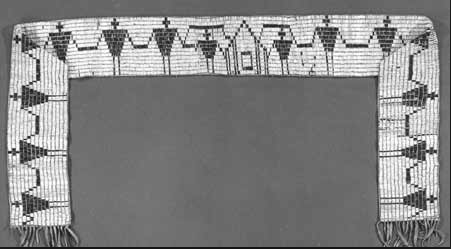
Courtesy of the Adirondack Museum.


As the years progressed, Beach aged gracefully, yet nonetheless came to require assistance. Raymond remarked that, “Beach has grown old—being about seventy, but he is still hale and hearty, he cannot shoot quite so far as he could once, he says, with the same certainty of hitting his game.” Beach invited Amos Hough of Long Lake to live with him and tend to his farm. (It is likely that Hough was the man that Webber found living with Beach in 1849.) 17

In 1856, Beach deeded his 25 acres to Amos Hough on condition that the latter take care of Beach until his death. 18   By 1860, Beach was living in the home of John Plumley in the Village of Long Lake. Plumley was Hough’s son-in-law, having married Hough’s eldest daughter Zobeda. He took on the family obligation and cared for Beach until his death in 1862. 19

John Plumley, who later became “Honest John” –the Adirondack Guide made famous by Reverend William H. H. Murray in his book Adventures in the Wilderness, not only played a part in Beach’s life. He also purchased William Wood’s 25 acres on Indian Point when Wood left Raquette for Elizabethtown in 1859. 20  Wood had found love with Celia Ann Whitman (almost a quarter century younger than Wood). Their daughter Lydia was born in 1857 on Raquette Lake. They wed in 1858 and settled in Elizabethtown or Westport where another daughter was born in 1860. William Wood died in 1868. 21
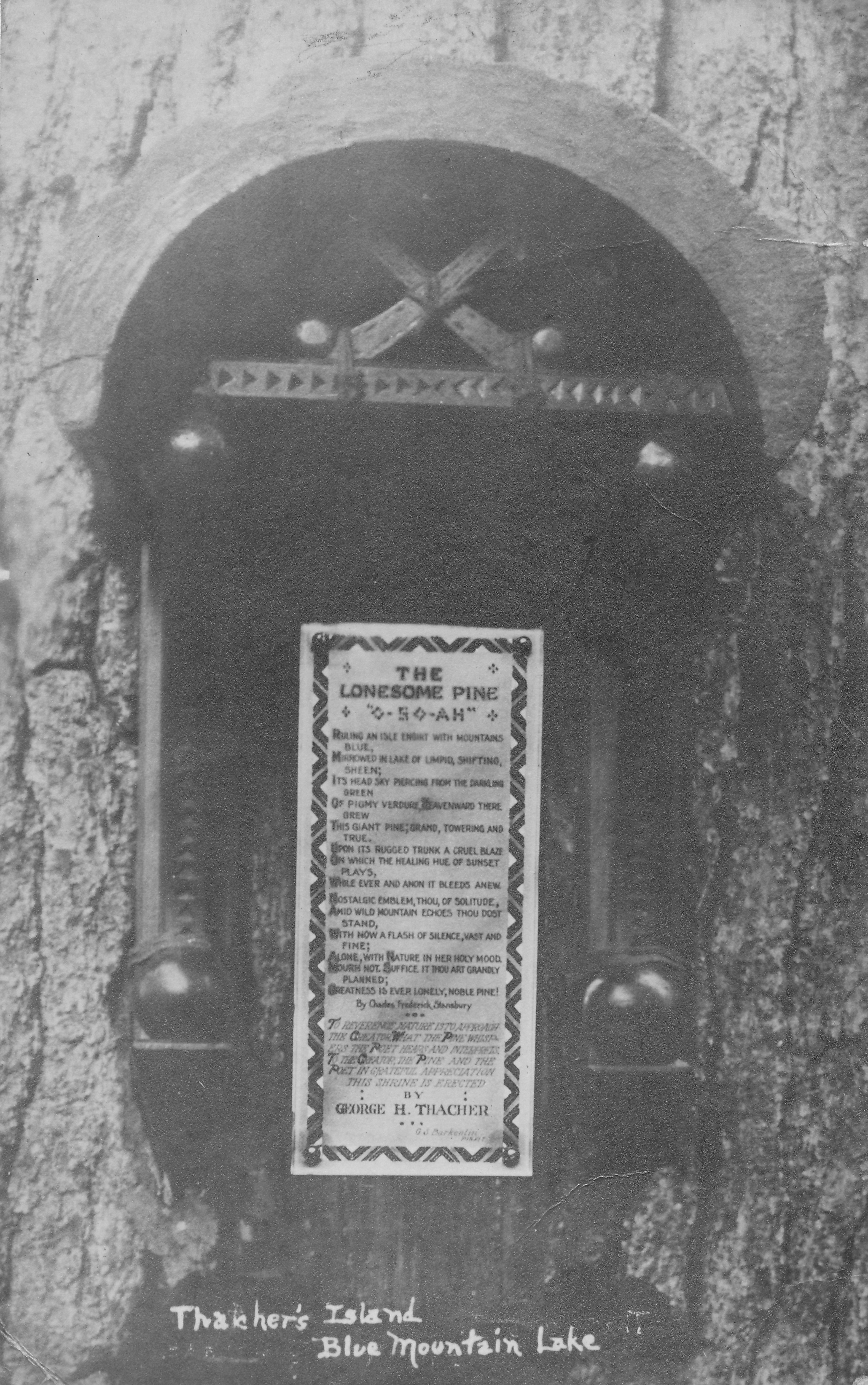
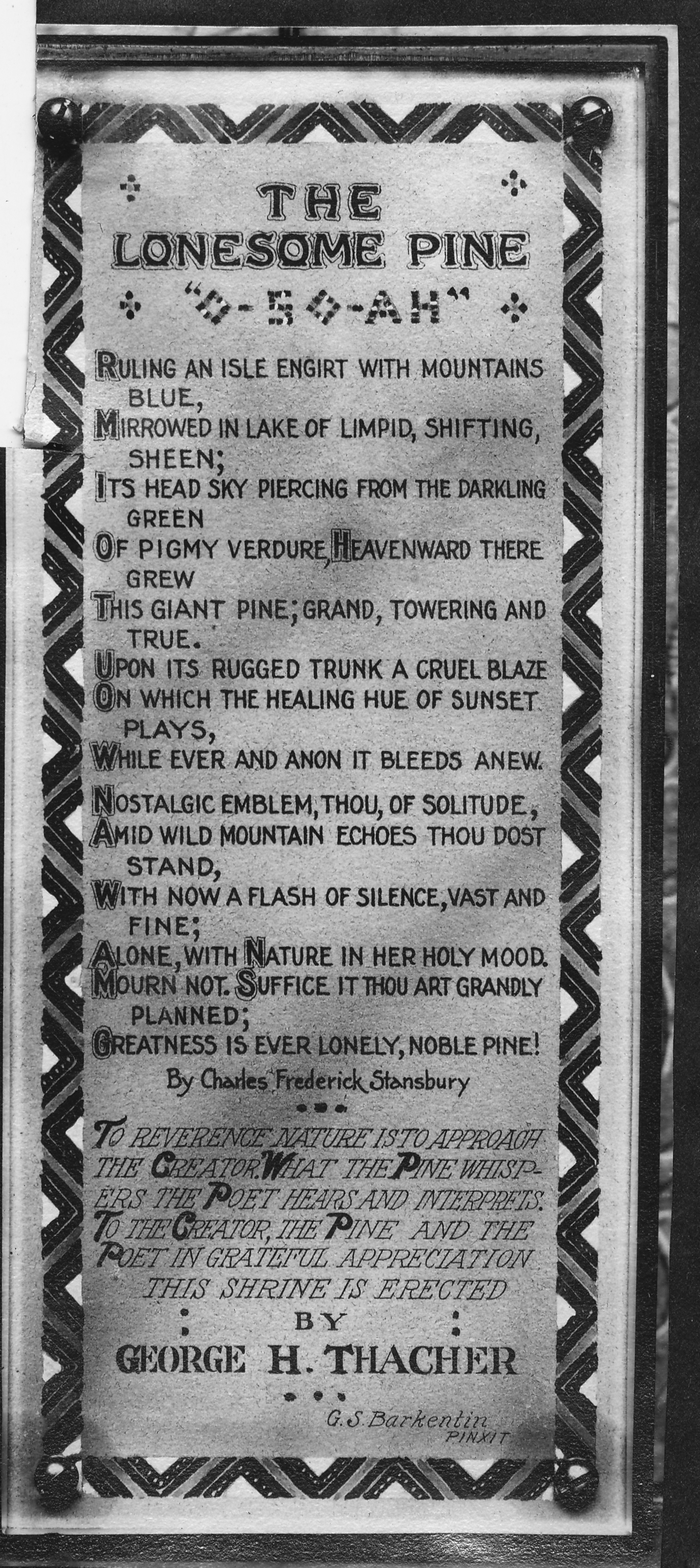
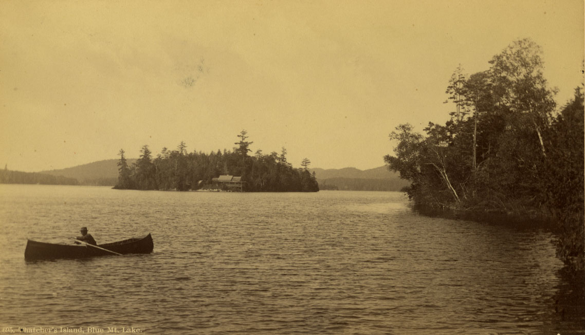
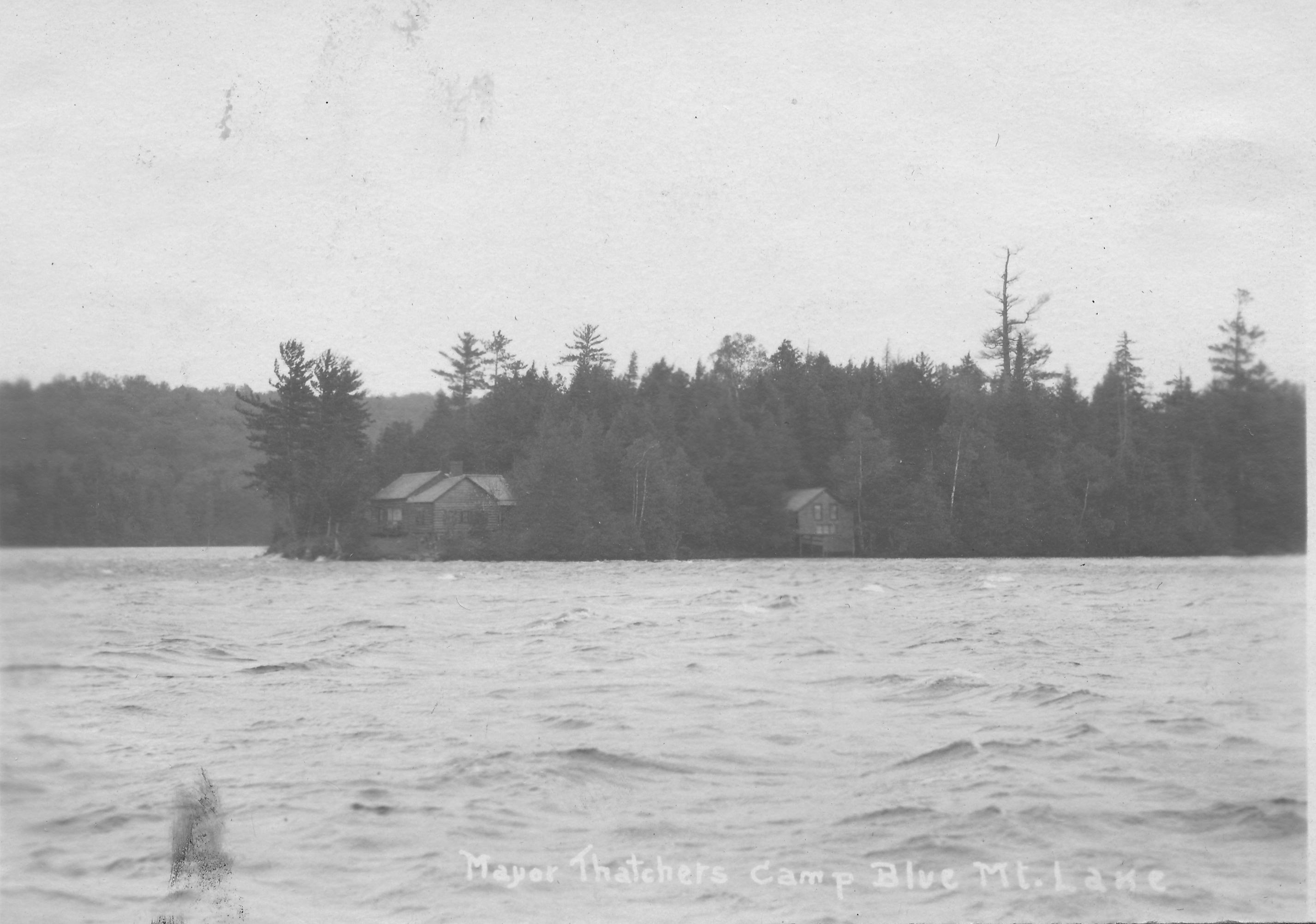
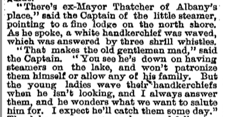
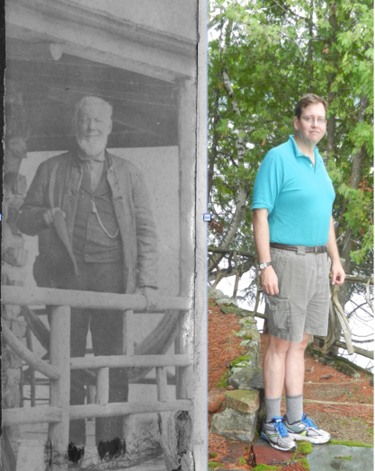
Farrand Benedict’s Canals

If you ever drive south along Route 28 to Indian Lake from Blue Mountain Lake, look for a sign on the right about 0.4 mile south of Potter’s Corner announcing you are crossing the divide between the St. Lawrence River and Hudson River Watersheds. The waters of Blue Mountain Lake flow through the Eckford Chain into Raquette Lake, north through Long Lake and the Raquette River eventually reaching the St. Lawrence Seaway. The waters of Durant Lake, only a half mile distant from Blue, eventually flow into the Hudson River.

If Farrand Benedict had been successful with his grand visions of reshaping the Adirondacks, the waters of Blue, Raquette and Long lakes would today flow into the Hudson River Watershed. The history of the development of the central Adirondacks might also have been greatly altered.

Courtesy of F.N. Benedict Jr. as published in To the Lake of the Skies.

Portrait of Farrand Benedict. Courtesy of F.N. Benedict Jr. as published in To the Lake of the Skies. 1

In my search for the history of our family’s cabin, I sought out all of the title deeds starting with our family’s in 1876 going back to the first title deed ever issued for this particular plot of land. I had always known from Ruth Timm’s books that the original settlers of Raquette Lake, Matthew Beach and William Wood had lived on Indian Point.   However, it was only in reading the title deeds that I became aware that it was on our current property that they had settled.

It was through researching the deeds that I first learned of Farrand Benedict. Although several contemporary descriptions of Matthew Beach and William Wood’s residency on the land peg their arrival to sometime between 1837 and 1840, they only obtained legal title to their lands in 1849. That is when they separately paid Farrand Benedict and David Read for titles to 25 acres each for their property. Obviously property owners having to pay for title to lands they already possessed is a pattern that history likes to repeat within Township 40.

I have yet to find direct evidence of Farrand Benedict interactions with Beach and Wood. However, it is almost certain that they met. Benedict was not an absentee landlord. A letter written by his business partner David Read to Joel Tyler Headley in 1849 describes a trip through Raquette with Benedict during which Read describes the two settlers.   Benedict’s personal explorations of the area are noted in his poetic description of Raquette Lake in the article “The Wilds of Northern New York” published in 1854 in Putnam’s Magazine. 2

FB RaqDescription titleFB Raq description 1FB Raq description 2

FB Raq description 3


Farrand Benedict was a professor of math and engineering at the University of Vermont in Burlington. He was an accomplished surveyor and began to explore the Adirondacks in 1835. In 1838, Professor Ebenezer Emmons, the surveyor who named the region the Adirondacks, engaged Benedict to resolve a dispute over the altitude of Mt. Marcy.

Between 1843 and 1852, Benedict purchased 152,000 acres stretching from west of the Moose River Plains to the headwaters of the Hudson River east of Long Lake. In 1848, he and his business partner David Read became sole owners of all of Township 40, which includes Raquette Lake.

In 1846, Benedict prepared an audacious plan for the NYS Legislature to build a series of canals, with locks and slackwater navigation, and railroads which would link Lake Champlain in the east with the Black River on the western edge of the Adirondacks. A 210-mile long course using the Ausable River Valley, Saranac River, Raquette River, the Fulton Chain of Lakes, Moose River and Black River would traverse from Port Kent to Lake Ontario.  3  The trans-Adirondack water route would bring people into the region and facilitate extracting timber and mineral resources from the Adirondacks. Alas, the entire project was a dream never realized.

Farrand Benedict 1846 Plan Corrected


A map accompanying the original 1846 plan appears to indicate a proposed canal between Caitlin Lake (L. Terrott) and Long Lake. It could be that this was intended to draw water from Caitlin Lake into Long Lake to increase the water flow to aid in navigation through his trans-Adirondack water route.   However, that would have required a dam on the natural outlet of Caitlin Lake to raise the water level and reverse the natural flow back toward Long Lake. It is more likely a map error and the canal marking relates to Benedict’s intention to build a canal from Long Lake to Round Pond (the body of water to the right of the canal line).


Screen Shot 2014-04-04 at 7.29.14 PM

Benson Lossing wrote of seeing evidence of this canal building effort in his 1859 trip through the area in his book The Hudson, from the Wilderness to the Sea. 4

Screen Shot 2014-04-04 at 7.51.41 PM

Lossing also saw the remains of a dam that would have reversed the flow of water from Round Pond (referred to as Fountain Lake) into Long Lake.

lossing ditch

A likeness of a similar dam found by Lossing at Rich Lake is shown.

Lossing dam

The initial plans called for water to flow from Round Pond into Long Lake. This would have benefited the floating of logs down the Raquette River.  However, starting in 1850, Benedict had written of using the canal between Long Lake and Round Pond to float logs from the Eckford Chain, Raquette, and Long Lakes into the Hudson River to access the burgeoning New York timber market centered at the Big Boom in Glens Falls. Lossing, Alfred Donaldson in a History of the Adirondacks, and John Todd in Long Lake each make the argument that opposition from lumber industry interests along the northern reaches of the Raquette River, who feared losing their supply of timber for the Canadian market, scuttled the plans for this first canal attempt.

In 1874, at the age of 71, Benedict returned to his idea to build the Long Lake to Round Pond canal. The goal now was to re-route the flow of water from Blue Mountain Lake, Raquette Lake and Long Lake into the Hudson River Watershed via Round Pond-Caitlin Lake-Rich Lake-Harris Lake.

FB Canal final

It appears that Benedict no longer intended for the logging industry to float timber along his route into the Hudson. His goal was to significantly increase the supply of water into the Hudson River Watershed. Dams on the outlets of Blue Mt., Raquette, Forked, Brandreth, and Little Tupper lakes would provide controlled outflows to increase the water flow into the Raquette River and Long Lake. The canal would then divert the water to sustain log drives throughout the summer on the Hudson River.   According to Finch, Pruyn and Co. records, low water levels sometimes required three years of Spring flows to transport logs from the Adirondack interior to the Big Boom at Glens Falls.   Benedict’s plan would have reduced this to one year and assured sufficient summertime water flow to power mills along the Hudson as far south as Troy.

Diverting the water flow out of Long Lake away from the north running Raquette River almost certainly would have endangered the effectiveness of the Raquette River for floating logs north to the Canadian market. While it appears a political scandal in the administration of the New York Governor in 1875 was the practical cause for the death of this project, had it come to fruition, it could have significantly altered the history of this region of the Adirondacks.

Chapter 264 of the Laws of 1850 in New York State declared the Raquette River a public highway for the purpose of floating logs and lumber from the foot of Raquette Lake to its mouth in Massena. In the 1850s, Raquette Pond (not to be confused with Raquette Lake) became the home of the Pomeroy Lumber Company. Loggers would float logs down the Raquette River to Raquette Pond where they would be marked, sorted and prepared for large log drives down the Raquette River to the mills in the northwest corner of New York and the Canadian timber market. The logging camps on Raquette Pond grew into the Town of Tupper Lake.

raq river log drive

Log Drive on Raquette River. Published by Jon Kopp in Tupper Lake – Images of America 5

The logging industry and the town expanded greatly in 1890 with John Hurd’s construction of the largest lumber mill ever built in New York and his completion of his Northern Adirondack Railroad that connected Tupper Lake to Ottawa, Canada.  6   Although the milled lumber now moved north on trains, the mill still was dependent on logs floated down the Raquette River to Raquette Pond. It is doubtful that Tupper Lake would have become the largest population center in this part of the Adirondacks had the water flow been diverted from the Raquette River by Farrand Benedict’s Canal.

John Hurd's Big Mill

John Hurd’s Big Mill. From the Goff Nelson Library Collection. Published by Jon Kopp in Tupper Lake: Images of America.

Fortunately for Tupper Lake, Benedict’s land empire began to evaporate with sales of large tracts to the railroad companies in 1855. By the time of his death in 1880, his family’s lands had all been sold or reclaimed by the State for back taxes. His grand plans were simply forgotten.

This chapter is based on the extensive research of Barbara McMartin in her book To the Lake of the Skies: The Benedicts in the Adirondacks. McMartin argues that despite the failure of his ventures, Benedict did have one lasting impact on the Adirondacks. He first introduced the Reverend John Todd and his cousin Joel Tyler Headley to the Adirondacks. Todd and Headley authored Long Lake in 1845 and The Adirondack: or Life in the Woods in 1849, respectively. These early writings attracted other adventurers and laid the path followed by the great Adirondack promoter Reverend William H. Murray.


Why Indian Point?

6 Indian Point red yellow and cabin

Matthew Beach and William Wood settled on the lands to the east of the red line. John Boyd Thacher purchased the portion to the east of the yellow line. The small red dot is the location of the little red cabin built in 1910.

Echoing across time, this question can be asked three ways.  Who were the Indians of its namesake?  Why did Matthew Beach and William Wood choose it for their home? Why was John Boyd Thacher enticed to buy these acres?

According to local lore, Indian Point was the site of an Indian settlement.  The earliest such reference was made by Joel Tyler Headley in The Adirondack: or Life in the Woods, published in 1849.

Screen Shot 2014-01-28 at 8.52.39 PM

Most research does not support the idea of large, permanent  Native American settlements within the Adirondacks.   However, evidence points to the Adirondacks being used as a seasonal hunting ground for the Iroquois, Huron and Algonquin Indians.  Four clues point to the area of Raquette Lake being under the control of the Mohawk Nation of the Iroquois Confederacy or Ho-dé-no-sau-nee (People of the Long House).  This map of the Six Nations of the Iroquois shows the Mohawks’ territory beginning to the west of Raquette Lake and expanding east to Lake Champlain. (Enlarge the map by clicking on it and read the text to the right of the compass rose)

Screen Shot 2014-01-26 at 2.28.39 PM

Guy Johnson’s 1771 Map of the Country of the VI Nations. New York State Museum.

Another clue is that the lands which would become the Totten & Crossfield Purchase (which includes Raquette Lake) were originally purchased by the British Crown from the Mohawk Nation in 1771.   The British had purchased the lands from the Mohawks for 1,000 pounds and sold it to Totten & Crossfield for 40,000 pounds in the same year.  (And you thought flipping real estate was a modern invention!)   Although this land sale took place, the Mohawk Nation later continued to claim the lands and use them until a peace treaty between the newly formed United States and the Iroquois was signed in 1794. 2

In Adirondack Pilgrimage, Paul Jamieson makes the argument that the Albany Road (sometimes referred to as the Old Military Road) constructed for the War of 1812 actually followed the path of an Iroquois trail which dates back to the 1600s.  Jamieson mines the first person writing of a Jesuit Priest named Joseph Poncet who was captured by Mohawks in 1653.  Poncet’s description combined with Jamieson’s research and that of Stephen B. Sulavik in Adirondack: Of Indians and Mountains 1535-1838 yields my approximation of the heavily travelled Mohawk trail which passed just to the west of Raquette Lake, traveling from the Mohawk River Valley to Canada.   The foot path led through the forest to the Oswegatchie River by which the Indians canoed to the St. Lawrence River.

Screen Shot 2014-01-26 at 4.32.19 PM

Beyond the evidence of this Mohawk trail passing close to Raquette Lake, the only other history which directly connects the Mohawk Indians with the lake is the escape of the Tory Sir John Johnson from Johnstown to Montreal in 1776.   His Mohawk guides brought him through the woods to the shores of Raquette Lake and then by canoe north to Canada, a tale which will be retold in a future chapter.

This scant evidence implies that the Mohawks were well acquainted with Raquette Lake for over a century.  But did they have an encampment on Indian Point?  There are no contemporary written histories which specifically speak of the use of Indian Point by the Mohawks.  My conjecture is based on descriptions of how large hunting parties of Mohawks would travel from their year-round villages along the Mohawk River to encampments in the Adirondacks from November to late January.

Father Isaac Jogues is another French Jesuit priest who was captured by the Mohawks in 1642, and his writings describe a hunting expedition departing from the Mohawk village of Ossernenon along the Mohawk River:

If we can assume that such a winter hunting camp existed on Indian Point, why did the Mohawks choose this location along the almost one hundred mile shoreline of Raquette Lake?  I believe it is the geography and topography which influenced their choice.

According to Lewis Morgan in the League of the Ho-De-Nau-Sau-Ne or Iroquois, “For three quarters of a century, from the year 1625 to the year 1700, the Iroquois were involved in almost uninterrupted warfare [with other Indian nations]…from about the year 1640 to the year 1700, a constant warfare was maintained between the Iroquois and the French.”  The 18th century brought ever greater conflict between the Mohawks and Europeans over control of Adirondack territory for the lucrative beaver fur trade. 3

In this context, the Mohawks would have benefited from siting their winter hunting camp in a location on Raquette Lake which could be defended and from which they could observe any approaching enemies.  Indian Point possesses a unique geological feature called the Crags, a series of three rock outcroppings at the top of the ridge line on the peninsula.  At an elevation of 2000 feet, even today one can see all the way to South Inlet, and anyone approaching from the Marion River or Brown’s Tract Inlet would be seen at least an hour before they could land on the shores of Indian Point.  To the northwest, one can see Sucker Brook Bay.

Screen Shot 2014-02-01 at 8.51.14 PM

USGS Raquette Lake Quadrangle Map

While today the tree cover does not provide a view to the northeast, images from the 1800s indicate that the Crags were almost clear of trees and it is highly likely that a lookout stationed there in the 1600s and 1700s would have also been able to see anyone rounding Bluff Point to the northeast of Indian Point.

Drawing from Craggs

Looking South from the Crags – a wood cut printed in Wallace’s Descriptive Guide to the Adirondacks. 1872.

Seneca Photo from Craggs

Photo from the Crags by Seneca Ray Stoddard. circa 1880.

While the Crags may have led the Mohawks to choose Indian Point, where along the shores of the peninsula was the hunting camp?  As the camp would have been used mostly from November to late January, I suspect a location sheltered from the worst of the cold winds blowing across Beaver Bay or North Bay.   Either of the two protective coves would have served well, the cove near Hen and Chickens Islands or the little bay between the two points on the eastern tip.

An understanding of the size and description of a hunting camp helps to create a theory as to where on the peninsula it was located.  Father Jogues’ description implies that a family clan headed by a Chief would likely all relocate to the winter hunting grounds.  The villages in the Mohawk River Valley  would each have several Long Houses.  Each Long House would be the home of a family clan.   The length of the Long House and the number of fire pits within the Long House would relate to the number of families.  An account of Dutch explorers encountering a Mohawk village in 1644 described one Long House of eighty paces in length being home to a Chief, 40 men and 17 women. 4

The Mohawks’ method of hunting deer illustrates the need for a very large hunting party.  Father Jogues experienced the hunt firsthand, “They beat up the stags and the elks from their coverts, and drove them headlong toward the fences that strecthed between the trees and into the narrowing alleys of the traps, were they could easily be slaughtered.  They tracked the animals over the rise and fall of the mountains, and had the zest of dropping them with musket or arrow or javelin.”

Morgan in League of the Ho-De-Nau-Sau-Ne or Iroquois, provides an even more detailed description of the hunting method:

The construction of a V-shaped fence that stretched two to three miles on a side would have required significant manpower.  If the Indian “settlement” on Indian Point was a winter hunting camp, it likely was the temporary home to at least fifty or more people.

A young Mohawk woman named Kateri Tekawitha described one style of temporary shelter used in a winter hunting camp in the late 1600s.

This depiction has been faithfully recreated by Barry Keegan, an expert in primitive Native American structures, in his construction of a traditional wigwam on the shores of Prospect Point on Blue Mountain Lake.

1415364_10201061516442946_2004213794_o

A traditional wigwam hunting-lodge constructed at Prospect Point on Blue Mountain Lake by Barry Keegan. Photo by Jerry Krasnick.

According to Keegan,  “South of the Adirondacks, wigwams were usually dome shaped and often sided with elm bark; north of our region they tended to be conical, like squat-shaped tepees with birch bark as the siding of choice. The Adirondacks are right on the border between those two types and probably both were in use here, at the very least as seasonal hunting camps.” 5

Father Jogues’s writings appear to describe the second style, “There the [women], under the direction of the men, threw up the three slanting poles of the hunting-huts and tied them at the top and sewed the bark and skins firmly about the triangular frame.”

IMG_0344

A conical teepee style hunting lodge from creaturehomes.blogspot.com

The “hunting-lodges of bark and close-woven boughs” referred to by Kateri or the bark tee pee style described by Jogues appear to have housed a small family of five to ten people.   To accommodate upwards of fifty to one hundred people, the winter hunting camp on Indian Point would have required up to ten lodges.  The annual construction of these lodges for over a century would have established significant forest clearings on Indian Point.

My theory that the hunting camp was on the shores of the little bay nestled within the eastern tips of Indian Point is tied to the reason I believe Matthew Beach and William Wood chose to settle at that spot.  My theory echoes one regarding land use in the Adirondacks first promoted in the late 1800s in an article in the New York Times.

Screen Shot 2014-02-02 at 6.27.40 PM

“The North Woods of Old” The New York Times. May 11, 1890.

The site of the Mohawk hunting camp would not have been open land by the 1840s. The majority of the Mohawk Nation relocated to the St. Lawrence River Valley on both sides of the New York/Canadian border after the Peace Treaty of Canandaigua in 1794 between the Iroquois Confederacy of the Six Nations and the new government of the United States. 6   Although Mohawks continued to come down from Canada into the Adirondacks for hunting in the early 1800s, it is likely that secondary forest regeneration began to take hold of the area of the hunting camp on Indian Point.

Beach and Wood were not simply hunters and trappers.  They also cleared ten acres of cropland to grow potatoes and vegetables.  When they first travelled the shores of Raquette Lake in search of where to stake their claim, Beach was nearly sixty years old and Wood was in his early forties.  I am sure they had a strength and vigor beyond what this author is capable of at 46, and they were accustomed to hard physical work.  Nonetheless, knowing that they intended to clear the land for farming, an area previously cleared by over a century of indigenous use yielding a young secondary forest would have been easier for Beach and Wood to clear with fire and axe than the surrounding primary forest of large diameter trees with deep rooted trunks.

young secondary forest

Young secondary forest

Old growth primary forest

Old growth primary forest

Screen Shot 2014-02-03 at 10.12.44 PM

Beach and Wood chose the twin tips of Indian Point because of the land use potential derived from the remains of the Mohawk hunting camp.  Conversely, the purchase of this land by John Boyd Thacher is puzzling in that it appears that he never really used the land.  It was his father George Hornell Thacher who built and frequented the mysterious original cabin, and yet the title to the land was always only in JBT’s name.  Could it be that JBT was motivated to buy the lands for their historical value?

JBT was an industrialist and politician but also an historian and scholar.  He was a renowned authority on Christopher Columbus and a collector of over 5,000 books and manuscripts from the 15th century, which his widow donated to the Library of Congress.  Among his varied interests, he showed a keen appreciation for the Iroquois Confederacy.  His collection included the original 1630 signed contract between the Iroquois and the Dutch for the sale of the land upon which the city of Albany was built.   At Albany’s Bicentennial Celebration in 1886, then Mayor JBT gave an eloquent speech welcoming a delegation from the Caughnawaga tribe and honoring the Iroquois Confederacy as the blueprint for our democratic form of government. 8

In 1893, he purchased four historically important Iroquois wampum belts. 9   The Hiawatha Wampum Belt was created in the 1500s to commemorate the union of the Five Nations of the Mohawks, Oneidas, Onondagas, Cayugas, and Senecas into the Ho-dé-no-sau-nee or Iroquois Confederacy.  To the Iroquois, this wampum belt is equivalent to the original copy of the Constitution of the United States.

Screen Shot 2014-02-02 at 9.04.41 PM

Hiawatha Wampum Belt

The George Washington Wampum Belt commemorates the Treaty of Canandaigua of 1794 which brought peace between the newly formed United State of America and the Iroquois Confederacy.

Screen Shot 2014-02-02 at 8.24.24 PM

George Washington Wampum Belt

The other two wampum belts commemorated the first encounter between the Iroquois and European explorers in the 1500s and their encounter with Samuel Champlain in 1609.

Given John Boyd Thacher’s clear respect and appreciation for the culture of the Iroquois Confederacy in his later years, I do not think it unlikely that as a young man of thirty he would be attracted by the folklore of an “Indian settlement” that once graced the tips of Indian Point.

Go West, Old Man

AberKing

The History of Hamilton County. Ted Aber & Stella King. 1965. page 793.

The mysterious original cabin of the Thachers on Indian Point received numerous mentions in the newspapers of the day.  However, the earliest evidence of its existence comes from the single sentence in the text above.  It refers to Rev. Henry Gabriels who at the time was President of the St. Joseph Seminary in Troy, NY and who later became the Bishop of the Diocese of Ogdensburg, which encompasses all of the Adirondacks. 1  Can we simply assume that the original cabin was built in 1878, or might it have existed prior to this first reference?  After all, the family purchased the land in 1876.

Two pieces of history steer me to conclude that 1878 does indeed mark the construction of the original cabin.  Starting in 1867, the G.W. and C. B. Colton & Co. publishing company produced a series titled Map of The New York Wilderness and The Adirondacks, compiled by the cartographer W.W. Ely.  The original map was updated almost annually from 1867 to 1890.  If one assumes that every updated map reflects changes that were first observed through surveys in the year prior to publication, these maps provide a vivid, visual historical timeline.

1879 Map of the New York Wilderness and the Adirondacks.  G. W. and C. B Colton & Co. publisher.  Compiled by W. W. Ely.  Image courtesy of the David Rumsey Map Collection online at www.davidrumsey.com

1879 Map of the New York Wilderness and the Adirondacks. G. W. and C. B. Colton & Co. publisher. Compiled by W. W. Ely.    Image courtesy of the David Rumsey Map Collection online at http://www.davidrumsey.com

I was amazed to discover in the fine details that in the version of the map published in 1879, the name Thatcher appears written across the whole of Indian Point.  The name appears on all subsequent map editions but on none prior to 1879.

1879 Map of the New York Wilderness and the Adirondacks.  G. W. and C. B Colton & Co. publisher.  Compiled by W. W. Ely.  Image courtesy of the David Rumsey Map Collection online at www.davidrumsey.com

1879 Map of the New York Wilderness and the Adirondacks. G. W. and C. B Colton & Co. publisher. Compiled by W. W. Ely. Image courtesy of the David Rumsey Map Collection online at http://www.davidrumsey.com

But if the original cabin was built in 1878, the question remains why, with a beautiful lodge on Thacher Island on Blue Mountain Lake, did George Hornell Thacher choose to move further west and establish a new outpost on the shores of Indian Point on Raquette Lake?  An understanding of the changes occurring at Blue Mountain Lake at the time provides a clue.

GHT first came to the Adirondacks in 1862 and established his summer home on Thacher Island in 1867.  This was a time when travel to the Adirondacks was an adventurous expedition for wealthy “sports” and their guides.  In the early years at Blue Mountain Lake, GHT’s peace and serenity among the pines would have only been disturbed by small groups of hunting and fishing parties frequenting the camps established by Chauncey Hathorne at Potter’s Landing and Mitchell Sabattis on Crane Point.

Things began to change in 1874 when Tyler M. Merwin built the first of several cottages above the lake on the hillside where the Adirondack Museum stands today.

Merwin's original Blue Mountain House - courtesy of the St. Hubert's Isle website.

Merwin’s original Blue Mountain House – courtesy of the St. Hubert’s Isle website.

The Blue Mountain House originally only accommodated between twelve and twenty people, but by 1880 additional buildings increased this number to 100.

Merwin's expansion of the Blue Mountain House - courtesy of the St. Hubert's Isle website.

Merwin’s expansion of the Blue Mountain House – courtesy of the St. Hubert’s Isle website.

In 1875 John G. Holland built the first proper hotel, the Blue Mountain Lake House.  A primitive log structure of two and a half floors, it accommodated up to 60 guests.  Within six months of the hotel opening, the Thachers purchased the land on Raquette Lake.  In 1878 an addition to the hotel allowed for a total of 200 guests.

Joh Holland's Blue Mountain Lake House - photo by Seneca Ray Stoddard - Library of Congress Collection - courtesy of the St. Hubert's Isle website

Joh Holland’s Blue Mountain Lake House – photo by Seneca Ray Stoddard – Library of Congress Collection – courtesy of the St. Hubert’s Isle website

In the same year, James Ordway built the Ordway House to house thirty guests, seen here in a painting by Levi Wells Prentice.   The structure on the island at the right of the painting is our family’s lodge on Thacher Island.

Painting by Levi Wells Prentice - Courtesy of the Adirondack Museum Collection.

Painting by Levi Wells Prentice – Courtesy of the Adirondack Museum Collection.

In 1879 on the same site, the first class Prospect House Hotel was built to serve over 300 guests. 2

Prospect House - 1889 photo by Seneca Ray Stoddard - Library of Congress Collection - Courtesy of St. Hubert's Isle website.

Prospect House – 1889 photo by Seneca Ray Stoddard – Library of Congress Collection – Courtesy of St. Hubert’s Isle website.

By 1878, the quiet calm of a summer season at Blue Mountain Lake had become a much different experience.  I believe GHT’s sentiment may have agreed with the writer of this poem:

Recreation magazine. July 1896. page 191. G. O. Shields, publisher. NY. NY.

Recreation magazine. July 1896. page 191. G. O. Shields, publisher. NY. NY.

An insight into GHT’s feelings about modern convenience invading the primitive beauty of the Adirondacks can be seen in this New York Times article:

New York Times. July 31, 1881.

New York Times. July 31, 1881.

GHT’s antagonism toward the modern steamboats plying the waters of Raquette Lake was not unique.  Their impact on the livelihoods of the Adirondack guides, whose guide boats were previously the only source of transportation, was a contentious issue of the day.

One fateful night in 1885, a few guides took it upon themselves to scuttle and sink  Buttercup, the first steamboat on Long Lake.  Simultaneously, co-conspiritors dynamited the outlet dam which kept the water deep enough for steamboat navigation of the lake.  The culprits were never brought to justice as related in these excerpts from an article in the Brooklyn Daily Eagle.

Screen Shot 2014-01-03 at 1.33.19 PM

*********

scuttled 2

scuttled 3

This steamboat is of a similar size and design of what the Buttercup may have looked like.

This steamboat replica is similar in size and appearance to the original Buttercup.

*********

Brooklyn Daily Eagle. August 16, 1885. page 12.

Brooklyn Daily Eagle. August 16, 1885. page 12.

The remains of Buttercup were raised from the lake bottom in 1959 and are exhibited behind the Long Lake Town Hall.  Photo courtesy of Diane Chase and adirondackalmanac.com

The remains of Buttercup were raised from the lake bottom in 1959 and are exhibited behind the Long Lake Town Hall. Photo courtesy of Diane Chase and adirondackalmanac.com

So in 1876, as Blue Mountain Lake began a building boom, George Hornell Thacher looked to Raquette Lake in search of a quiet, isolated place more in keeping with the rugged character of the Adirondack guides whom he held in high esteem.  Why did he choose Indian Point upon which to build his “camp” and where on Indian Point was this “fine lodge”, “fine residence”, “cottage” built in 1878?  The mystery will continue to unravel in these pages.

Nessmuk Comes to Visit

Nessmuck Woodcraft p63

Published on page 63 of Woodcraft by Nessmuk in 1884.

Whenever and wherever the original Thacher cabin was built on Indian Point is my holy grail.  Delving into the details of the few literary mentions of the cabin might yield clues.  This visit by Nessmuk was published in 1884; however, it makes no mention of when the encounter actually occurred.  I needed to learn about this man called Nessmuk.

Screen Shot 2013-12-14 at 11.50.52 AM

Title Page of Woodcraft. George Washington Sears. 1884.

Nessmuk was the pen name of George Washington Sears.  In his youth, he had been befriended by a young Narragansett Indian named Nessmuk (“wood drake”) who taught him hunting, fishing, and camping.  Later he took the Indian name for his pen name and its English translation for the name of his first canoe.   His book Woodcraft was first published in 1884 and remains in print today as one of the most widely read guides for the bushcraft and wilderness survival community.

According to the editor Dan Brenan in The Adirondack Letters of George Washington Sears, “At the age of 59, a little more than 5 feet tall, weighing less than 105 pounds, and weak with acute pulmonary tuberculosis, Sears decided to see if the Adirondack lakes and forests could improve his health. Since Sears was so small and weak, he could not carry the usual heavy guide boat over the carries between the lakes of the Fulton Chain. He persuaded J. Henry Rushton to build him solo canoes that he could carry.”

Nessmuk published accounts of his three trips through the lakes and streams of the Adirondacks  in a series of letters to Forest and Stream magazine: “Cruise of the Wood Drake” (1881), “Cruise of the Susan Nipper” (1882), and “Cruise of the Sairy Gamp” (1883).     

The high regard and esteem in which Nessmuk was held by his readers is evident in the editorial published by Forest and Stream to promote the creation of a memorial for him.

Screen Shot 2013-12-14 at 2.07.27 PM

Forest and Stream. February 9, 1893.

Nessmuk photo

George Washington Sears – “Nessmuk”


So when did this renowned writer meet my great-great-grandfather George Hornell Thacher at his “fine residence” on Raquette Lake? Three clues appear to reveal a possible date.

Nessmuk’s habit appears to have been to write not about what transpired on the day he put pen to paper, but about his adventures in the preceding days.  This combined with the fact that often only the date of publication in Forest and Stream is known for most letters, makes it a challenge to date the actual occurrences of which he writes.

In a letter published on August 9, 1883, he describes his travels through the Fulton Chain prior to his arrival at Raquette Lake.  That letter does identify that it was written at Raquette Lake on July 27, 1883.  If one is to assume that Nessmuck would choose a day of idle and not a day of arduous paddling to compose his letters, it is likely that his letter of July 27th was written on the day he later described in his letter published on August 16th.

Screen Shot 2013-12-15 at 9.46.15 PM

Forest and Stream. August 16. 1883.

In a letter written while at Paul Smith’s and published August 23, 1883, Nessmuk tells of his visits to various private camps on Raquette Lake.

Screen Shot 2013-12-15 at 8.31.05 PM

Forest and Stream. August 23, 1883.

Notice the repetition of the text in bold within both letters.  I believe Nessmuk is describing the same day in two different letters.  Given that the Raquette House was directly across from the original Thacher Camp on Indian Point, I am fairly confident that the two men made their acquaintance on July 27, 1883.

The Sairy Gamp that carried Nessmuk to this rendezvous with my ancestor is described by Forest and Stream fisheries editor Fred Mather:

Nessboat

My Angling Friends. Fred Mather. 1901.

Screen Shot 2013-12-14 at 4.49.17 PM

The Sairy Gamp on display at the Adirondack Museum.

I can only imagine that this fateful visit might once have been the topic of an encounter between Fred Mather and John Boyd Thacher, GHT’s son.  Although no evidence exists to corroborate it, I suspect such an encounter did happen and would have been described like this in Forest and Stream,

Screen Shot 2013-12-16 at 5.20.21 AM

A fictional but historically accurate allusion to facts.

To entice you to seek out Nessmuk’s writings, I have reproduced one of his stories,

Screen Shot 2013-12-14 at 1.55.24 PM

Screen Shot 2013-12-14 at 1.55.46 PM

Screen Shot 2013-12-14 at 1.56.15 PM

Screen Shot 2013-12-14 at 1.56.34 PM

Enjoy one of his poems from his book of poetry Forest Runes published in 1887.

Screen Shot 2013-12-14 at 3.09.13 PM

Screen Shot 2013-12-14 at 3.09.41 PM

Screen Shot 2013-12-14 at 3.09.58 PM