If you ever drive south along Route 28 to Indian Lake from Blue Mountain Lake, look for a sign on the right about 0.4 mile south of Potter’s Corner announcing you are crossing the divide between the St. Lawrence River and Hudson River Watersheds. The waters of Blue Mountain Lake flow through the Eckford Chain into Raquette Lake, north through Long Lake and the Raquette River eventually reaching the St. Lawrence Seaway. The waters of Durant Lake, only a half mile distant from Blue, eventually flow into the Hudson River.
If Farrand Benedict had been successful with his grand visions of reshaping the Adirondacks, the waters of Blue, Raquette and Long lakes would today flow into the Hudson River Watershed. The history of the development of the central Adirondacks might also have been greatly altered.
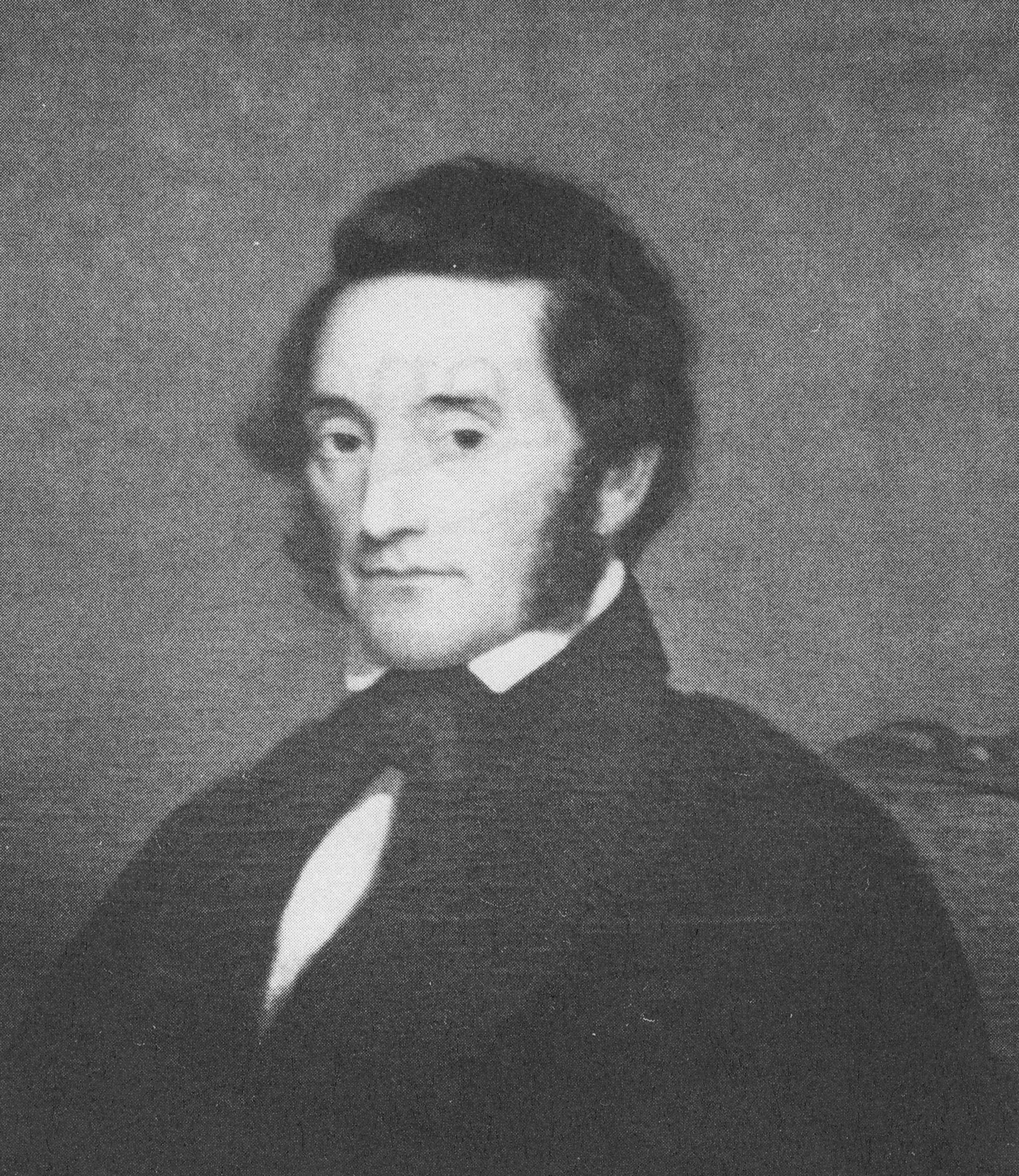
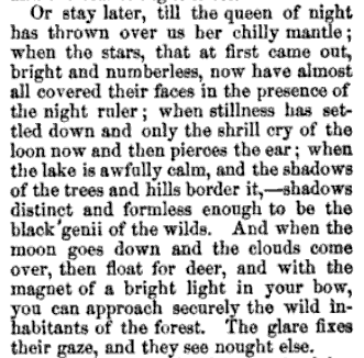
Portrait of Farrand Benedict. Courtesy of F.N. Benedict Jr. as published in To the Lake of the Skies. 1
In my search for the history of our family’s cabin, I sought out all of the title deeds starting with our family’s in 1876 going back to the first title deed ever issued for this particular plot of land. I had always known from Ruth Timm’s books that the original settlers of Raquette Lake, Matthew Beach and William Wood had lived on Indian Point. However, it was only in reading the title deeds that I became aware that it was on our current property that they had settled.
It was through researching the deeds that I first learned of Farrand Benedict. Although several contemporary descriptions of Matthew Beach and William Wood’s residency on the land peg their arrival to sometime between 1837 and 1840, they only obtained legal title to their lands in 1849. That is when they separately paid Farrand Benedict and David Read for titles to 25 acres each for their property. Obviously property owners having to pay for title to lands they already possessed is a pattern that history likes to repeat within Township 40.
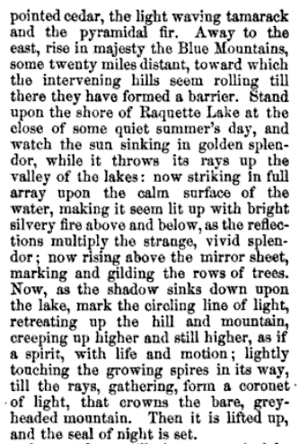
I have yet to find direct evidence of Farrand Benedict interactions with Beach and Wood. However, it is almost certain that they met. Benedict was not an absentee landlord. A letter written by his business partner David Read to Joel Tyler Headley in 1849 describes a trip through Raquette with Benedict during which Read describes the two settlers. Benedict’s personal explorations of the area are noted in his poetic description of Raquette Lake in the article “The Wilds of Northern New York” published in 1854 in Putnam’s Magazine. 2
Farrand Benedict was a professor of math and engineering at the University of Vermont in Burlington. He was an accomplished surveyor and began to explore the Adirondacks in 1835. In 1838, Professor Ebenezer Emmons, the surveyor who named the region the Adirondacks, engaged Benedict to resolve a dispute over the altitude of Mt. Marcy.
Between 1843 and 1852, Benedict purchased 152,000 acres stretching from west of the Moose River Plains to the headwaters of the Hudson River east of Long Lake. In 1848, he and his business partner David Read became sole owners of all of Township 40, which includes Raquette Lake.
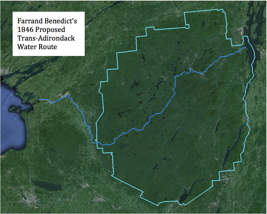
In 1846, Benedict prepared an audacious plan for the NYS Legislature to build a series of canals, with locks and slackwater navigation, and railroads which would link Lake Champlain in the east with the Black River on the western edge of the Adirondacks. A 210-mile long course using the Ausable River Valley, Saranac River, Raquette River, the Fulton Chain of Lakes, Moose River and Black River would traverse from Port Kent to Lake Ontario. 3 The trans-Adirondack water route would bring people into the region and facilitate extracting timber and mineral resources from the Adirondacks. Alas, the entire project was a dream never realized.
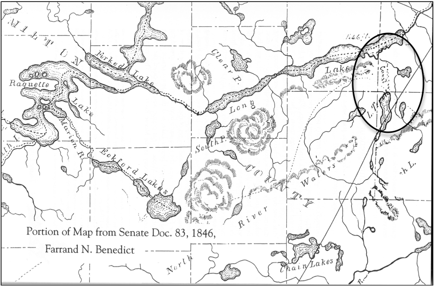
A map accompanying the original 1846 plan appears to indicate a proposed canal between Caitlin Lake (L. Terrott) and Long Lake. It could be that this was intended to draw water from Caitlin Lake into Long Lake to increase the water flow to aid in navigation through his trans-Adirondack water route. However, that would have required a dam on the natural outlet of Caitlin Lake to raise the water level and reverse the natural flow back toward Long Lake. It is more likely a map error and the canal marking relates to Benedict’s intention to build a canal from Long Lake to Round Pond (the body of water to the right of the canal line).
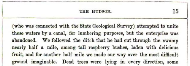
Benson Lossing wrote of seeing evidence of this canal building effort in his 1859 trip through the area in his book The Hudson, from the Wilderness to the Sea. 4
Lossing also saw the remains of a dam that would have reversed the flow of water from Round Pond (referred to as Fountain Lake) into Long Lake.
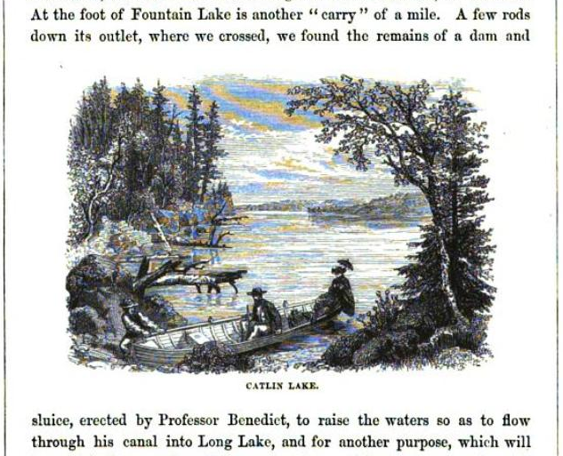
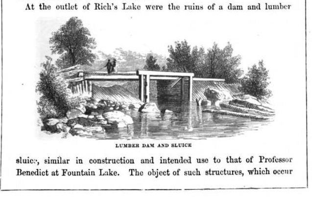
A likeness of a similar dam found by Lossing at Rich Lake is shown.
The initial plans called for water to flow from Round Pond into Long Lake. This would have benefited the floating of logs down the Raquette River. However, starting in 1850, Benedict had written of using the canal between Long Lake and Round Pond to float logs from the Eckford Chain, Raquette, and Long Lakes into the Hudson River to access the burgeoning New York timber market centered at the Big Boom in Glens Falls. Lossing, Alfred Donaldson in a History of the Adirondacks, and John Todd in Long Lake each make the argument that opposition from lumber industry interests along the northern reaches of the Raquette River, who feared losing their supply of timber for the Canadian market, scuttled the plans for this first canal attempt.
In 1874, at the age of 71, Benedict returned to his idea to build the Long Lake to Round Pond canal. The goal now was to re-route the flow of water from Blue Mountain Lake, Raquette Lake and Long Lake into the Hudson River Watershed via Round Pond-Caitlin Lake-Rich Lake-Harris Lake.
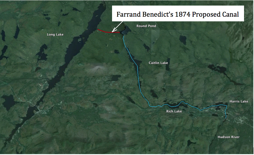
It appears that Benedict no longer intended for the logging industry to float timber along his route into the Hudson. His goal was to significantly increase the supply of water into the Hudson River Watershed. Dams on the outlets of Blue Mt., Raquette, Forked, Brandreth, and Little Tupper lakes would provide controlled outflows to increase the water flow into the Raquette River and Long Lake. The canal would then divert the water to sustain log drives throughout the summer on the Hudson River. According to Finch, Pruyn and Co. records, low water levels sometimes required three years of Spring flows to transport logs from the Adirondack interior to the Big Boom at Glens Falls. Benedict’s plan would have reduced this to one year and assured sufficient summertime water flow to power mills along the Hudson as far south as Troy.
Diverting the water flow out of Long Lake away from the north running Raquette River almost certainly would have endangered the effectiveness of the Raquette River for floating logs north to the Canadian market. While it appears a political scandal in the administration of the New York Governor in 1875 was the practical cause for the death of this project, had it come to fruition, it could have significantly altered the history of this region of the Adirondacks.
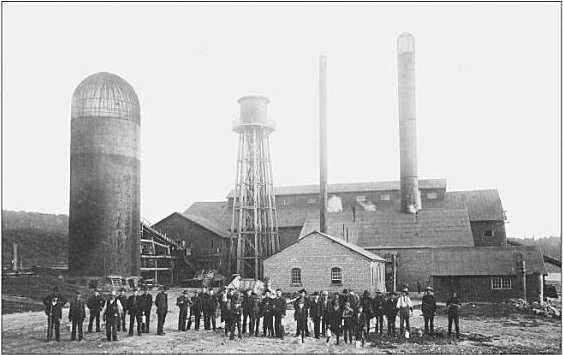
Chapter 264 of the Laws of 1850 in New York State declared the Raquette River a public highway for the purpose of floating logs and lumber from the foot of Raquette Lake to its mouth in Massena. In the 1850s, Raquette Pond (not to be confused with Raquette Lake) became the home of the Pomeroy Lumber Company. Loggers would float logs down the Raquette River to Raquette Pond where they would be marked, sorted and prepared for large log drives down the Raquette River to the mills in the northwest corner of New York and the Canadian timber market. The logging camps on Raquette Pond grew into the Town of Tupper Lake.
Log Drive on Raquette River. Published by Jon Kopp in Tupper Lake – Images of America 5
The logging industry and the town expanded greatly in 1890 with John Hurd’s construction of the largest lumber mill ever built in New York and his completion of his Northern Adirondack Railroad that connected Tupper Lake to Ottawa, Canada. 6 Although the milled lumber now moved north on trains, the mill still was dependent on logs floated down the Raquette River to Raquette Pond. It is doubtful that Tupper Lake would have become the largest population center in this part of the Adirondacks had the water flow been diverted from the Raquette River by Farrand Benedict’s Canal.
John Hurd’s Big Mill. From the Goff Nelson Library Collection. Published by Jon Kopp in Tupper Lake: Images of America.
Fortunately for Tupper Lake, Benedict’s land empire began to evaporate with sales of large tracts to the railroad companies in 1855. By the time of his death in 1880, his family’s lands had all been sold or reclaimed by the State for back taxes. His grand plans were simply forgotten.
This chapter is based on the extensive research of Barbara McMartin in her book To the Lake of the Skies: The Benedicts in the Adirondacks. McMartin argues that despite the failure of his ventures, Benedict did have one lasting impact on the Adirondacks. He first introduced the Reverend John Todd and his cousin Joel Tyler Headley to the Adirondacks. Todd and Headley authored Long Lake in 1845 and The Adirondack: or Life in the Woods in 1849, respectively. These early writings attracted other adventurers and laid the path followed by the great Adirondack promoter Reverend William H. Murray.

Tom, there is a map in township 34 that shows a proposed canel between the eastern shore of Blue and Durant
If you look closely at Google’s satellite view, you can see where the beginnings of the canal were dug on the Round Pond side: a long arrow-straight bit of water stretching northwest from the western inlet of Round.