Adirondack Murray’s Guide Honest John

John Plumley Photo

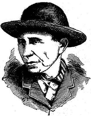
Honest John Plumbley [sic], the prince of guides, patient as a hound, and as faithful, – a man who knows the wilderness as a farmer knows his fields, whose instinct is never at fault, whose temper is never ruffled, whose paddle is silent as falling snow, whose eye is true along the sights, whose pancakes are the wonder of the woods…

Reverend William H. H. Murray in Adventures in the Wilderness 1869.

Murray is widely credited with bringing the masses to the Adirondacks.   The historian Warder Cadbury said, “Murray quite literally popularized both wilderness and the Adirondacks.” “Murray’s Rush”, the onslaught of tourists who rushed to the mountains in response to his book, gave rise to the claim that the Adirondacks are the birthplace of the American vacation.

John Plumley* is the man who brought the Adirondacks to Murray, serving as his guide through his adventures.

Following the similar Adirondack migration of fellow Vermonters Matthew Beach and William Wood, Plumley’s father moved his family from Shrewsbury, Vermont, to Long Lake in the 1830s. John was younger than ten when he arrived and quickly befriended an older boy, Mitchell Sabattis. Like Sabattis, John became an active guide at the age of twenty-one.

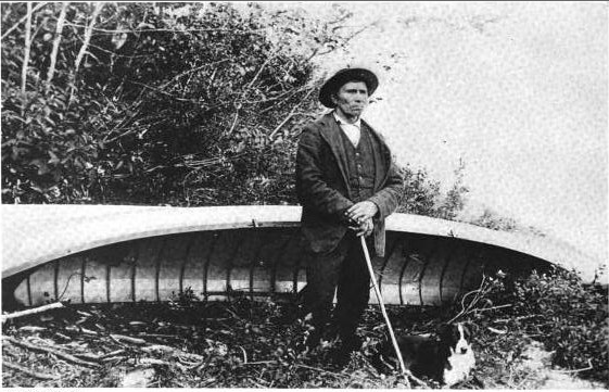
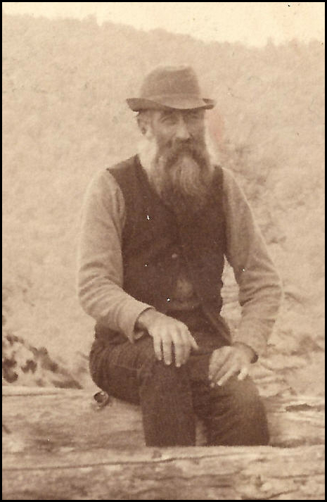
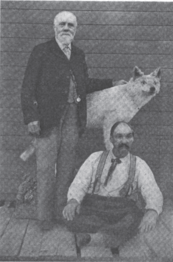
Plumley was the first guide to introduce Beach’s Lake to Dr. Benjamin Brandreth. In 1851, Brandreth purchased 24,000 acres surrounding Beach’s Lake (now called Brandreth Lake) to form the first private preserve in the region. Plumley served several years as caretaker for Brandreth Park and constructed many of the cabins within the park. The last photo taken of Plumley in 1899 shows him seated at the feet of what was believed to be the last wolf killed in the Adirondacks.

Screen Shot 2014-12-17 at 3.13.46 PM

There are two strings that tie Plumley to the fifty acres of Beach and Wood. As a young man, Plumley married Zobeda Hough, the daughter of Amos Hough. In 1856, Matthew Beach deeded his 25 acres on Indian Point to Amos Hough on condition that Hough would care for Beach until his death. Although Hough sold the land the same year to a land speculator named Marshall Shedd, from 1856 to1859, Hough and Beach still lived in his cabin on Indian Point. However in the 1860 census, Beach is found living in the Long Lake home of John Plumley, who had assumed his father-in-law’s obligation. Plumley also purchased William Wood’s 25 acres on Indian Point, owning the land from 1859 to 1864.

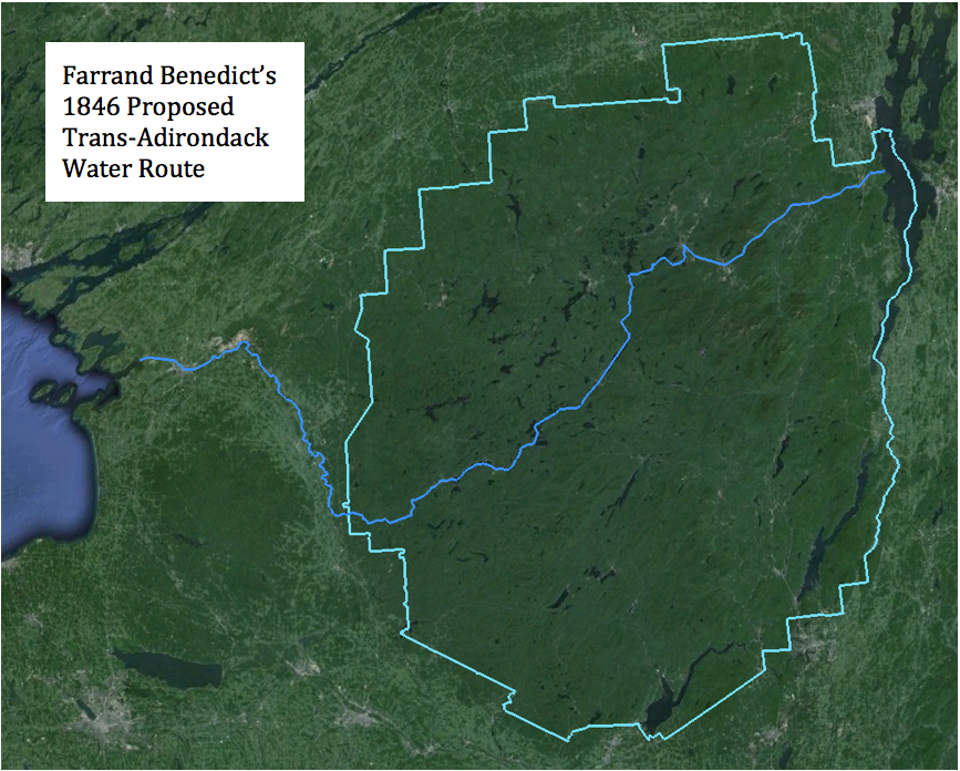
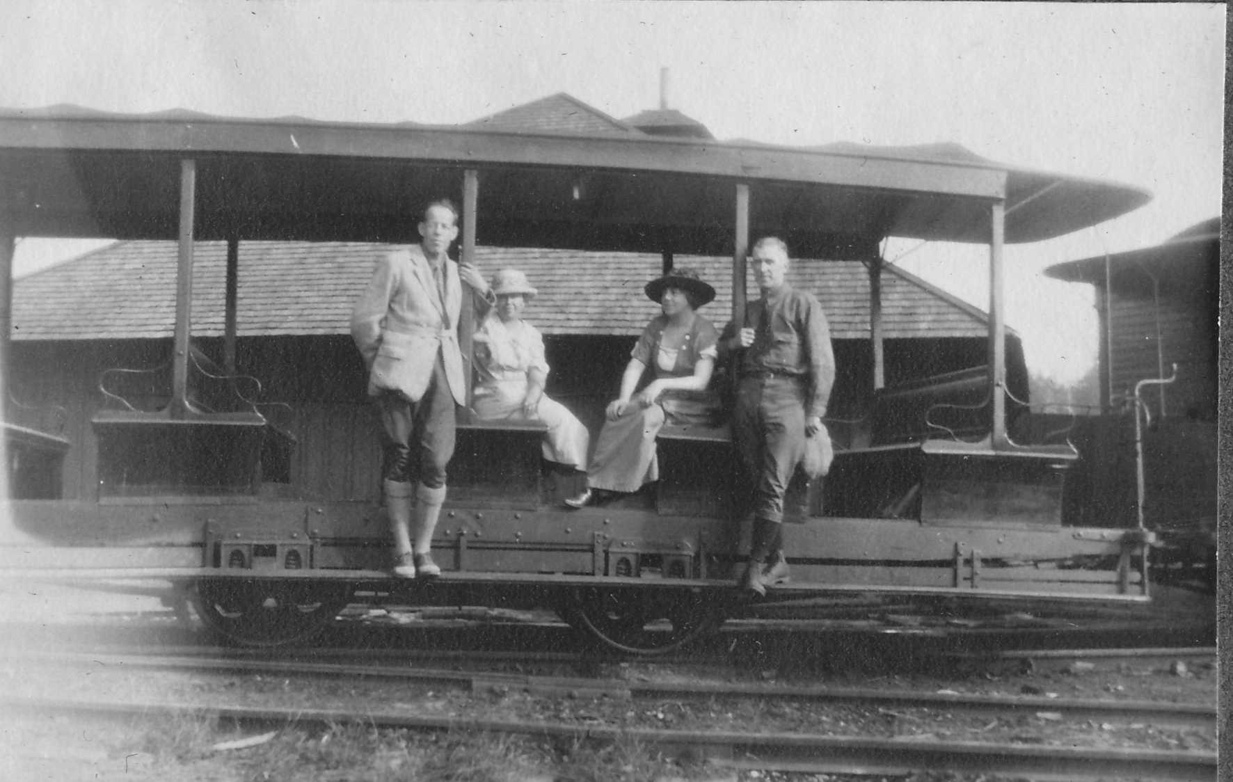
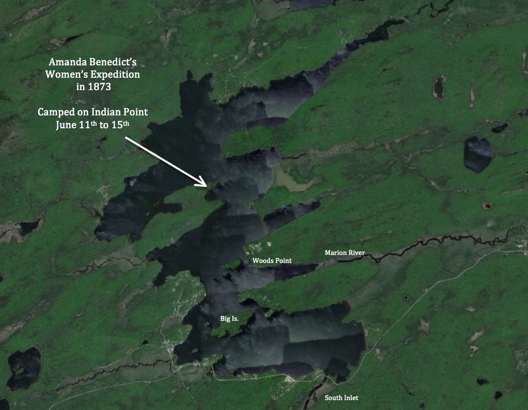
Hough and Plumley’s intimate familiarity with Indian Point led to a most remarkable rendezvous that occurred on these shores in the summer of 1873. Using Adirondack Murray’s book as a guide, a group of 25 women traversed the Adirondacks from four directions to meet at Indian Point. They were a group of teachers and students from a women’s academy in New York City founded by Amanda Benedict, the wife of Farrand Benedict’s younger brother Joel.

While not the first group of women to explore the Adirondacks, this expedition was clearly the most ambitious. The 16 Adirondack guides employed by the expedition included several of the most prominent guides of Adirondack history: Mitchell Sabattis and his son Charlie, John Cheney, William Higby, James Sturgess, Alvah Dunning, and Plumley.

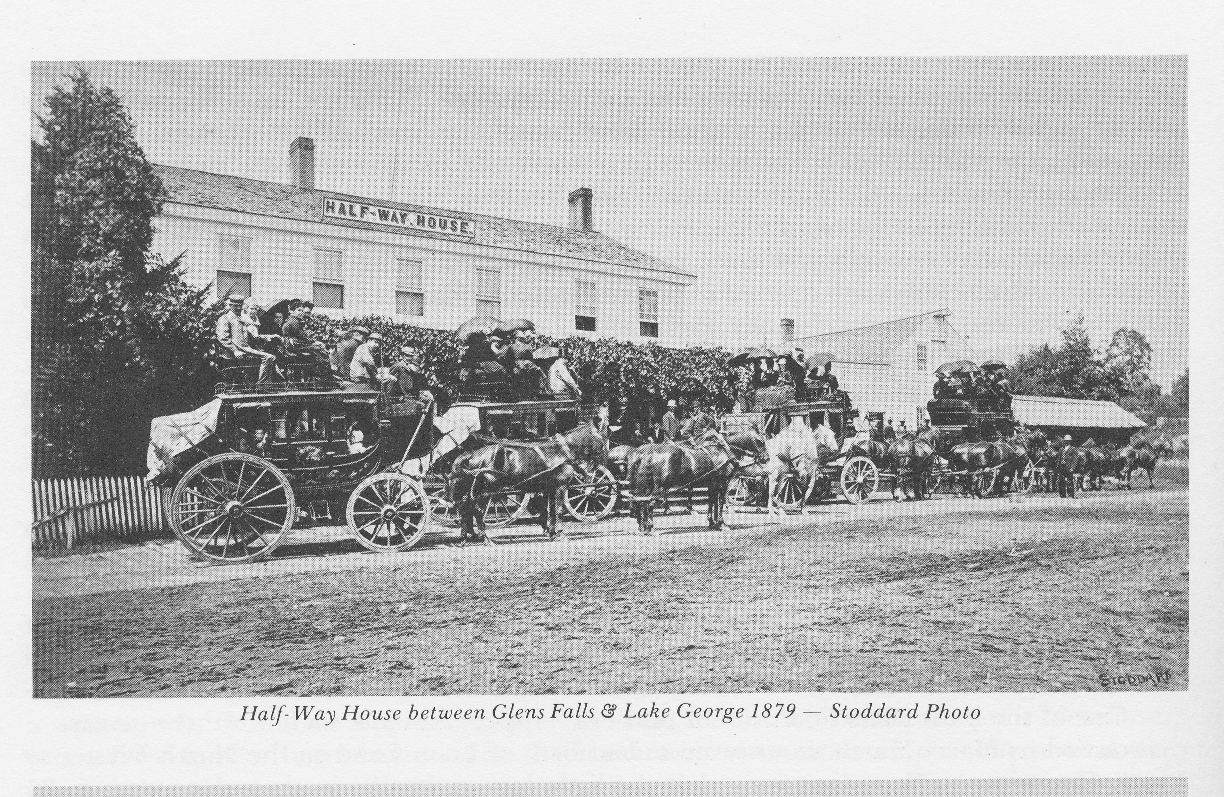
One group travelled from Lake Champlain along the Saranac River and Raquette River to Raquette Lake in the company of Amos Hough. Another entered the region from the west, following the Moose River into the Fulton Chain of Lakes where Plumley guided them through to Raquette. A third group followed a path similar to Sir John Johnson’s escape north from Lake Pleasant, approaching Raquette Lake from the south. The forth group departed Ticonderoga and followed the Schroon River, and then hiked west to meet the rest.

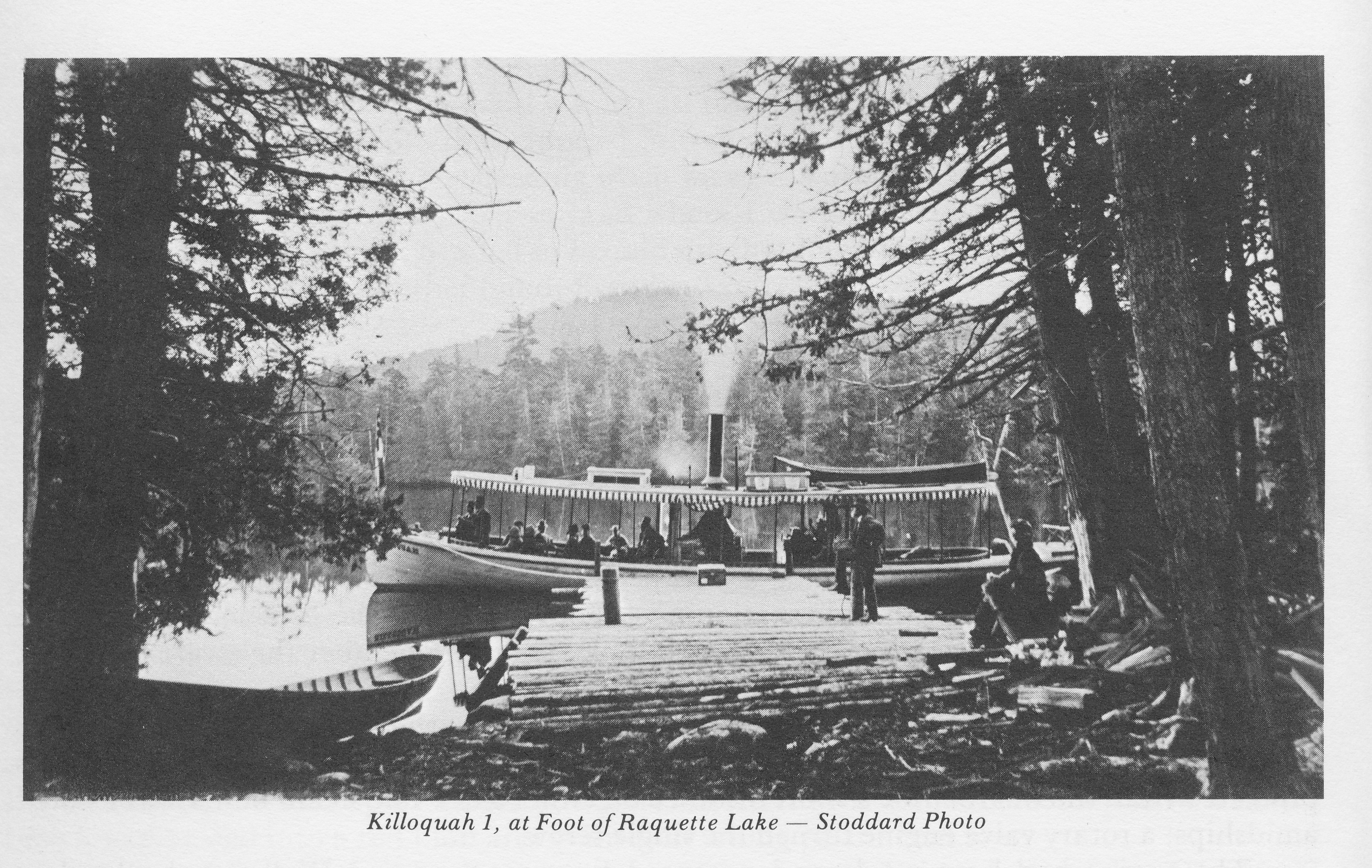
The expedition’s final destination was Blue Mountain Lake, or as the women called it the “Lake of the Skies” (also the title of Barbara McMartin’s wonderful book detailing the expedition). All four groups rendezvoused at Raquette Lake’s South Inlet Falls on June 11th, then spent four days camped near the site of Beach’s cabin on Indian Point prior to continuing to Blue Mountain Lake on June 15th.

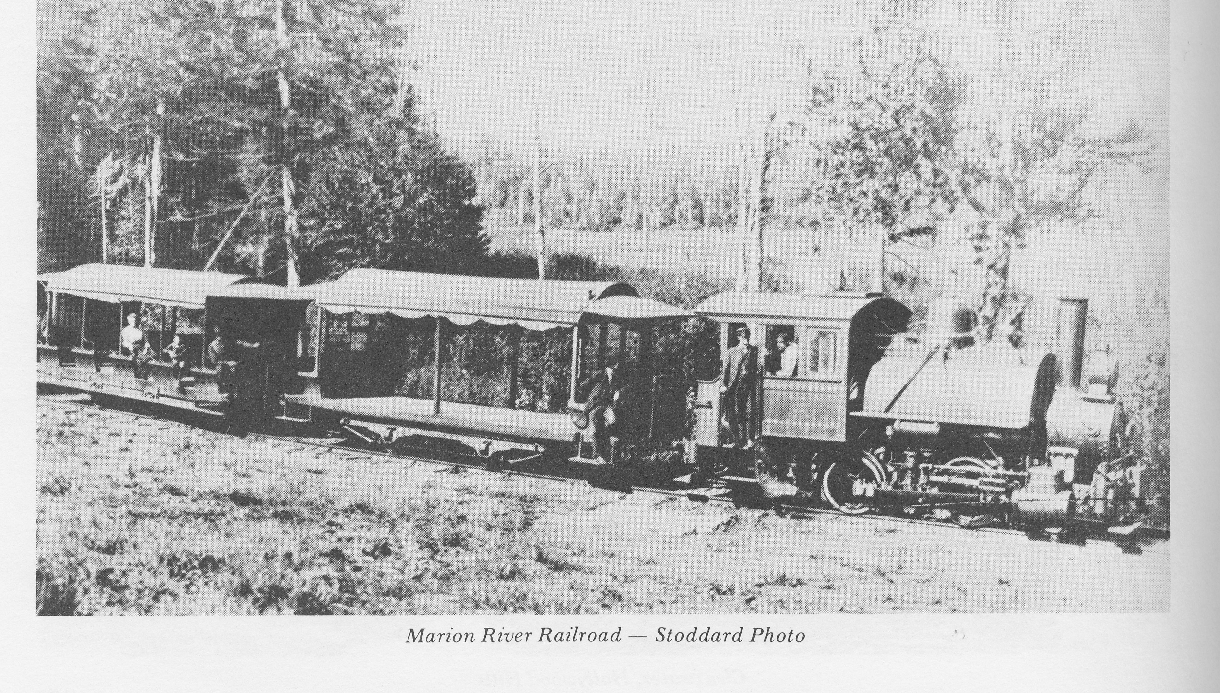
A number of places could have served for their base camp, perhaps Big Island or Woods Point, which both lie between South Inlet and the mouth of the Marion River that leads to Blue Mountain Lake. Indian Point was out of their way and double the distance from South Inlet. Hough and Plumley must have proposed the use of their former property for the base camp.

Screen Shot 2014-12-20 at 1.59.16 PM

When John Plumley died in 1900, the Rev. William H. H. Murray wrote in the journal Woods and Waters:

He taught me a faultless knowledge of the woods, the name and nature of plant and herb and tree, the languages of the night, and the occultism of silent places and soundless shores…He had a most gentle and mannerly reticence and that sweetest of all habits in man or woman – the habit of silence. He could look and see, listen and hear, and say nothing… His knowledge of woodcraft was intuitive. He knew the points of the compass sensationally. He was an atom whose nature mysteriously held it in reciprocal connection with the magnetic currents of the world. In the densest woods, on the darkest nights, he was never bewildered, never at fault… He was the only guide I ever knew…that could not in any circumstance lose himself or his way.

They tell me he is dead. It is a foolish fashion of speech and not true. Not until the woods are destroyed to the last tree, the mountains crumbled to their bases, the lakes and streams dried up to their beds, and the woods and wood life are forgotten, will the saying become fact. For John Plumbley [sic] was so much of the woods, the mountains and the streams that he personified them. He was a type that is deathless. Memory, affection, imagination, literature – until these die, the great guide of the woods will live with ever enlarging life as the years are added to the years, and the lovers of nature and sport multiply.

And so here I do my part to breathe life into the memory of Honest John Plumley.


* John’s last name appears with and without the “b” in various written histories. However, the legal deeds to his property on Indian Point spell his name without the “b” and thus I have adopted that standard.

Mitchell Sabattis – Boatbuilder

When I walk the land around Matthew Beach’s original hut and William Wood’s shanty, I imagine the Abenaki Indian guide Mitchell Sabattis pulling into their landings in a canoe or guideboat made by his own hand. Indian Point was a waypoint for many a traveler boating through the Central Adirondacks.

Screen Shot 2014-10-20 at 9.17.23 PM

1890 Engraving of a photo of Sabattis by Seneca Ray Stoddard

While it is impossible to know how often Sabattis visited these acres, we have written record of at least 3 occasions: his trips with Joel Tyler Headley in 1844-46, accompanying C. W. Webber in 1849, and an expedition of women who explored the region in 1873 (beautifully told in Barbara McMartin’s book To the Lake of the Skies)

Sabattis guided for my great-great-grandfather George Hornell Thacher in 1862 as they explored the region from a base camp Sabattis had on Crane Point on Blue Mountain Lake. However, even if Thacher travelled to Raquette Lake as early as 1862, it is unlikely that he spent a night on Indian Point.  Sabattis maintained a campsite from 1852 to 1877 on Watch Point according to Ken Hawks, who now owns the property.

A member of the St. Francis tribe of Abenaki Indians, Mitchell Sabattis was born in Parishville, St. Lawrence County in 1823. He began to accompany his father Captain Peter Sabattis on hunting expeditions at the age of seven.  At eleven, he was one of the earliest settlers in Long Lake, moving there with his father in the early 1830’s. Over a life of 83 years, he and his wife Elizabeth raised five sons and a daughter. He was a founding member of the Wesleyan Methodist Church of Long Lake. In 1865, he raised funds to build the church where he frequently played the violin, sang and preached.  When not working as a guide he tended to a 20-acre farm on his 160-acre homestead.

Screen Shot 2014-10-20 at 9.20.03 PM

Image of Sabattis on Long Lake near Sagamore Hotel in 1886 – History of the Adirondacks. A. Donaldson. 1921.

Much has been written about Sabattis as the legendary Adirondack Guide, but I am intrigued by his abilities as a boat builder. The historian Alfred Donaldson claimed that Sabattis created the first guide boat around 1849.   Subsequent historians have debated different people as the originator of the idea for the guideboat’s design. Nonetheless, Hallie Bond says in Boats and Boating in the Adirondacks, “The guideboat did not spring full-blown from the forehead of Mitchell Sabattis, or anyone else for that matter, but Sabattis, living in the center of early guideboat development, may well have had a hand in its evolution.”

The earliest tale of Sabattis describes his skill in building another type of boat – a spruce bark canoe like the one shown here.

In 1843, John MacMullen and his friend Jim R. were rescued along the Raquette River by Mitchell Sabattis, who was travelling with two men (one is presumed to have been his father Peter), two women and a baby.   For one day all eight crammed into Sabattis’ birch bark canoe, which barely stayed afloat with the water only three inches below the gunwales. Upon reaching a cabin on the shores of Tupper Lake, Sabattis decided to construct a spruce bark canoe to carry four of the men. MacMullen described the process in The Evening Post of New York in 1880:

This kind of craft is made of a single piece of bark while a birch canoe is made of many pieces fastened together. The process of making our canoe was very interesting. A fine large spruce tree about a foot and a half in diameter was chosen that grew in an open space near the river and had fifteen feet of good thick bark without break or knot-hole. The tree was cut down, [they] relieved one another in the work, a ring was cut through the bark along the trunk. ‘Spuds’ were made, and the whole clear sheet of bark, fifteen feet long and four feet wide, was laid upon the ground with the inner side down.

[Captain Peter Sabattis] then cut away a slender triangular piece of the thick outer bark, about six inches at the base and about three feet from each end, leaving the flexible inner bark to fold over so that when the corners were brought together and the ends closed up the bow and stern might both be somewhat higher out of the water, and the sides need not sag out so much in the middle.

The ends of our boat were sewed up with the roots of the spruce tree. These slender roots or rootlets can be had of six feet in length and running from a quarter of an inch down to a point. The smaller part is taken to use as thread. A hole is made in the bark with a sharp stick and the rootlet thus inserted… The spruce gum is used to make the inside of the seam water-tight. Thus this tree supplied for our boat bark, thread and gum…

Long, narrow pieces of cedar… fifteen feet long by two inches wide, and only three quarters of an inch thick, [were] split almost as smoothly as if they had been sawed. These pieces were used as gunwales and tied on with strips of tough and flexible bark passed through punched holes. Strips of wood thin enough to bend were cut just of the proper length and then forced in so that they followed the curve of the boat, their strong crosspieces also ran athwart between the gunwales to stiffen the craft…This ‘naval construction’ took the best part of two days.”

Discussing the origins of the Adirondack guideboat, John Duquette wrote in the Adirondack Daily Enterprise: “To avoid the solid weight of a skiff or dory, it was necessary to experiment with a skeletal frame sheathed with light but strong material. The frame consisted of a bottom board with ribs that were bent or steamed to fit an outer shell. Ribs that were bent had a tendency to warp which resulted in a distortion of the hull. An alert Adirondacker noticed that an uprooted spruce tree disclosed a natural crook where the root grew out from the base of the tree. Here was a strong resilient piece of wood in a shape that required no bending.”

While a spruce bark canoe does not use solid pieces of spruce root wood for ribbing, Sabattis would have been keenly aware of this unique attribute of the spruce tree’s roots. He is as likely a candidate as any other to be the one who contributed this innovation to the design of the Adirondack guideboat.

(watch a video of the recent construction of a spruce bark canoe https://www.youtube.com/watch?v=u6V-v7mVymo )

Farrand Benedict’s Canals

If you ever drive south along Route 28 to Indian Lake from Blue Mountain Lake, look for a sign on the right about 0.4 mile south of Potter’s Corner announcing you are crossing the divide between the St. Lawrence River and Hudson River Watersheds. The waters of Blue Mountain Lake flow through the Eckford Chain into Raquette Lake, north through Long Lake and the Raquette River eventually reaching the St. Lawrence Seaway. The waters of Durant Lake, only a half mile distant from Blue, eventually flow into the Hudson River.

If Farrand Benedict had been successful with his grand visions of reshaping the Adirondacks, the waters of Blue, Raquette and Long lakes would today flow into the Hudson River Watershed. The history of the development of the central Adirondacks might also have been greatly altered.

Courtesy of F.N. Benedict Jr. as published in To the Lake of the Skies.

Portrait of Farrand Benedict. Courtesy of F.N. Benedict Jr. as published in To the Lake of the Skies. 1

In my search for the history of our family’s cabin, I sought out all of the title deeds starting with our family’s in 1876 going back to the first title deed ever issued for this particular plot of land. I had always known from Ruth Timm’s books that the original settlers of Raquette Lake, Matthew Beach and William Wood had lived on Indian Point.   However, it was only in reading the title deeds that I became aware that it was on our current property that they had settled.

It was through researching the deeds that I first learned of Farrand Benedict. Although several contemporary descriptions of Matthew Beach and William Wood’s residency on the land peg their arrival to sometime between 1837 and 1840, they only obtained legal title to their lands in 1849. That is when they separately paid Farrand Benedict and David Read for titles to 25 acres each for their property. Obviously property owners having to pay for title to lands they already possessed is a pattern that history likes to repeat within Township 40.

I have yet to find direct evidence of Farrand Benedict interactions with Beach and Wood. However, it is almost certain that they met. Benedict was not an absentee landlord. A letter written by his business partner David Read to Joel Tyler Headley in 1849 describes a trip through Raquette with Benedict during which Read describes the two settlers.   Benedict’s personal explorations of the area are noted in his poetic description of Raquette Lake in the article “The Wilds of Northern New York” published in 1854 in Putnam’s Magazine. 2

FB RaqDescription titleFB Raq description 1FB Raq description 2

FB Raq description 3


Farrand Benedict was a professor of math and engineering at the University of Vermont in Burlington. He was an accomplished surveyor and began to explore the Adirondacks in 1835. In 1838, Professor Ebenezer Emmons, the surveyor who named the region the Adirondacks, engaged Benedict to resolve a dispute over the altitude of Mt. Marcy.

Between 1843 and 1852, Benedict purchased 152,000 acres stretching from west of the Moose River Plains to the headwaters of the Hudson River east of Long Lake. In 1848, he and his business partner David Read became sole owners of all of Township 40, which includes Raquette Lake.

In 1846, Benedict prepared an audacious plan for the NYS Legislature to build a series of canals, with locks and slackwater navigation, and railroads which would link Lake Champlain in the east with the Black River on the western edge of the Adirondacks. A 210-mile long course using the Ausable River Valley, Saranac River, Raquette River, the Fulton Chain of Lakes, Moose River and Black River would traverse from Port Kent to Lake Ontario.  3  The trans-Adirondack water route would bring people into the region and facilitate extracting timber and mineral resources from the Adirondacks. Alas, the entire project was a dream never realized.

Farrand Benedict 1846 Plan Corrected


A map accompanying the original 1846 plan appears to indicate a proposed canal between Caitlin Lake (L. Terrott) and Long Lake. It could be that this was intended to draw water from Caitlin Lake into Long Lake to increase the water flow to aid in navigation through his trans-Adirondack water route.   However, that would have required a dam on the natural outlet of Caitlin Lake to raise the water level and reverse the natural flow back toward Long Lake. It is more likely a map error and the canal marking relates to Benedict’s intention to build a canal from Long Lake to Round Pond (the body of water to the right of the canal line).


Screen Shot 2014-04-04 at 7.29.14 PM

Benson Lossing wrote of seeing evidence of this canal building effort in his 1859 trip through the area in his book The Hudson, from the Wilderness to the Sea. 4

Screen Shot 2014-04-04 at 7.51.41 PM

Lossing also saw the remains of a dam that would have reversed the flow of water from Round Pond (referred to as Fountain Lake) into Long Lake.

lossing ditch

A likeness of a similar dam found by Lossing at Rich Lake is shown.

Lossing dam

The initial plans called for water to flow from Round Pond into Long Lake. This would have benefited the floating of logs down the Raquette River.  However, starting in 1850, Benedict had written of using the canal between Long Lake and Round Pond to float logs from the Eckford Chain, Raquette, and Long Lakes into the Hudson River to access the burgeoning New York timber market centered at the Big Boom in Glens Falls. Lossing, Alfred Donaldson in a History of the Adirondacks, and John Todd in Long Lake each make the argument that opposition from lumber industry interests along the northern reaches of the Raquette River, who feared losing their supply of timber for the Canadian market, scuttled the plans for this first canal attempt.

In 1874, at the age of 71, Benedict returned to his idea to build the Long Lake to Round Pond canal. The goal now was to re-route the flow of water from Blue Mountain Lake, Raquette Lake and Long Lake into the Hudson River Watershed via Round Pond-Caitlin Lake-Rich Lake-Harris Lake.

FB Canal final

It appears that Benedict no longer intended for the logging industry to float timber along his route into the Hudson. His goal was to significantly increase the supply of water into the Hudson River Watershed. Dams on the outlets of Blue Mt., Raquette, Forked, Brandreth, and Little Tupper lakes would provide controlled outflows to increase the water flow into the Raquette River and Long Lake. The canal would then divert the water to sustain log drives throughout the summer on the Hudson River.   According to Finch, Pruyn and Co. records, low water levels sometimes required three years of Spring flows to transport logs from the Adirondack interior to the Big Boom at Glens Falls.   Benedict’s plan would have reduced this to one year and assured sufficient summertime water flow to power mills along the Hudson as far south as Troy.

Diverting the water flow out of Long Lake away from the north running Raquette River almost certainly would have endangered the effectiveness of the Raquette River for floating logs north to the Canadian market. While it appears a political scandal in the administration of the New York Governor in 1875 was the practical cause for the death of this project, had it come to fruition, it could have significantly altered the history of this region of the Adirondacks.

Chapter 264 of the Laws of 1850 in New York State declared the Raquette River a public highway for the purpose of floating logs and lumber from the foot of Raquette Lake to its mouth in Massena. In the 1850s, Raquette Pond (not to be confused with Raquette Lake) became the home of the Pomeroy Lumber Company. Loggers would float logs down the Raquette River to Raquette Pond where they would be marked, sorted and prepared for large log drives down the Raquette River to the mills in the northwest corner of New York and the Canadian timber market. The logging camps on Raquette Pond grew into the Town of Tupper Lake.

raq river log drive

Log Drive on Raquette River. Published by Jon Kopp in Tupper Lake – Images of America 5

The logging industry and the town expanded greatly in 1890 with John Hurd’s construction of the largest lumber mill ever built in New York and his completion of his Northern Adirondack Railroad that connected Tupper Lake to Ottawa, Canada.  6   Although the milled lumber now moved north on trains, the mill still was dependent on logs floated down the Raquette River to Raquette Pond. It is doubtful that Tupper Lake would have become the largest population center in this part of the Adirondacks had the water flow been diverted from the Raquette River by Farrand Benedict’s Canal.

John Hurd's Big Mill

John Hurd’s Big Mill. From the Goff Nelson Library Collection. Published by Jon Kopp in Tupper Lake: Images of America.

Fortunately for Tupper Lake, Benedict’s land empire began to evaporate with sales of large tracts to the railroad companies in 1855. By the time of his death in 1880, his family’s lands had all been sold or reclaimed by the State for back taxes. His grand plans were simply forgotten.

This chapter is based on the extensive research of Barbara McMartin in her book To the Lake of the Skies: The Benedicts in the Adirondacks. McMartin argues that despite the failure of his ventures, Benedict did have one lasting impact on the Adirondacks. He first introduced the Reverend John Todd and his cousin Joel Tyler Headley to the Adirondacks. Todd and Headley authored Long Lake in 1845 and The Adirondack: or Life in the Woods in 1849, respectively. These early writings attracted other adventurers and laid the path followed by the great Adirondack promoter Reverend William H. Murray.


The Changing Times to the Adirondacks

I apply the brakes just a tad as the car hugs the downhill S-curve – getting closer.  The wheels straighten out and I sprint for the sign.  Up ahead on the right, there it is – the golden letters on brown wood canvas inviting us to enter Golden Beach State Campground.  We whiz by, thankful for the guidepost that alerts me to the prize.  Just a thousand feet.  There! As the trickle of Death Brook drops into the lake, the trees part and I can see the sun glinting on the waves of South Bay.  I am here.

My trip from our home in Western Massachusetts has ended when I see the water.  A simple three and a half hour drive.  Ok, my wife insists the trip is not over until we unload the car, pack the boat at Burke’s Marina, traverse the lake, unload the boat and schlep everything into the cabin.  A five-hour ordeal in her mind, but my blood pressure has lowered and serenity floods my mind and heart the minute I see the water.

Be it 3.5 or 5 hours, our trip is nothing compared to the arduous travels our ancestors took to reach these shores.

In 1862, George Hornell Thacher first travelled to the region, guided by Mitchell Sabattis who maintained a camp at Crane Point on Blue Mountain Lake. 1   At this time, the railroad to North Creek and the stage road from North Creek to Blue Mountain Lake did not exist.  Access to Blue Mountain Lake was only from the north, down from Long Lake.  The trip from Albany took between three and four days.

The Adirondack Museum has a description of a trip made by Miles Tyler Merwin, founder of the Blue Mountain House, which indicates the travel route that GHT likely followed. 2   On day one, he would have taken the train from Albany to Glens Falls, then a stagecoach similar to one shown below to Minerva.  On day two, he would have travelled again by stagecoach to Long Lake and spent the night.

Published in Heydays of the Adirondacks by Maitland Desormo

Published in Heydays of the Adirondacks by Maitland Desormo

From Long Lake to Blue Mountain Lake he would have taken either of two routes, each one potentially lasting more than a day in travel.  We do not know whether Mitchell Sabattis led GHT through the arduous South Pond route to Blue or the longer yet easier water route via Raquette Lake to Blue.

GHT route map

Click on the map and open to full screen to see an animation of these presumed routes. 

If we are to believe John Boyd Thacher, GHT’s son, it is more likely that Sabattis chose to go via Raquette Lake.   JBT wrote the following in a letter published in Forest and Stream magazine in 1874.

“From Blue Mountain Lake to Long Lake there is a more direct route with four miles of “carry” but even the guides will take the longer and all-water route.”

If JBT was right, it is even conceivable that GHT camped on Indian Point during his passage to Blue a full fifteen years prior to owning the land.

Of course JBT had an easier trip of only two days in 1874, which he chronicled in his letter.

Blue Mountain Lake, Adirondacks, Café Hathorne, June 15, 1874

             Already has the winter of our discontent yielded to glorious summer in these parts, and the faithful tide of tourists and sportsmen is setting in toward the woods.   Doubtless from now till November snows will your desk, drawers and basket be filled with letters concerning the delights and joys here experienced.

            We do not know of any easier of more accessible entrance to the North Woods, especially to the New Yorker than the route we have taken and always take, no matter at which point we may eventually aim.   Leaving Albany at seven o’clock in the morning on the Rensselaer and Saratoga Railroad, we connect at Saratoga with the Adirondack Railroad, reaching North Creek, its northern terminus, at about noon.  Thence by stage to Dick Jackson’s, a distance of nineteen miles, where we spend the night.   This is the last place on the route where one can experience the comforts of a good hotel, although there is soon to be one opened at Wakely’s on the Cedar River.

            Bright and early the next morning a buckboard wagon will take us to Blue Mountain Lake, a distance of twelve miles, over a road that has never been submitted to the process of Macadamization.  You remember it was one of Macadam’s theories that a bog was preferable to a hard bottom in constructing his roads.  There is plenty of substratum of that nature here.

            At Chauncey Hathorne’s shanty will we find a smoking hot fish-chowder in thirty minutes after we tear ourselves off the buck-board, and, in fact, it were no bad idea to consume a goodly portion of this time in gradually performing this operation.  About twenty minutes is the average time allotted for accomplishing this in safety.

See the complete letter as published in Forest and Stream magazine.  3  The letter begins at the bottom left side of the page.

JBT route map

Click on the map and open to full screen to see an animation of his presumed route.

From 1879 to 1893, the route to Blue Mountain Lake continued to be via train to North Creek; however a shorter stagecoach ride out of Indian Lake brought people to Blue along what is now Route 28.    Those travelling to Raquette Lake would take guideboats, and in later years steamboats, that flowed from Blue Mountain Lake through Eagle Lake and Utowana Lake (the Eckford Chain) and the Marion River into Raquette Lake.

In 1893, the railroad was extended from Utica, NY, to Thendara Station near Old Forge.  From that year until 1900, there were two paths to Raquette Lake.  Some still chose to take the train to North Creek, stagecoach to Blue Mountain Lake and by water through the Eckford Chain into Raquette Lake.  Others approached from the West; they would take the train to Thendara and then go by steamboat and buckboard through the Fulton Chain of Lakes to Raquette Lake.   If their final destination was Blue Mountain Lake, they would reverse the previous route from Raquette Lake through the Marion River, Utowana Lake and Eagle Lake into Blue Mountain Lake.

In 1900, the Raquette Lake Railroad was built to extend the rail lines from Carter Station (just north of Thendara) all the way to Raquette Lake Village.  In the same year the Marion River Railroad, the shortest full gauge railroad in the world, was built to transport travelers and their luggage the three-quarters of a mile of the Marion River Carry.  4   Travelers would take steamboats from Raquette Lake Village to the end of the Marion River.

Published in Heydays of the Adirondacks by Maitland Desormo

Published in Heydays of the Adirondacks by Maitland Desormo

They would then board the train for the short trip to the landing of the steamboats of the Eckford Chain (Utowana, Eagle, and Blue Mountain lakes).

Published in Heydays of the Adirondacks by Maitland Desormo

Published in Heydays of the Adirondacks by Maitland Desormo

The photo above by Seneca Ray Stoddard serves to authenticate the following two photos taken by members of the Thacher family traveling on the Marion River Railroad in the mid-1920s.

1925 Marion Carry RR

1922 Marion Carry RR

At this time, those travelling to Blue Mountain Lake preferred to take the train all the way to Raquette Lake and travel by steamboat into Blue Mountain Lake, thus avoiding the long stagecoach ride from North Creek.  It was now possible to reach Raquette Lake and Blue Mountain Lake in only one day of travel from Albany and even from New York City.

In 1929, the auto road was built between Raquette Lake and Blue Mountain Lake and brought to an end the Marion River Railroad.  The Raquette Lake Railroad and the steamboats of the region ended service in 1933.  5

Getting to the lakes was never the end of the journey.  Our daily trips from cabin to mainland have changed as well.  My father told us stories of my grandfather rowing a couple of hours to the village every day in his guideboat.

1922 JBT2 in guideboat

As a boy, I would sit in the bow of a 17 foot aluminum fishing boat, holding the bowline as we bounced and crashed against the waves – water spraying my face for the forty-five minute ride powered by a 15 horsepower Johnson outboard.  Fifteen minutes marks the duration of my kids’ trips from our cabin to the Raquette Lake Village dock in our Four Winns 190 Horizon speedboat.  I think my kids are missing out. (They don’t.)