He Who Would Give the Name ————– “Adirondacks” —————– Prof. Ebenezer Emmons

After much toil and labor in rowing, in consequence of a strong head wind, we reached the lake at its eastern extremity. This accomplished, our next business was to find the establishment of Beach and Wood situated on some point on the opposite shore. By fortunate conjecture, our guide struck upon the right course and soon landed on Indian Point at the residence of the above named gentlemen. Here we determined to remain till we had thoroughly explored the region.  1

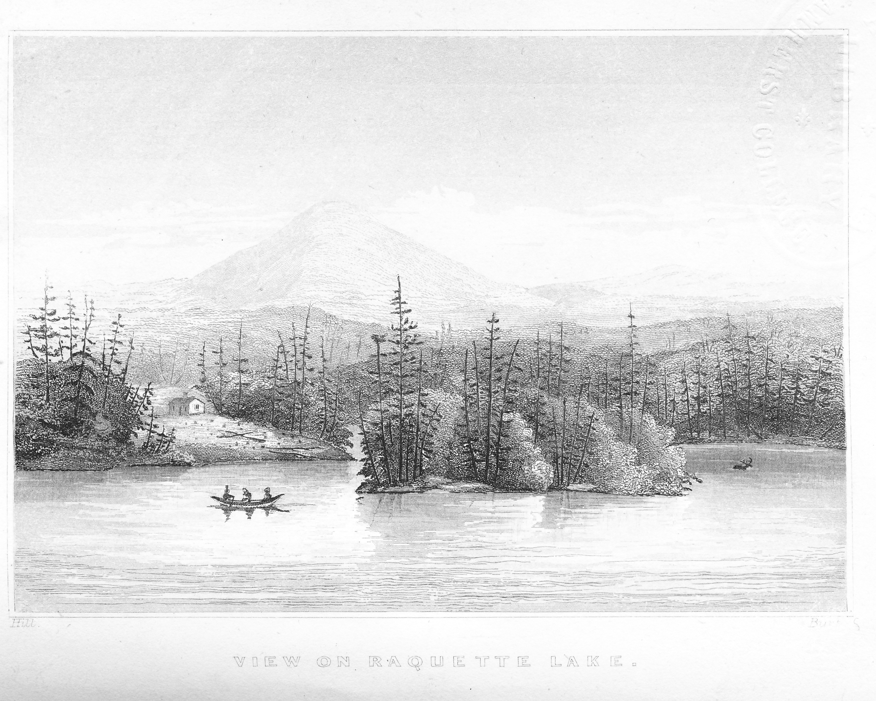
Thus Prof. Ebenezer Emmons described his arrival on my family’s land in 1840, captured in this sketch of Beach and Woods’ cabin by John William Hill.

1849 Birch Pt sketch

Emmons was continuing his efforts, begun in 1837, as director of the Survey of the Second Geological District to study the mineralogy, geography and geology of 10,000 acres across northern New York State.  2

In his 1838 report Emmons wrote:

The cluster of mountains in the neighborhood of the Upper Hudson and Ausable river, I propose to call the Adirondack group, a name by which a well known tribe of Indians who once hunted here may be commemorated. 3

Emmons’ term for the high peaks region was adopted and expanded to describe all of the area now known as the Adirondacks.

However, Emmons’ impact on the region is not limited to its name. In the summer of 1837, he led the first recorded ascent of the tallest mountain in New York and named it Mt. Marcy, in recognition of Governor William Marcy who appointed him to lead the survey.  4

Ebenezer Emmons

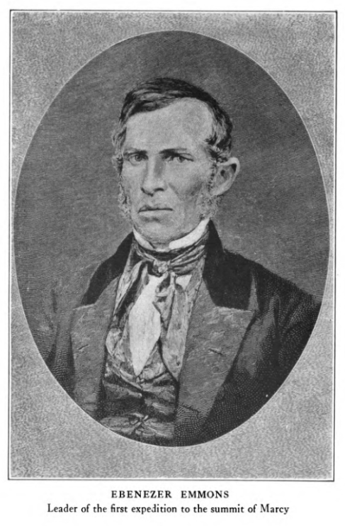
Emmons was a true renaissance scholar who took a winding path through various disciplines before taking the helm of the survey. Born in 1799 in Middlefield, MA, his fascination with the natural world began early. According to an 1896 biography published in Popular Science Monthly,

The doors in his room were covered with bugs and butterflies pinned on when he was a small boy. His mother often used to say: ‘Eb, why do you always have your pockets filled with stones? I have to mend them every week.  5

Emmons enrolled at the age of fifteen to study botany at Williams College, graduating in 1818. He then attended Berkshire Medical College and became a practicing physician in Chester, MA. In 1824, he began his pursuit of geology at the Rensselear Institute (RPI), a member of the first graduating class of 1826. That year, he published his Manual of Mineralogy and Geology, which became the instructional text at RPI. He returned to Williams to chair the Natural History department, while spending part of each year teaching chemistry and obstetrics at the Albany Medical College.  6

While traveling with Williams College President Hopkins and Hopkins’ brother Emmons’ enthusiasm for discovery got the better of him according to the 1896 biography.

Emmons asked his friends to turn aside with him to visit a certain cave. They consented to the delay, although the brother was on his way to be married, and waited just within the entrance of the cavern while Emmons penetrated to its inmost depths. After a time they heard the excited cry, ‘I’ve got it! I’ve got it! And out rushed the geologist, bearing triumphantly a muddy fragment of rock.  7

Governor Marcy selected Emmons to lead the geologic survey because of his preeminence in the field best expressed a century later by Cecil J. Schneer.

If we were to limit our study to the selection of any single individual as principally responsible for transformation of American geology it would have to be Professor Ebenezer Emmons. Emmons’ work served as a model and a standard for the geologic-stratigraphic surveys for the rest of the United States.  8

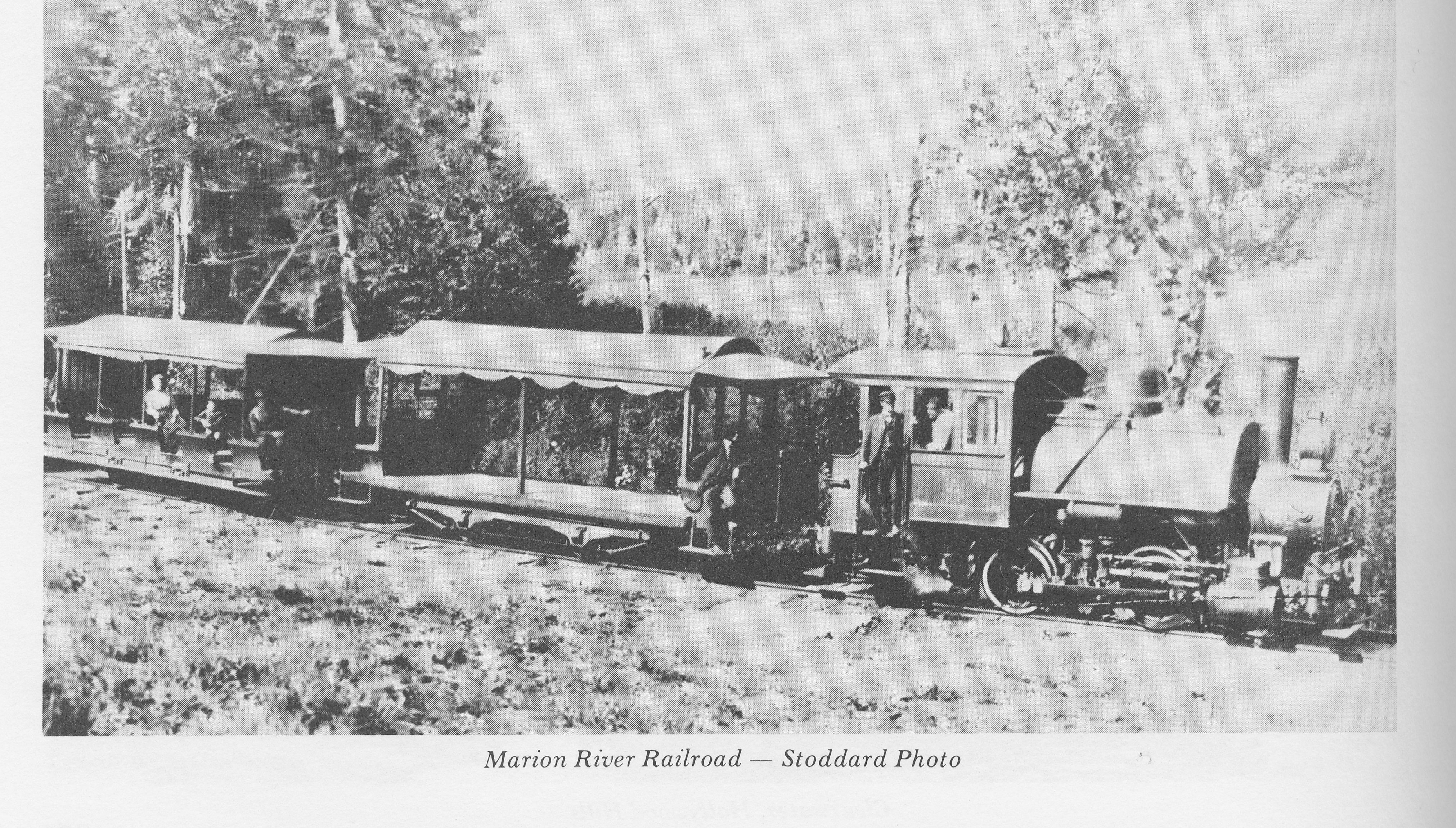
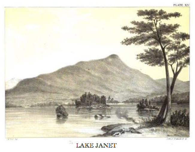
While Emmons’ work left an imprint across the country, some of his impacts on the Adirondacks were short-lived. During the 1840 expedition, Emmons travelled through the Eckford Chain of Lakes, named for Henry Eckford who originally surveyed them in 1811. Emmons named the individual lakes for Eckford’s daughters: Lake Janet (Blue Mt. Lake), Lake Catherine (Eagle Lake) and Lake Marion (Utowana Lake). For a short time, Blue Mountain was called Mt. Emmons.  Today the Marion River is the only piece still carrying the name Emmons gave it.  9

LAKE JANET

The long-term impact of Emmons on the Adirondacks has more to do with the language and art work in his Survey reports. His writing romanticized an idyllic location that previously had been portrayed as cold, swampy and dreary. His reports were accompanied by some of the first drawings to show the public the majestic beauty of the Adirondack mountains, lakes and streams.

Emmons drawing 4

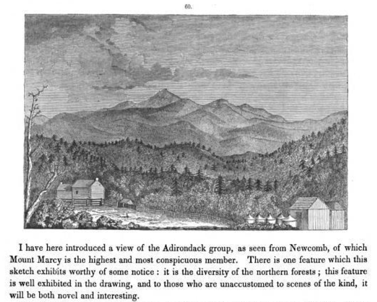
He gave an attractive description of Raquette Lake, which others ascribed to the region as a whole.

The view of the lake from [Indian Point] is also fine, and it is no exaggeration to represent it as equal to any in the northern highlands of New York. The waters are clear but generally ruffled with the breeze. It is well supplied with lake trout, which often weigh twenty pounds. The neighboring forests abound also in deer and other game. Hence it is finely fitted for the temporary residence of those who are troubled with ennui or who wish to escape for a time during the months of July and August from the cares of business or the heat and bustle of the city. To enable the traveler or invalid to make the most of the situation, a supply of light boats are always on hand for fishing and hunting, or for exploring the inlets and neighboring lakes which are connected with the Racket [sic].  10

Historian Philip Terrie places Emmons in the context of his times.

Emmons understood that America would follow western Europe down the path of industrialization, and he knew that the beauty and opportunities for spiritual renewal offered by the Adirondacks would be an invaluable treasure in a state where mills and smokestacks were even then beginning rapidly to replace forests and farms.  11

However, Emmons also promoted the economic exploitation of the natural resources within the Adirondacks. According to Terrie, Emmons had a vision of an “intensely populated and cultivated landscape” that embodied within one man the conflict between natural preservation and resource use, which still confounds us today. It is probable that the indomitable pioneer spirit of Matthew Beach and William Wood and early settlers of Long Lake and similar hamlets caused this vision to flourish as Emmons described.

We found that Indian Point was situated about midway in the lake between its southern and northern extremities and projecting far into it towards the northeast. It contains four or five hundred acres of excellent land, a warm, rich soil, as it appeared from the fine state of vegetables which were growing in the garden, and which were in an equal state of forwardness with the same vegetables growing on Lake Champlain.  12

Beach and Woods’s farm consisted of several acres of crops and hay pasture for up to ten cattle. But, theirs was a deceptively impressive subsistence farm. Though most Adirondack soils and the climate would not support expansive cultivation, their farm likely owed its success to two centuries of soil enrichment through burning and cultivating of root crops by Native Indians for their seasonal hunting parties.

Emmons’ experience on Indian Point affected his overall vision for the region. Fortunately for us, his connection to Indian Point did not alter the lake’s name. Had Emmons chosen to re-name the lake, we might know it today by the aboriginal name recorded in his report, Lake Fobullangamuck.

The Changing Times to the Adirondacks

I apply the brakes just a tad as the car hugs the downhill S-curve – getting closer.  The wheels straighten out and I sprint for the sign.  Up ahead on the right, there it is – the golden letters on brown wood canvas inviting us to enter Golden Beach State Campground.  We whiz by, thankful for the guidepost that alerts me to the prize.  Just a thousand feet.  There! As the trickle of Death Brook drops into the lake, the trees part and I can see the sun glinting on the waves of South Bay.  I am here.

My trip from our home in Western Massachusetts has ended when I see the water.  A simple three and a half hour drive.  Ok, my wife insists the trip is not over until we unload the car, pack the boat at Burke’s Marina, traverse the lake, unload the boat and schlep everything into the cabin.  A five-hour ordeal in her mind, but my blood pressure has lowered and serenity floods my mind and heart the minute I see the water.

Be it 3.5 or 5 hours, our trip is nothing compared to the arduous travels our ancestors took to reach these shores.

In 1862, George Hornell Thacher first travelled to the region, guided by Mitchell Sabattis who maintained a camp at Crane Point on Blue Mountain Lake. 1   At this time, the railroad to North Creek and the stage road from North Creek to Blue Mountain Lake did not exist.  Access to Blue Mountain Lake was only from the north, down from Long Lake.  The trip from Albany took between three and four days.

The Adirondack Museum has a description of a trip made by Miles Tyler Merwin, founder of the Blue Mountain House, which indicates the travel route that GHT likely followed. 2   On day one, he would have taken the train from Albany to Glens Falls, then a stagecoach similar to one shown below to Minerva.  On day two, he would have travelled again by stagecoach to Long Lake and spent the night.

Published in Heydays of the Adirondacks by Maitland Desormo

Published in Heydays of the Adirondacks by Maitland Desormo

From Long Lake to Blue Mountain Lake he would have taken either of two routes, each one potentially lasting more than a day in travel.  We do not know whether Mitchell Sabattis led GHT through the arduous South Pond route to Blue or the longer yet easier water route via Raquette Lake to Blue.

GHT route map

Click on the map and open to full screen to see an animation of these presumed routes. 

If we are to believe John Boyd Thacher, GHT’s son, it is more likely that Sabattis chose to go via Raquette Lake.   JBT wrote the following in a letter published in Forest and Stream magazine in 1874.

“From Blue Mountain Lake to Long Lake there is a more direct route with four miles of “carry” but even the guides will take the longer and all-water route.”

If JBT was right, it is even conceivable that GHT camped on Indian Point during his passage to Blue a full fifteen years prior to owning the land.

Of course JBT had an easier trip of only two days in 1874, which he chronicled in his letter.

Blue Mountain Lake, Adirondacks, Café Hathorne, June 15, 1874

             Already has the winter of our discontent yielded to glorious summer in these parts, and the faithful tide of tourists and sportsmen is setting in toward the woods.   Doubtless from now till November snows will your desk, drawers and basket be filled with letters concerning the delights and joys here experienced.

            We do not know of any easier of more accessible entrance to the North Woods, especially to the New Yorker than the route we have taken and always take, no matter at which point we may eventually aim.   Leaving Albany at seven o’clock in the morning on the Rensselaer and Saratoga Railroad, we connect at Saratoga with the Adirondack Railroad, reaching North Creek, its northern terminus, at about noon.  Thence by stage to Dick Jackson’s, a distance of nineteen miles, where we spend the night.   This is the last place on the route where one can experience the comforts of a good hotel, although there is soon to be one opened at Wakely’s on the Cedar River.

            Bright and early the next morning a buckboard wagon will take us to Blue Mountain Lake, a distance of twelve miles, over a road that has never been submitted to the process of Macadamization.  You remember it was one of Macadam’s theories that a bog was preferable to a hard bottom in constructing his roads.  There is plenty of substratum of that nature here.

            At Chauncey Hathorne’s shanty will we find a smoking hot fish-chowder in thirty minutes after we tear ourselves off the buck-board, and, in fact, it were no bad idea to consume a goodly portion of this time in gradually performing this operation.  About twenty minutes is the average time allotted for accomplishing this in safety.

See the complete letter as published in Forest and Stream magazine.  3  The letter begins at the bottom left side of the page.

JBT route map

Click on the map and open to full screen to see an animation of his presumed route.

From 1879 to 1893, the route to Blue Mountain Lake continued to be via train to North Creek; however a shorter stagecoach ride out of Indian Lake brought people to Blue along what is now Route 28.    Those travelling to Raquette Lake would take guideboats, and in later years steamboats, that flowed from Blue Mountain Lake through Eagle Lake and Utowana Lake (the Eckford Chain) and the Marion River into Raquette Lake.

In 1893, the railroad was extended from Utica, NY, to Thendara Station near Old Forge.  From that year until 1900, there were two paths to Raquette Lake.  Some still chose to take the train to North Creek, stagecoach to Blue Mountain Lake and by water through the Eckford Chain into Raquette Lake.  Others approached from the West; they would take the train to Thendara and then go by steamboat and buckboard through the Fulton Chain of Lakes to Raquette Lake.   If their final destination was Blue Mountain Lake, they would reverse the previous route from Raquette Lake through the Marion River, Utowana Lake and Eagle Lake into Blue Mountain Lake.

In 1900, the Raquette Lake Railroad was built to extend the rail lines from Carter Station (just north of Thendara) all the way to Raquette Lake Village.  In the same year the Marion River Railroad, the shortest full gauge railroad in the world, was built to transport travelers and their luggage the three-quarters of a mile of the Marion River Carry.  4   Travelers would take steamboats from Raquette Lake Village to the end of the Marion River.

Published in Heydays of the Adirondacks by Maitland Desormo

Published in Heydays of the Adirondacks by Maitland Desormo

They would then board the train for the short trip to the landing of the steamboats of the Eckford Chain (Utowana, Eagle, and Blue Mountain lakes).

Published in Heydays of the Adirondacks by Maitland Desormo

Published in Heydays of the Adirondacks by Maitland Desormo

The photo above by Seneca Ray Stoddard serves to authenticate the following two photos taken by members of the Thacher family traveling on the Marion River Railroad in the mid-1920s.

1925 Marion Carry RR

1922 Marion Carry RR

At this time, those travelling to Blue Mountain Lake preferred to take the train all the way to Raquette Lake and travel by steamboat into Blue Mountain Lake, thus avoiding the long stagecoach ride from North Creek.  It was now possible to reach Raquette Lake and Blue Mountain Lake in only one day of travel from Albany and even from New York City.

In 1929, the auto road was built between Raquette Lake and Blue Mountain Lake and brought to an end the Marion River Railroad.  The Raquette Lake Railroad and the steamboats of the region ended service in 1933.  5

Getting to the lakes was never the end of the journey.  Our daily trips from cabin to mainland have changed as well.  My father told us stories of my grandfather rowing a couple of hours to the village every day in his guideboat.

1922 JBT2 in guideboat

As a boy, I would sit in the bow of a 17 foot aluminum fishing boat, holding the bowline as we bounced and crashed against the waves – water spraying my face for the forty-five minute ride powered by a 15 horsepower Johnson outboard.  Fifteen minutes marks the duration of my kids’ trips from our cabin to the Raquette Lake Village dock in our Four Winns 190 Horizon speedboat.  I think my kids are missing out. (They don’t.)